Home
Browse
Ask Us
Chat
Harmful Language Statement
Log in
Advanced Search
Year
1840
1841
1842
1843
1844
1845
1846
1847
1848
1849
1850
1851
1852
1853
1854
1855
1856
1857
1858
1859
1860
1861
1862
1863
1864
1865
1866
1867
1868
1869
1870
1871
1872
1873
1874
1875
1876
1877
1878
1879
1880
1881
1882
1883
1884
1885
1886
1887
1888
1889
1890
1891
1892
1893
1894
1895
1896
1897
1898
1899
1900
1901
1902
1903
1904
1905
1906
1907
1908
1909
1910
1911
1912
1913
1914
1915
1916
1917
1918
1919
1920
1921
1922
1923
1924
1925
1926
1927
1928
1929
1930
1931
1932
1933
1934
1935
1936
1937
1938
1939
1940
1941
1942
1943
1944
1945
1946
1947
1948
1949
1950
1951
1952
1953
1954
1955
1956
1957
1958
1959
1960
1961
1962
1963
1964
1965
1966
1967
1968
1969
1970
1971
1972
1973
1974
1975
1976
1977
1978
1979
1980
1981
1982
1983
1984
1985
1986
1987
1988
1989
1990
1991
1992
1993
1994
1995
1996
1997
1998
1999
2000
2001
2002
2003
2004
2005
2006
2007
2008
TO
1840
1841
1842
1843
1844
1845
1846
1847
1848
1849
1850
1851
1852
1853
1854
1855
1856
1857
1858
1859
1860
1861
1862
1863
1864
1865
1866
1867
1868
1869
1870
1871
1872
1873
1874
1875
1876
1877
1878
1879
1880
1881
1882
1883
1884
1885
1886
1887
1888
1889
1890
1891
1892
1893
1894
1895
1896
1897
1898
1899
1900
1901
1902
1903
1904
1905
1906
1907
1908
1909
1910
1911
1912
1913
1914
1915
1916
1917
1918
1919
1920
1921
1922
1923
1924
1925
1926
1927
1928
1929
1930
1931
1932
1933
1934
1935
1936
1937
1938
1939
1940
1941
1942
1943
1944
1945
1946
1947
1948
1949
1950
1951
1952
1953
1954
1955
1956
1957
1958
1959
1960
1961
1962
1963
1964
1965
1966
1967
1968
1969
1970
1971
1972
1973
1974
1975
1976
1977
1978
1979
1980
1981
1982
1983
1984
1985
1986
1987
1988
1989
1990
1991
1992
1993
1994
1995
1996
1997
1998
1999
2000
2001
2002
2003
2004
2005
2006
2007
2008
Type
Image
1,299
Image/StillImage
116
Text
53
Sound
2
Format
image/jpeg
1,411
application/pdf
115
video/mp4
2
Collection
Beckwith Photograph Collection
9
Glen Canyon
1
Hiram B. Clawson Papers
1
Mormon Settlement in Arizona
2
Photo Archives
1,304
UAIDA Main Collection
2
Utah Humanities Research Foundation
2
Utah Quilt Heritage Records
44
Utah River Running Photo Archives
158
Western Soundscape
2
Western Waters NEH
2
Westminster University Photographs
2
More
Filters:
Spatial Coverage:
"Kane County (Utah)"
501
-
525
of
1,529
<
16
17
18
19
20
21
22
23
24
25
>
Gallery view
Number of results to display per page
10
25
50
100
200
Sort by Relevance
Sort by Title A-Z
Sort by Title Z-A
Sort by Date Ascending
Sort by Date Descending
Sort by Last Modified Ascending
Sort by Last Modified Descending
Title
Date
Type
Setname
501
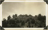
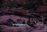
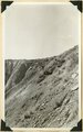
Exposure of weathered bsalt in flow from isolated cone near "corrals," upper Kanab Valley. Pinon and juniper. Kane County, Utah, 1932.
1934
Image
uum_map
502
Factory Farm
Image
uum_map
503
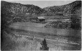
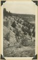
Falls in Kanab Creek near Corral Knoll. Carmel formation. Ancient channel of the Kanab filled with alluvium. Kane County, UT, 1939
1939
Image
uum_map
504
family camping
1964-05
Image
uum_map
505
Family camping in Glen Canyon area
1964-05
Image
uum_map
506
Fans quilt, by Dessie R. R. Goulding
1950; 1951; 1952; 1953; 1954; 1955; 1956; 1957; 1958; 1959; 1960
Text
uum_uqhr
507
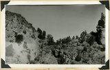
Fault at Mt. Carmel Junction, looking southeast. Carmel limestone on upthrown side (middle); Entrada (foreground). Kane County, UT, 1939
1939
Image
uum_map
508
Fault in Jurassic formations 3 miles south of Mt. Carmel. Carmel limestone (left). Entrada and Carmel (right). Elkheart Cliffs (Navajo) (upper right). Kane County, UT, 1939
1939
Image
uum_map
509
Fault in short canyon east of road one mile south of Mt. Carmel Junction. Carmel strata capped with old consolidated gravel, Kane County, UT, 1939
1939
Image
uum_map
510
Fault near Mt. Carmel Junction. Right (up throw side) Carmel limestone; left sands capped by gypsum. Three miles north of Glendale,
1936
Image
uum_map
511
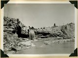
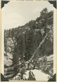
Fault, Navajo sandstone (right), Carmel formation (left), head of box canyon in Lick Wash. Kane County, UT, 1940
1940
Image
uum_map
512
Fault. Wasatch Tertiary on left (west); Cretaceous on right; head of Paria Canyon. Garfield County, UT, 1938
1938
Image
uum_map
513
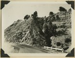
Faults in Navajo sandstone along Zion-Mt. Carmel road, Kane County, Utah, 1930.
1930
Image
uum_map
514
Features of the East Kaibab monocline [and] Structural relations of rocks along Utah-Arizona boundary
1943; 1944; 1945
Image
uum_map
515
Ferris Shaw with rattlesnake
1956-06
Image/StillImage
uum_map_rr
516
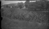
Field and stalks
Image
uum_map
517
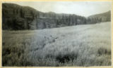
Field at the Esplin ranch
Image
uum_map
518
Fifth night camp near spot where Escalante meets Lake Powell
1963-04-26
Image
uum_map
519
Five children at Esplin home on Sand Street
Image
uum_map
520
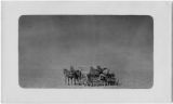
Five horses pulling a man on a tilling machine
Image
uum_map
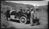
521
Five people and a car, by the tannery near Hidden Lake
Image
uum_map
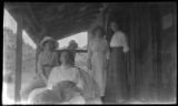
522
Five people on a porch
Image
uum_map
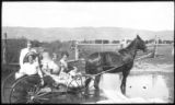
523
Five women and a horse
Image
uum_map
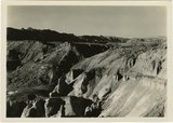
524
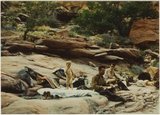
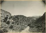
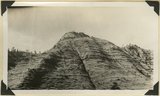
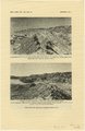
Flat lying Upper Jurassic (foreground) and Cretaceous strata bed abruptly upward against the Navajo on the flank of the East Kaibab monocline (left sky line). Table Cliffs (right sky line) is about 50 miles north. Paria Valley near Adairville. Kane County, UT. 1944
1944
Image
uum_map
525
Flat lying Upper Jurassic (foreground) and Cretaceous strata bed abruptly upward against the Navajo on the flank of the East Kaibab monocline (left sky line). Table Cliffs (right sky line) is about 50 miles north. Paria Valley near Adairville. Kane County, UT. 1944
1944
Image
uum_map
501
-
525
of
1,529
<
16
17
18
19
20
21
22
23
24
25
>