Home
Browse
Ask Us
Chat
Harmful Language Statement
Log in
Uintah County Regional History Center Maps
Advanced Search
Year
1878
1879
1880
1881
1882
1883
1884
1885
1886
1887
1888
1889
1890
1891
1892
1893
1894
1895
1896
1897
1898
1899
1900
1901
1902
1903
1904
1905
1906
1907
1908
1909
1910
1911
1912
1913
1914
1915
1916
1917
1918
1919
1920
1921
1922
1923
1924
1925
1926
1927
1928
1929
1930
1931
1932
1933
1934
1935
1936
1937
1938
1939
1940
1941
1942
1943
1944
1945
1946
1947
1948
1949
1950
1951
1952
1953
1954
1955
1956
1957
1958
1959
1960
1961
1962
1963
1964
1965
1966
1967
1968
1969
1970
1971
1972
1973
1974
1975
1976
1977
1978
1979
1980
1981
1982
1983
1984
1985
1986
1987
1988
1989
1990
1991
1992
1993
1994
1995
1996
1997
1998
1999
2000
2001
2002
2003
2004
2005
2006
2007
2008
2009
2010
2011
2012
2013
2014
TO
1878
1879
1880
1881
1882
1883
1884
1885
1886
1887
1888
1889
1890
1891
1892
1893
1894
1895
1896
1897
1898
1899
1900
1901
1902
1903
1904
1905
1906
1907
1908
1909
1910
1911
1912
1913
1914
1915
1916
1917
1918
1919
1920
1921
1922
1923
1924
1925
1926
1927
1928
1929
1930
1931
1932
1933
1934
1935
1936
1937
1938
1939
1940
1941
1942
1943
1944
1945
1946
1947
1948
1949
1950
1951
1952
1953
1954
1955
1956
1957
1958
1959
1960
1961
1962
1963
1964
1965
1966
1967
1968
1969
1970
1971
1972
1973
1974
1975
1976
1977
1978
1979
1980
1981
1982
1983
1984
1985
1986
1987
1988
1989
1990
1991
1992
1993
1994
1995
1996
1997
1998
1999
2000
2001
2002
2003
2004
2005
2006
2007
2008
2009
2010
2011
2012
2013
2014
Type
Image/StillImage
300
Format
image/jpeg
300
Collection
Uintah County Regional History Center...
300
Filters:
Format:
"image/jpeg"
Collection:
"ucl_maps"
Subject:
"Utah"
176
-
200
of
300
<
3
4
5
6
7
8
9
10
11
12
>
Gallery view
Number of results to display per page
10
25
50
100
200
Sort by Relevance
Sort by Title A-Z
Sort by Title Z-A
Sort by Date Ascending
Sort by Date Descending
Sort by Last Modified Ascending
Sort by Last Modified Descending
Title
Date
Type
176
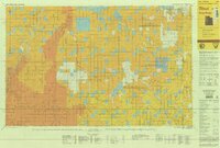
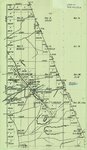
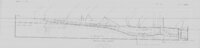
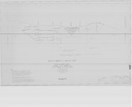
Road Commission - Highway 40 Jensen To Vernal 1930
1930
Image/StillImage
177
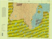
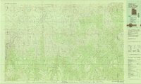
Roan Plateau (Pianimetric) SE-3 (US DOI BLM) 1977 (revised)
1977
Image/StillImage
178
Roan Plateau (Planimetric) SE-3 (US DOI BLM) 1975
1975
Image/StillImage
179
Salt Flats US DOI BLM 1977
1977
Image/StillImage
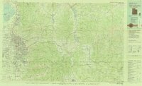
180
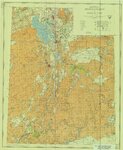
Salt Lake City, Utah-Wyoming 1980
1980
Image/StillImage
181
Sanpete US DOI BLM 1978
1978
Image/StillImage
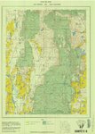
182
Seep Ridge, Utah 1999
1999
Image/StillImage
183
Seep Ridge, Utah-Colorado 1981
1981
Image/StillImage
184
Seep Ridge, Utah-Colorado 1982
1981; 1982
Image/StillImage
185
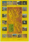
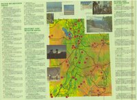
Snow Canyon State Park (Brochure and Map)
Image/StillImage
186
Southeastern Utah, Sectional and Multipurpose Map #5 of 5
1975
Image/StillImage
187
Southwestern Utah, Sectional and Multipurpose Map #4 of 5
1975
Image/StillImage
188
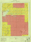
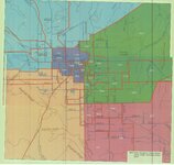
Stake Boundaries for the Glines, Maeser, Vernal, Uintah, and Ashley Stakes 2005?
2005
Image/StillImage
189
State of Utah - Minerals Status 1983
1983
Image/StillImage
190
State Open Ride for Mountain Bikes Map of Trails 2001
2001
Image/StillImage
191
State Parks of Utah (Brochure and Map)
Image/StillImage
192
The Strip - no date
Image/StillImage
193
The Strip - no date (2)
Image/StillImage
194
Sunnyside (Planimetric) NE-16 (US DOI BLM) 1974
1974
Image/StillImage
195
Sunnyside (Planimetric) NE-16 (US DOI BLM) 1975 (revised)
1975
Image/StillImage
196
Surficial Deposits and Ingenious Rocks 1980
1980
Image/StillImage
197
Swain Hatch Home 1989
1989
Image/StillImage
198
Taylor Mountain Formations
Image/StillImage
199
Tintic US DOI BLM 1976
1976
Image/StillImage
200
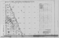
Tom Taylor Mines Mining Plan Proposal (Bulk Head & Floor Map) - Ziegler Chemical & Mineral Corp
1997; 1999; 2000
Image/StillImage
176
-
200
of
300
<
3
4
5
6
7
8
9
10
11
12
>