Over 70,000 photos covering a variety of topics from Marriott Library Special Collections
TO
| Title | Collection Number And Name | Photo Number | ||
|---|---|---|---|---|
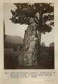
| 251 |
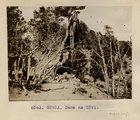 |
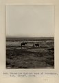
Same as Photo G291 (Photo G291A) | P0013 Herbert E. Gregory Photograph Collection | P0013n05_78_0800 |
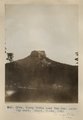
| 252 |
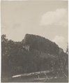
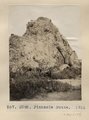 |
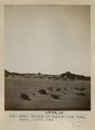
Pinnacle Butte. 1911 (Photo G292) | P0013 Herbert E. Gregory Photograph Collection | P0013n05_78_0801 |
| 253 |
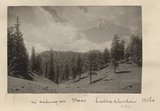 |
Washington Pass, Lukachukai Mts | P0013 Herbert E. Gregory Photograph Collection | P0013n05_78verso_0802 |
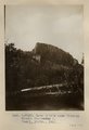
| 254 |
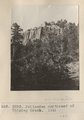 |
Palisades northeast of Whiskey Creek. 1911 (Photo G293) | P0013 Herbert E. Gregory Photograph Collection | P0013n05_79_0803 |
| 255 |
 |
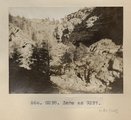
Lava flow near Sonsala. Looking northeast. Whiskey Creek in foreground (Photo G294) | P0013 Herbert E. Gregory Photograph Collection | P0013n05_79_0804 |
| 256 |
 |
Camp by Sonsala Buttes near Whiskey Creek. Heald, photo. 1911 (Photo N-M129) | P0013 Herbert E. Gregory Photograph Collection | P0013n05_80_0805 |
| 257 |
 |
Dike at Sonsala Buttes. South bank of Whiskey Creek, looking west toward Sonsala Buttes (Photo G295) | P0013 Herbert E. Gregory Photograph Collection | P0013n05_81_0806 |
| 258 |
 |
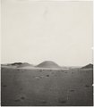
Tubby Butte near Tsa-lee. Looking east. Heald, photo, 1911 (Photo G296) | P0013 Herbert E. Gregory Photograph Collection | P0013n05_82_0807 |
| 259 |
 |
[Whiskey Creek palisades] (Photo N-M130) | P0013 Herbert E. Gregory Photograph Collection | P0013n05_82_808_neg |
| 260 |
 |
Lava cliffs near Whiskey Creek (Palisades). Heald, photo. 1911 (Photo N-M130) | P0013 Herbert E. Gregory Photograph Collection | P0013n05_83_0808 |
| 261 |
 |
Lava cliffs near Whiskey Creek (Palisades). Heald, photo. 1911 (Photo N-M130) | P0013 Herbert E. Gregory Photograph Collection | P0013n05_83_0808 |
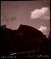
| 262 |
 |
Canyon de Chelly. VII, 26 (Photo N-M131) | P0013 Herbert E. Gregory Photograph Collection | P0013n05_84_0809 |
| 263 |
 |
Near head of Canyon de Chelly. Shinarump on Moencopie. 1911 (Photo G297) | P0013 Herbert E. Gregory Photograph Collection | P0013n05_84_0810 |
| 264 |
 |
Same as Photo G297 (Near head of Canyon de Chelly, Photo G298) | P0013 Herbert E. Gregory Photograph Collection | P0013n05_84_0811 |
| 265 |
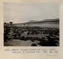 |
Black Creek valley, east toward Baigaiche Mt. VI, 45, 55 (Photo G299) | P0013 Herbert E. Gregory Photograph Collection | P0013n05_85_0812 |
| 266 |
 |
Manuelito Springs east of Tohatchie, N.M. Shaler, photo | P0013 Herbert E. Gregory Photograph Collection | P0013n05_85_0813 |
| 267 |
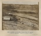 |
Sheep Dip of Pueblo Bonito agency. Heald, photo. 1911 (Photo N-M132 & N-M132a) | P0013 Herbert E. Gregory Photograph Collection | P0013n05_86_0814 |
| 268 |
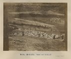 |
Same as Photo N-M132 (Photo N-M132a) | P0013 Herbert E. Gregory Photograph Collection | P0013n05_87_0815 |
| 269 |
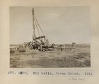 |
Oil wells, Seven Lakes. 1911 (Photo G300) | P0013 Herbert E. Gregory Photograph Collection | P0013n05_88_0816 |
| 270 |
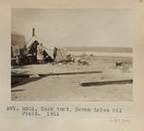 |
Cook tent, Seven Lakes Oil Field. 1911 (Photo G301) | P0013 Herbert E. Gregory Photograph Collection | P0013n05_88_0817 |
| 271 |
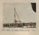 |
Oil well, Seven Lakes. 1911 (Photo G302) | P0013 Herbert E. Gregory Photograph Collection | P0013n05_88_0818 |
| 272 |
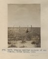 |
Stakes marking corners of oil claims, Seven Lakes, 1911 (Photo G303) | P0013 Herbert E. Gregory Photograph Collection | P0013n05_89_0819 |
| 273 |
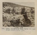 |
Cretaceous Mesa Verde (?) near Crown Point, N.M. 1911 (Photo G304) | P0013 Herbert E. Gregory Photograph Collection | P0013n05_89_0820 |
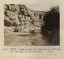
| 274 |
 |
Erosion in Dolores near Tuba. Heald, photo. 1911 (Photo G305) | P0013 Herbert E. Gregory Photograph Collection | P0013n05_90_0821 |
| 275 |
 |
Erosion in Dolroes near Tuba. Heald, photo. 1911 (Photo G306) | P0013 Herbert E. Gregory Photograph Collection | P0013n05_91_0822 |