Home
Browse
Ask Us
Chat
Harmful Language Statement
Log in
Photo Archives
Advanced Search
About
Over 70,000 photos covering a variety of topics from Marriott Library Special Collections
Year
1910
TO
1910
Type
Image
163
Format
image/jpeg
162
application/pdf
1
Collection
Photo Archives
163
Filters:
Collection Name:
"Herbert E. Gregory"
Date:
"1910"
Type:
"Image"
151
-
175
of
163
<
1
2
3
4
5
6
7
>
Gallery view
Number of results to display per page
10
25
50
100
200
Sort by Relevance
Sort by Title A-Z
Sort by Title Z-A
Sort by Date Ascending
Sort by Date Descending
Sort by Last Modified Ascending
Sort by Last Modified Descending
Title
Date
Type
151
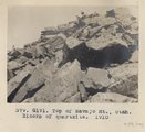
Top of Navajo Mt., Utah. Blocks of quartzite, 1910 (Photo G171)
1910
Image
152
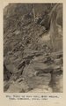
Trail up west wall, Noki Canyon, Utah (Townsend photo), 1910.
1910
Image
153
Trail, bare rock, angle 30 degrees, 10+ mil. northeast of Agathla Needle (Photo N-M94)
1910
Image
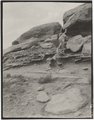
154
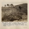
Trail, bare rock, wind-swept steep slopes, between Beaver and Junction canyons, north of Navajo Mt., Utah, 1910 (Photo G172)
1910
Image
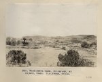
155
View looking southwest across Comb Wash at Navajo Springs, 12+ mi. west of Bluff, Utah, toward Carboniferous anticline, 1910 (Photo N-M80)
1910
Image
156
View looking west across Comb Wash at Navajo Springs, 12+ mi. west of Bluff, Utah, toward Carboniferous anticline, 1910 (Photo G135)
1910
Image
157
View looking west across Comb Wash at Navajo Springs, 12± miles west of Bluff, UT. 1910 (Photo G135)
1910
Image
158
View, Navajo Mt., Utah, from west run of Pahute Canyon, 1910 (Photo G170A)
1910
Image
159
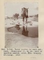
Water pocket on bare surface (Moencopie?), 4+ mi. east of Agathla Needle, Ariz. Mrs. Gregory drinking, 1910 (Photo N-M92)
1910
Image
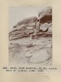
160
Wind erosion, 3+ mi. southwest of Oljato, Utah, 1910 (Photo G140)
1910
Image
161
Wind erosion, 3± miles southwest of Oljato, Utah, 1910 (Photo G140)
1910
Image
162
Wind-swept mesa, Shinarump, at Oljato, Utah (S.M. Young photo)
1910
Image
163
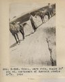
Woodruff's outfit, fording San Juan River near Mexican Hat, July 1910 (Photo N-M102)
1910
Image
151
-
175
of
163
<
1
2
3
4
5
6
7
>