|
|
Title | Date | Type |
| 126 |
 |
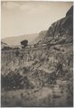
Protruding quartz veins in LaPlata sandstone on road from Cortez to Aneth, 1910. | 1910 | Image |
| 127 |
 |
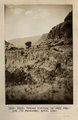
Quartz veins in LaPlata sandstone, north bank of San Juan river, between Aneth and Bluff, U., 1910 (Photo G131) | 1910 | Image |
| 128 |
 |
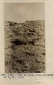
Recent cutting in Sagy Canyon (Towanaoche) Ariz., 1910 (Photo G163) | 1910 | Image |
| 129 |
 |
Recent cutting in Sagy Canyon (Towanaoche) Ariz., 1910 (Photo G163) | 1910 | Image |
| 130 |
 |
Reservoir Canyon, Tuba, Ariz., 1910 (Photo G188) | 1910 | Image |
| 131 |
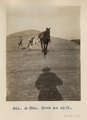 |
Same as G172 (Trail from Navajo Mountain to Rainbow Bridge, Utah, in 1910, photo N-M96) | 1910 | Image |
| 132 |
 |
Same as G172 (Trail from Navajo Mountain to Rainbow Bridge, Utah, in 1910; photo G193) | 1910 | Image |
| 133 |
 |
Same as G174 (Owl Bridge, Nasja Canyon, Utah, 1910, photo N-M97) | 1910 | Image |
| 134 |
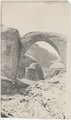 |
Same as G176 (Barohoini Bridge from upstream, nearer view, 1910, Photo G178) | 1910 | Image |
| 135 |
 |
Same as G176 (Barohoini Bridge from upstream, nearer view, 1910, Photo G178) | 1910 | Image |
| 136 |
 |
Same as G176 (Rainbow Bridge, distance 1/4+ mile from upstream, 1910 (Photo G177) | 1910 | Image |
| 137 |
 |
Same as G178 (Barohoini Bridge from upstream, 1910, Photo N-M99) | 1910 | Image |
| 138 |
 |
Same as G180 (Barohoini Bridge, northeast arch, 1910, Photo G181) | 1910 | Image |
| 139 |
 |
Same as G185 (Dinosaur tracks, Navajo Canyon, Ariz., 1910, Photo G186) | 1910 | Image |
| 140 |
 |
San Francisco Mountain (Photo N-M83a) | 1910 | Image |
| 141 |
 |
Shanto Springs (photograph from Herbert E. Gregory Book 4: Navajo, San Juan, 1910) | 1910 | Image |
| 142 |
 |
Sheep by store, Ganado, 1910 (photo by Edna H. Gregory) | 1910 | Image |
| 143 |
 |
Slim Rock or "The Queen" from the east (Photo G153) | 1910 | Image |
| 144 |
 |
Slim Rock or "The Queen" from the east (Photo G153) | 1910 | Image |
| 145 |
 |
Slim Rock or "the Queen," LaPlata outlier on Dolores, near Agathla Needle, Ariz., looking southwest, 1910 (Photo G152) | 1910 | Image |
| 146 |
 |
Slim Rock or "the Queen," LaPlata outlier on Dolores, near Agathla Needle, Ariz., looking southwest, 1910 (Photo G152) | 1910 | Image |
| 147 |
 |
Slim Rock or "the Queen," LaPlata outlier on Dolores, near Agathla Needle, Ariz., looking southwest, 1910 (Photo N-M91) | 1910 | Image |
| 148 |
 |
Structure, Dolores and La Plata, looking west from Oljato, Utah, 1910 (Photo N-M84) | 1910 | Image |
| 149 |
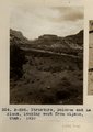 |
Structure, Dolores and La Plata, looking west from Oljato, Utah, 1910 (Photo N-M84) | 1910 | Image |
| 150 |
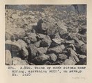 |
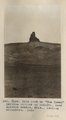
Talus or rock stream near spring, elevation 9000 ft., on Navajo Mt., 1910 (Photo N-M95) | 1910 | Image |