|
|
Title | Date | Type |
| 26 |
 |
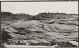
Branch of Navajo Canyon, Ariz., 1910 (Photo G184) | 1910 | Image |
| 27 |
 |
Branch of Navajo Canyon, Ariz., 1910 (Photo G184) | 1910 | Image |
| 28 |
 |
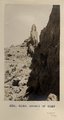
Burros, San Juan Valley, 1910 (Photo N-M78) | 1910 | Image |
| 29 |
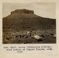 |
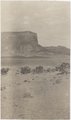
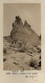
Butte (Moencopie strata), east branch of Copper Canyon, Utah, 1910 (Photo G167) | 1910 | Image |
| 30 |
 |
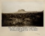
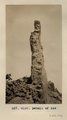
Butte, junction Sagy canyon with middle of East Branch, Ariz., 1910 (Photo G162) | 1910 | Image |
| 31 |
 |
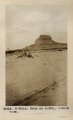
Butte, LaPlata on Dolores, 12+ mi. south of Oljato, Utah. Agathla Needle and QueenRock in distance, 1910 (Photo G159) | 1910 | Image |
| 32 |
 |
Butte, LaPlata on Dolores, 12+ mi. south of Oljato, Utah. Agathla Needle in distance, 1910 (Photo N-M91A) | 1910 | Image |
| 33 |
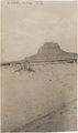 |
Butte, LaPlata on Dolores, 12± mi. south of Oljato, Utah. Agathla Needle in distance, 1910 | 1910 | Image |
| 34 |
 |
Camp 3+ mi. east of Agathla Needle, Ariz. (Photo N-M93) | 1910 | Image |
| 35 |
 |
Camp in cave by spring, 8+ mi. southeast of Agathla Needle, 1910 (Photo N-M104) | 1910 | Image |
| 36 |
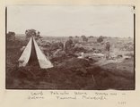 |
Camp, Pahute Mesa, Navajo Mtn in distance (Townsend photograph) | 1910 | Image |
| 37 |
 |
Canyon de Chelly near junction with Canyon del Muerto, 1910 (Edna H. Gregory photo, N-M101) | 1910 | Image |
| 38 |
 |
Cha-ez Kla. (No. 4). Volcanic neck or dike, 2+ mi, south of Agathla Needle, Ariz., 1910 (Photo G147) | 1910 | Image |
| 39 |
 |
Cliff dwelling in Canyon de Chelly (or near mouth of del Muerto), 1910 (photo by Edna H. Gregory) | 1910 | Image |
| 40 |
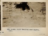 |
Cliff Dwelling near Oljato, Utah (Photo N-M85) | 1910 | Image |
| 41 |
 |
Cliff, LaPlata on Dolores at mouth of Sagy at Sosi canyon, Ariz., 1910 (Photo G166) | 1910 | Image |
| 42 |
 |
Cliff, LaPlata on Dolores at mouth of Sagy at Sosi canyon, AZ. 1910 (Photo G166) | 1910 | Image |
| 43 |
 |
Cliff-vein in Canyon de Chelly, 1910. | 1910 | Image |
| 44 |
 |
Cross-bedding in Moencopie, capped by Shinarump, Oljato, Utah, 1910. | 1910 | Image |
| 45 |
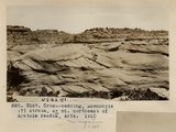 |
Cross-bedding, Moencopie (?) strata, 6+ mi. northeast of Agathla Needle, Ariz., 1910 (Photo G157) | 1910 | Image |
| 46 |
 |
Cross-bedding, Moencopie (?) strata, 6± mi. northeast of Agathla Needle, Ariz., 1910 (Photo G157) | 1910 | Image |
| 47 |
 |
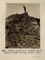
Detail of dike 6 mi. SE of Agathla Needle, Laguna Creek valley, 1910 (Photo G149) | 1910 | Image |
| 48 |
 |
Detail of dike 6 mi. SE of Agathla Needle, Laguna Creek valley, 1910 (Photo G150) | 1910 | Image |
| 49 |
 |
Detail of dike 6 mi. SE of Agathla Needle, Laguna Creek valley, 1910 (Photo G151) | 1910 | Image |
| 50 |
 |
Dike east of Dike no. 2, Laguna Creek valley, Ariz., 1910 (Photo N-M87) | 1910 | Image |