Over 70,000 photos covering a variety of topics from Marriott Library Special Collections
TO
Filters: Collection Name: "Frederick J. Pack" Date: "1911" Format: "image/jpeg" Collection: "uum_map"
| Title | Collection Number And Name | Photo Number | ||
|---|---|---|---|---|
| 201 |
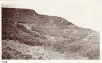 |
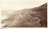
Wasatch Fault, crossing moraine, mouth of Little Cottonwood Canyon | P0268 Frederick J. Pack photograph collection | P0268n01_13_139 |
| 202 |
 |
Anticline (Artificial ) Used as Exhibit at Utah State Fair | P0268 Frederick J. Pack photograph collection | P0268n01_13_140 |
| 203 |
 |
Anticline (Artificial ) Used as Exhibit at Utah State Fair | P0268 Frederick J. Pack photograph collection | P0268n01_13_141 |
| 204 |
 |
Anticline (Artificial ) Used as Exhibit at Utah State Fair | P0268 Frederick J. Pack photograph collection | P0268n01_13_142 |
| 205 |
 |
Anticline (Artificial ) Used as Exhibit at Utah State Fair | P0268 Frederick J. Pack photograph collection | P0268n01_13_143 |
| 206 |
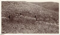 |
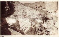
Faults - One Mile East of Fort Douglas | P0268 Frederick J. Pack photograph collection | P0268n01_13_144 |
| 207 |
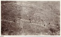 |
Faults - One Mile East of Fort Douglas | P0268 Frederick J. Pack photograph collection | P0268n01_13_145 |
| 208 |
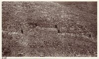 |
Faults - One Mile East of Fort Douglas | P0268 Frederick J. Pack photograph collection | P0268n01_13_146 |
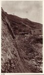
| 209 |
 |
Wasatch Fault - Surface exposed, one half Mile north of Warm Springs | P0268 Frederick J. Pack photograph collection | P0268n01_13_147 |
| 210 |
 |
Wasatch Fault - Surface exposed, one half Mile north of Warm Springs | P0268 Frederick J. Pack photograph collection | P0268n01_13_148 |
| 211 |
 |
Wasatch Fault - Surface exposed, one half Mile north of Warm Springs | P0268 Frederick J. Pack photograph collection | P0268n01_13_149 |
| 212 |
 |
Natural Bridge Party, May 1931: Augusta [Sipapu] - San Juan County | P0268 Frederick J. Pack photograph collection | P0268n01_13_151 |
| 213 |
 |
Natural Bridge Party, May 1931: Augusta [Sipapu] - San Juan County | P0268 Frederick J. Pack photograph collection | P0268n01_13_152 |
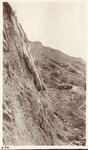
| 214 |
 |
Wasatch Fault - North of Becks Hot Springs | P0268 Frederick J. Pack photograph collection | P0268n01_13_153 |
| 215 |
 |
Wasatch Fault - Immediately south of Becks Hot Springs | P0268 Frederick J. Pack photograph collection | P0268n01_13_154 |
| 216 |
 |
Wasatch Fault - One half mile south of Becks Hot Springs | P0268 Frederick J. Pack photograph collection | P0268n01_13_155 |
| 217 |
 |
Wasatch Fault - One half mile north of Becks Hot Springs | P0268 Frederick J. Pack photograph collection | P0268n01_13_156 |
| 218 |
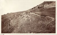 |
Land Slide - South West slope of Ensign Peak [01] | P0268 Frederick J. Pack photograph collection | P0268n01_13_160 |
| 219 |
 |
Land Slide - South West slope of Ensign Peak [02] | P0268 Frederick J. Pack photograph collection | P0268n01_13_161 |
| 220 |
 |
Land Slide - South West slope of Ensign Peak [03] | P0268 Frederick J. Pack photograph collection | P0268n01_13_162 |
| 221 |
 |
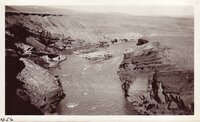
Unconformity - in Lime Kiln Quarry, one fourth mile north of Warm Springs | P0268 Frederick J. Pack photograph collection | P0268n01_13_163 |
| 222 |
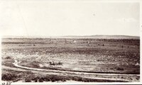 |
Oil field, Byron, Wyoming | P0268 Frederick J. Pack photograph collection | P0268n01_13_258 |
| 223 |
 |
Shoshone River - Near Cody - Wyo | P0268 Frederick J. Pack photograph collection | P0268n01_13_259 |
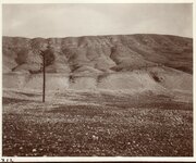
| 224 |
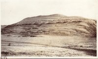 |
Stratification, Lower Cretaceous, south slope of Pryor Mountains, Wyo. | P0268 Frederick J. Pack photograph collection | P0268n01_13_260 |
| 225 |
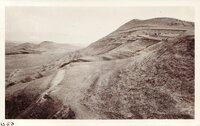 |
Stratification, Lower Cretaceous, south slope of Pryor Mountains, Wyo. | P0268 Frederick J. Pack photograph collection | P0268n01_13_265 |