Home
Browse
Ask Us
Chat
Harmful Language Statement
Log in
Advanced Search
Year
1826
1827
1828
1829
1830
1831
1832
1833
1834
1835
1836
1837
1838
1839
1840
1841
1842
1843
1844
1845
1846
1847
1848
1849
1850
1851
1852
1853
1854
1855
1856
1857
1858
1859
1860
1861
1862
1863
1864
1865
1866
1867
1868
1869
1870
1871
1872
1873
1874
1875
1876
1877
1878
1879
1880
1881
1882
1883
1884
1885
1886
1887
1888
1889
1890
1891
1892
1893
1894
1895
1896
1897
1898
1899
1900
1901
1902
1903
1904
1905
1906
1907
1908
1909
1910
1911
1912
1913
1914
1915
1916
1917
1918
1919
1920
1921
1922
1923
1924
1925
1926
1927
1928
1929
1930
1931
1932
1933
1934
1935
1936
1937
1938
1939
1940
1941
1942
1943
1944
1945
1946
1947
1948
1949
1950
1951
1952
1953
1954
1955
1956
1957
1958
1959
1960
1961
1962
1963
1964
1965
1966
1967
1968
1969
1970
1971
1972
1973
1974
1975
1976
1977
1978
1979
1980
1981
1982
1983
1984
1985
1986
1987
1988
1989
1990
1991
1992
1993
1994
1995
1996
1997
1998
1999
2000
2001
2002
2003
2004
2005
2006
2007
2008
2009
2010
2011
2012
2013
2014
2015
2016
2017
2018
2019
2020
2021
2022
2023
TO
1826
1827
1828
1829
1830
1831
1832
1833
1834
1835
1836
1837
1838
1839
1840
1841
1842
1843
1844
1845
1846
1847
1848
1849
1850
1851
1852
1853
1854
1855
1856
1857
1858
1859
1860
1861
1862
1863
1864
1865
1866
1867
1868
1869
1870
1871
1872
1873
1874
1875
1876
1877
1878
1879
1880
1881
1882
1883
1884
1885
1886
1887
1888
1889
1890
1891
1892
1893
1894
1895
1896
1897
1898
1899
1900
1901
1902
1903
1904
1905
1906
1907
1908
1909
1910
1911
1912
1913
1914
1915
1916
1917
1918
1919
1920
1921
1922
1923
1924
1925
1926
1927
1928
1929
1930
1931
1932
1933
1934
1935
1936
1937
1938
1939
1940
1941
1942
1943
1944
1945
1946
1947
1948
1949
1950
1951
1952
1953
1954
1955
1956
1957
1958
1959
1960
1961
1962
1963
1964
1965
1966
1967
1968
1969
1970
1971
1972
1973
1974
1975
1976
1977
1978
1979
1980
1981
1982
1983
1984
1985
1986
1987
1988
1989
1990
1991
1992
1993
1994
1995
1996
1997
1998
1999
2000
2001
2002
2003
2004
2005
2006
2007
2008
2009
2010
2011
2012
2013
2014
2015
2016
2017
2018
2019
2020
2021
2022
2023
Type
Image/StillImage
1,440
Image
1,431
Text
348
Sound
64
Format
image/jpeg
2,917
application/pdf
483
audio/mpeg
43
video/mp4
21
Collection
Al W. Morton Collection, 1930s-1950s
5
Alta Avalanche
2
American Westward Migration
1
Chieko N Okazaki papers
2
Classified Photographs
267
Colorado Riverbed Case
12
David Oman McKay Papers
1
John Hamilton Morgan Papers
43
Land Use - Transportation Scenario Pl...
1
Marriner S. Eccles Papers
1
Photo Archives
592
Regional History Center
46
Shipler Commercial Photographers
40
Ski and Snow Sports Photo Archives
787
Taylor A. Woolley Papers
2
Thorne Photographs
5
UAIDA Main Collection
595
Uintah County Regional History Center...
35
Utah Humanities Research Foundation
1
Utah Quilt Heritage Records
4
Utah River Running Photo Archives
821
Vernal Express Photographs
3
Vertebrate Zoology Voucher Images
337
Western Soundscape
64
Western Waters Electronic Resources
69
William Edward Hook Glass Negatives
70
More
Filters:
Spatial Coverage:
"Colorado"
51
-
75
of
3,806
<
1
2
3
4
5
6
7
8
9
10
>
Gallery view
Number of results to display per page
10
25
50
100
200
Sort by Relevance
Sort by Title A-Z
Sort by Title Z-A
Sort by Date Ascending
Sort by Date Descending
Sort by Last Modified Ascending
Sort by Last Modified Descending
Title
Date
Type
Setname
51
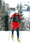
2006 NCAA tournament Steamboat Springs, Colorado-Men's Giant Slalom. Scott Veenis [03]
2006-03
Image/StillImage
uum_map_usa
52
2006 NCAA tournament Steamboat Springs, Colorado-Men's Giant Slalom. Scott Veenis [04]
2006-03
Image/StillImage
uum_map_usa
53
2006 NCAA tournament Steamboat Springs, Colorado-Men's Giant Slalom. Scott Veenis [05]
2006-03
Image/StillImage
uum_map_usa
54
2006 NCAA tournament Steamboat Springs, Colorado-Men's Giant Slalom. Scott Veenis [06]
2006-03
Image/StillImage
uum_map_usa
55
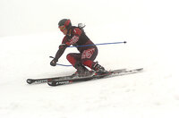
2006 NCAA tournament Steamboat Springs, Colorado-Men's Slalom [01]
2006-03
Image/StillImage
uum_map_usa
56
2006 NCAA tournament Steamboat Springs, Colorado-Men's Slalom [02]
2006-03
Image/StillImage
uum_map_usa
57
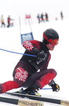
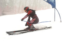
2006 NCAA tournament Steamboat Springs, Colorado-Men's Slalom [03]
2006-03
Image/StillImage
uum_map_usa
58
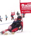
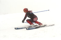
2006 NCAA tournament Steamboat Springs, Colorado-Men's Slalom [04]
2006-03
Image/StillImage
uum_map_usa
59
2006 NCAA tournament Steamboat Springs, Colorado-Men's Slalom. Will McDonald [01]
2006-03
Image/StillImage
uum_map_usa
60
2006 NCAA tournament Steamboat Springs, Colorado-Men's Slalom. Will McDonald [02]
2006-03
Image/StillImage
uum_map_usa
61
2006 NCAA tournament Steamboat Springs, Colorado-Men's Slalom. Will McDonald [03]
2006-03
Image/StillImage
uum_map_usa
62
2006 NCAA tournament Steamboat Springs, Colorado-Men's Slalom. Will McDonald [04]
2006-03
Image/StillImage
uum_map_usa
63
2006 NCAA tournament Steamboat Springs, Colorado-Men's Slalom. Will McDonald [05]
2006-03
Image/StillImage
uum_map_usa
64
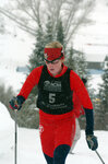
2006 NCAA tournament Steamboat Springs, Colorado-Women's 5K [01]
2006-03
Image/StillImage
uum_map_usa
65
2006 NCAA tournament Steamboat Springs, Colorado-Women's 5K [02]
2006-03
Image/StillImage
uum_map_usa
66
2006 NCAA tournament Steamboat Springs, Colorado-Women's 5K [03]
2006-03
Image/StillImage
uum_map_usa
67
2006 NCAA tournament Steamboat Springs, Colorado-Women's 5K [04]
2006-03
Image/StillImage
uum_map_usa
68
2006 NCAA tournament Steamboat Springs, Colorado-Women's 5K. Sara Schwieger [01]
2006-03
Image/StillImage
uum_map_usa
69
2006 NCAA tournament Steamboat Springs, Colorado-Women's 5K. Sara Schwieger [02]
2006-03
Image/StillImage
uum_map_usa
70
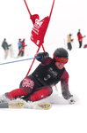
2006 NCAA tournament Steamboat Springs, Colorado-Women's Giant Slalom. [01]
2006-03
Image/StillImage
uum_map_usa
71
2006 NCAA tournament Steamboat Springs, Colorado-Women's Giant Slalom. [02]
2006-03
Image/StillImage
uum_map_usa
72
2006 NCAA tournament Steamboat Springs, Colorado-Women's Giant Slalom. [03]
2006-03
Image/StillImage
uum_map_usa
73
2006 NCAA tournament Steamboat Springs, Colorado-Women's Giant Slalom. [04]
2006-03
Image/StillImage
uum_map_usa
74
2006 NCAA tournament Steamboat Springs, Colorado-Women's Giant Slalom. [05]
2006-03
Image/StillImage
uum_map_usa
75
2006 NCAA tournament Steamboat Springs, Colorado-Women's Giant Slalom. [06]
2006-03
Image/StillImage
uum_map_usa
51
-
75
of
3,806
<
1
2
3
4
5
6
7
8
9
10
>