|
|
Title | Collection Number And Name | Photo Number |
| 51 |
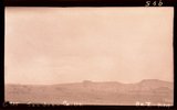 |
Raplee anticline (part north of river) from West Rico strata: Halgaito foreground and on crest, San Juan County, Utah, 1932. | P0013 Herbert E. Gregory Photograph Collection | P0013n10_109_2272 |
| 52 |
 |
Raplee anticline (part north of river) from West Rico strata: Halgaito foreground and on crest, San Juan County, Utah, 1932. | P0013 Herbert E. Gregory Photograph Collection | P0013n10_109_2272 |
| 53 |
 |
Bluff sandstone (Morrison) 3 miles west of Bluff, San Juan County, Utah, 1932. | P0013 Herbert E. Gregory Photograph Collection | P0013n10_110_2273 |
| 54 |
 |
Cross bedded Wingate sandstone, Johnson Canyon, Kane County, Utah, 1932. | P0013 Herbert E. Gregory Photograph Collection | P0013n10_110_2274 |
| 55 |
 |
Contact Morrison (?) and Dakota (?) 2 miles north of Henrieville, Garfield County, Utah, 1932. | P0013 Herbert E. Gregory Photograph Collection | P0013n10_111_2275 |
| 56 |
 |
Contact Entrada (?) bottom and Summerville (?) Paria River 6± miles south of Cannonville, Garfield County, Utah, 1932. | P0013 Herbert E. Gregory Photograph Collection | P0013n10_112_2276 |
| 57 |
 |
Zion member of Navajo sandstone overlain by gypsiferous Carmel formation Sheep Creek, Kane County, Utah, 1932. | P0013 Herbert E. Gregory Photograph Collection | P0013n10_112_2277 |
| 58 |
 |
Zion member of Navajo sandstone overlain by gypsiferous Carmel formation Sheep Creek, Kane County, Utah, 1932. | P0013 Herbert E. Gregory Photograph Collection | P0013n10_112_2277 |
| 59 |
 |
Coal beds just above Morrison Dakota contact (in shadow) 2± miles north of Cannonville, Utah, 1932. | P0013 Herbert E. Gregory Photograph Collection | P0013n10_113_2278 |
| 60 |
 |
Coal beds just above Morrison Dakota contact (in shadow) 2± miles north of Cannonville, Utah, 1932. | P0013 Herbert E. Gregory Photograph Collection | P0013n10_113_2278 |
| 61 |
 |
Perched potholes in Navajo sandstone Pine Creek, Zion National Park, Utah, 1932. | P0013 Herbert E. Gregory Photograph Collection | P0013n10_113_2279 |
| 62 |
 |
Same as G717 [Perched potholes in Navajo sandstone Pine Creek, Zion National Park, Utah, 1932.] | P0013 Herbert E. Gregory Photograph Collection | P0013n10_114_2280 |
| 63 |
 |
Same as G717 [Perched potholes in Navajo sandstone Pine Creek, Zion National Park, Utah, 1932.] | P0013 Herbert E. Gregory Photograph Collection | P0013n10_115_2281 |
| 64 |
 |
Same as G717 [Perched potholes in Navajo sandstone Pine Creek, Zion National Park, Utah, 1932.] | P0013 Herbert E. Gregory Photograph Collection | P0013n10_115_2282 |
| 65 |
 |
Same as G717 [Perched potholes in Navajo sandstone Pine Creek, Zion National Park, Utah, 1932.] | P0013 Herbert E. Gregory Photograph Collection | P0013n10_115_2282 |
| 66 |
 |
Basalt in Moenkopi, north wash. | P0013 Herbert E. Gregory Photograph Collection | P0013n10_217_2479 |
| 67 |
 |
Elkheart Cliffs east of Mt. Carmel. | P0013 Herbert E. Gregory Photograph Collection | P0013n10_218_2480 |
| 68 |
 |
Same as 191 (Looking north across Orderville, Sevier fault), taken nearer Orderville. | P0013 Herbert E. Gregory Photograph Collection | P0013n10_218_2481 |
| 69 |
 |
View NE across head of Kanab valley. Left, tilted Tertiary west of Sevier fault; right, Alton Cirque (lowland), above it, Pink Cliffs. | P0013 Herbert E. Gregory Photograph Collection | P0013n10_219_2482 |
| 70 |
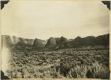 |
West edge Kolob plateau from New Harmony road. | P0013 Herbert E. Gregory Photograph Collection | P0013n10_219_2483 |
| 71 |
 |
One of "Three Lakes," Kanab Canyon. | P0013 Herbert E. Gregory Photograph Collection | P0013n10_220_2484 |
| 72 |
 |
Cliff dweller niche, base of Navajo sandstone. Zion Park. | P0013 Herbert E. Gregory Photograph Collection | P0013n10_221_2486 |
| 73 |
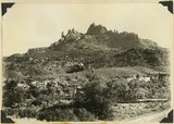 |
Eagle Crags. | P0013 Herbert E. Gregory Photograph Collection | P0013n10_221_2487 |
| 74 |
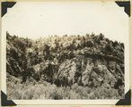 |
Carmel on Navajo. Head of Parunuweap Canyon. | P0013 Herbert E. Gregory Photograph Collection | P0013n10_223_2488 |
| 75 |
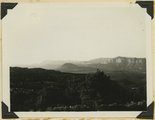 |
Coalpits volcano north of Grafton. | P0013 Herbert E. Gregory Photograph Collection | P0013n10_223_2489 |