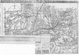
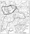
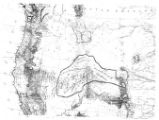
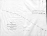
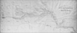
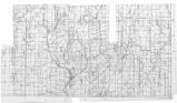
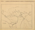
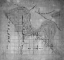
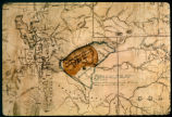
26 - 50 of 98
Number of results to display per page
TitleDateType
26 Map of Indian Reservation. 1884Image/StillImage
27 Map of Indian Reservations in the Western United StatesImage/StillImage
28 Map of Indian Territory in the Western United StatesImage/StillImage
29 Map of Indian Tribes of North AmericaImage/StillImage
30 Map of Navajo, Ute, and Jicarilla Apache Indian ReservesImage/StillImage
31 Map of North America and Original Inhabitants' Territory.Image/StillImage
32 Map of Northern Utah, Early SettlementsImage/StillImage
33 Map of Part of the West Boundary of the Uncompahgre Ute Indian Reservation as Surveyed by William B. DougallImage/StillImage
34 Map of Reservations of the Western United States and the Religions that Worked on the Reservations 1870's1873Image/StillImage
35 Map of Shoshone Indian Territory, and the Division of Shoshone Boundaries in NevadaImage/StillImage
36 Map of Shoshone Territory; Prepared by Doty, 1859Image/StillImage
37 Map of Southern Colorado and the Ute Mountain Ute ReservationImage/StillImage
38 Map of Stock Mining Claims in the Uintah BasinImage/StillImage
39 Map of the Four Corners Region and the Reservation of the Ute Mountain Ute TribeImage/StillImage
40 Map of the Homelands of Northern Shoshone, 1863Image/StillImage
41 Map of the Northern Part of the Former Uintah Indian Reservation Showing the Irrigation SystemImage/StillImage
42 Map of the original range of the Bannock Indians according to Bureau of Indian Affairs, 1952.Image/StillImage
43 Map of the Shoshone TribesImage/StillImage
44 Map of the South West Boundary of the Uintah Indian Reserve Utah Territory.Image/StillImage
45 Map of the Southern Part of the Former Uintah Indian Reservation Showing the Irrigation System of Indian AllotmentsImage/StillImage
46 Map of the Uintah Basin and the Uintah Ouray ReservationImage/StillImage
47 Map of Uintah Basin and Fort DuchesneImage/StillImage
48 Map of Uintah Reservation. Green River AreaImage/StillImage
49 Map of Uintah Valley Reserve, formed by order of President Abraham Lincoln, 1861.Image/StillImage
50 Map of Uncompahgre Ute Indian Reservation Boundaries, Sheet Number 1, 1889Image/StillImage
26 - 50 of 98