Home
Browse
Ask Us
Chat
Harmful Language Statement
Log in
Uintah County Regional History Center Maps
Advanced Search
Year
1839
1840
1841
1842
1843
1844
1845
1846
1847
1848
1849
1850
1851
1852
1853
1854
1855
1856
1857
1858
1859
1860
1861
TO
1839
1840
1841
1842
1843
1844
1845
1846
1847
1848
1849
1850
1851
1852
1853
1854
1855
1856
1857
1858
1859
1860
1861
Type
Image/StillImage
2
Format
application/pdf
2
Collection
Uintah County Regional History Center...
2
Filters:
Format:
"application/pdf"
Collection:
"ucl_maps"
Spatial Coverage:
"United States"
1
-
25
of
2
Gallery view
Number of results to display per page
10
25
50
100
200
Sort by Relevance
Sort by Title A-Z
Sort by Title Z-A
Sort by Date Ascending
Sort by Date Descending
Sort by Last Modified Ascending
Sort by Last Modified Descending
Title
Date
Type
1
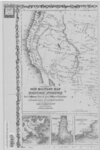
Johnson's New Military Map of the US (Western-half) Showing Forts, Military Posts and All Military Division, 1861
1861
Image/StillImage
2
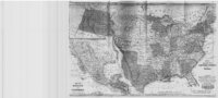
United States and Texas, Mexico, and Guatemala - 1839
1839
Image/StillImage
1
-
25
of
2