Home
Browse
Ask Us
Chat
Harmful Language Statement
Log in
Photo Archives
Advanced Search
About
Over 70,000 photos covering a variety of topics from Marriott Library Special Collections
Year
1915
1916
1917
1918
1919
1920
1921
1922
1923
1924
1925
1926
1927
1928
1929
1930
1931
1932
1933
1934
1935
1936
1937
1938
TO
1915
1916
1917
1918
1919
1920
1921
1922
1923
1924
1925
1926
1927
1928
1929
1930
1931
1932
1933
1934
1935
1936
1937
1938
Type
Image
173
Format
image/jpeg
171
application/pdf
2
Collection
Photo Archives
173
Filters:
Collection Name:
"Herbert E. Gregory"
Date:
"1936"
26
-
50
of
173
<
1
2
3
4
5
6
7
>
Gallery view
Number of results to display per page
10
25
50
100
200
Sort by Relevance
Sort by Title A-Z
Sort by Title Z-A
Sort by Date Ascending
Sort by Date Descending
Sort by Last Modified Ascending
Sort by Last Modified Descending
Title
Date
Type
26
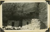
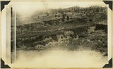
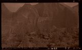
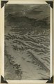
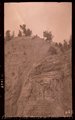
Cliff houses in branch of Cottonwood Canyon northwest of Kanab, Kane County, Utah, 1936.
1936
Image
27
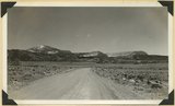
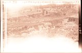
Cliffs north of highway west of Bicknell (right center). Moenkopi, Shinarump, Chinle, Wingate. Plain in foreground borders Fremont River. Wayne County, UT, 1936
1936
Image
28
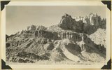
Cliffs, mouth of Parunuweap, Utah, 1936.
1936
Image
29
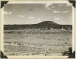
Coalpits volcano north of Grafton.
1930; 1931; 1932; 1933; 1934; 1935; 1936; 1937
Image
30
Color banded Navajo-Wingate, Sand Wash, 1936.
1936
Image
31
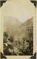
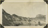
Colorado River looking down stream from the mouth of Moki Canyon (at the left).
1930; 1931; 1932; 1933; 1934; 1935; 1936; 1937
Image
32
Colorado River looking up stream from the mouth of Moki Canyon.
1930; 1931; 1932; 1933; 1934; 1935; 1936; 1937
Image
33
Congar Mt. fault, 1936.
1936
Image
34
Contact, Carmel & Navajo Skutumpah
1936
Image
35
Contact, Carmel and Navajo Skutumpah, 1936.
1936
Image
36
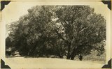
Cottonwood trees partly buried in drifted sands, Short Creek, Arizona, 1936.
1936
Image
37
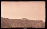
Crater on Kanab Creek, at "the Corrals." Kane County, Utah, 1937.
1936
Image
38
Crossbedded Navajo sandstone along Zion-Mt. Carmel road. Checker Board Mountain on the horizon eastward. Temple Cap member in upper right. Zion National Park, Utah, 1936.
1936
Image
39
Crossbedding of sandstone along Mt. Carmel road. Indicating wind action and sand dune formation prior to the formation of rock.
1930; 1931; 1932; 1933; 1934; 1935; 1936; 1937
Image
40
Curvillinear fractures in sandstone, west wall of Temple of Sinawava, Zion Canyon.
1930; 1931; 1932; 1933; 1934; 1935; 1936; 1937
Image
41
Cutting of alluvial fill, Kanab Canyon, above mouth of Caves Lake Canyon, Wingate, Kayenta. Navajo at right, Kane County, Utah, 1936.
1936
Image
42
E. Birch Creek, Zion Canyon
1936
Image
43
E. Kanab
1936
Image
44
Eagle Crags.
1930; 1931; 1932; 1933; 1934; 1935; 1936; 1937
Image
45
Elephant Gap in Harris Mountain from Arizona-Utah line north of Cane beds. Navajo sandstone, foreground, and cliffs, Carmel caps, Kane County, Utah, 1936.
1936
Image
46
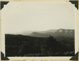
Elkheart Cliffs east of Mt. Carmel.
1930; 1931; 1932; 1933; 1934; 1935; 1936; 1937
Image
47
Elkheart Cliffs, 1936.
1936
Image
48
Erosion Cretaceous along Fruita-Cainsville road, Pleasant Creek 1936.
1936
Image
49
Fault in gulch along road 1/2 mile northwest Mt. Carmel Junction, throw 120 feet. 1936.
1936
Image
50
Fault in gulch, Mt. Carmel Junc.
1936
Image
26
-
50
of
173
<
1
2
3
4
5
6
7
>