Home
Browse
Ask Us
Chat
Harmful Language Statement
Log in
Advanced Search
Year
1850
1851
1852
1853
1854
1855
1856
1857
1858
1859
1860
1861
1862
1863
1864
1865
1866
1867
1868
1869
1870
1871
1872
1873
1874
1875
1876
1877
1878
1879
1880
1881
1882
1883
1884
1885
1886
1887
1888
1889
1890
1891
1892
1893
1894
1895
1896
1897
1898
1899
1900
1901
1902
1903
1904
1905
1906
1907
1908
1909
1910
1911
1912
1913
1914
1915
1916
1917
1918
1919
1920
1921
1922
1923
1924
1925
1926
1927
1928
1929
1930
1931
1932
1933
1934
1935
1936
1937
1938
1939
1940
1941
1942
1943
1944
1945
1946
1947
1948
1949
1950
1951
1952
1953
1954
1955
1956
1957
1958
1959
1960
1961
1962
1963
1964
1965
1966
1967
1968
1969
1970
1971
1972
1973
1974
1975
1976
1977
1978
1979
1980
1981
1982
1983
1984
1985
1986
1987
1988
1989
1990
1991
1992
1993
1994
1995
1996
1997
1998
1999
2000
2001
2002
2003
2004
TO
1850
1851
1852
1853
1854
1855
1856
1857
1858
1859
1860
1861
1862
1863
1864
1865
1866
1867
1868
1869
1870
1871
1872
1873
1874
1875
1876
1877
1878
1879
1880
1881
1882
1883
1884
1885
1886
1887
1888
1889
1890
1891
1892
1893
1894
1895
1896
1897
1898
1899
1900
1901
1902
1903
1904
1905
1906
1907
1908
1909
1910
1911
1912
1913
1914
1915
1916
1917
1918
1919
1920
1921
1922
1923
1924
1925
1926
1927
1928
1929
1930
1931
1932
1933
1934
1935
1936
1937
1938
1939
1940
1941
1942
1943
1944
1945
1946
1947
1948
1949
1950
1951
1952
1953
1954
1955
1956
1957
1958
1959
1960
1961
1962
1963
1964
1965
1966
1967
1968
1969
1970
1971
1972
1973
1974
1975
1976
1977
1978
1979
1980
1981
1982
1983
1984
1985
1986
1987
1988
1989
1990
1991
1992
1993
1994
1995
1996
1997
1998
1999
2000
2001
2002
2003
2004
Type
Image/StillImage
181
Text
1
Format
image/jpeg
140
application/pdf
41
Collection
Aziz Suryal Atiya papers
1
Classified Photographs
10
Photo Archives
4
Salt Lake Tribune Negative Collection
14
Shipler Collection Negative Preservat...
18
UAIDA Main Collection
134
More
Filters:
Subject:
"Maps"
Type:
"Image/StillImage"
76
-
100
of
181
<
1
2
3
4
5
6
7
8
>
Gallery view
Number of results to display per page
10
25
50
100
200
Sort by Relevance
Sort by Title A-Z
Sort by Title Z-A
Sort by Date Ascending
Sort by Date Descending
Sort by Last Modified Ascending
Sort by Last Modified Descending
Title
Date
Type
Setname
76
Map of the original range of the Bannock Indians according to Bureau of Indian Affairs, 1952.
Image/StillImage
uaida_main
77
Map of the Shoshone Tribes
Image/StillImage
uaida_main
78
Map of the South West Boundary of the Uintah Indian Reserve Utah Territory.
Image/StillImage
uaida_main
79
Map of the Southern Part of the Former Uintah Indian Reservation Showing the Irrigation System of Indian Allotments
Image/StillImage
uaida_main
80
Map of the Uintah Basin and the Uintah Ouray Reservation
Image/StillImage
uaida_main
81
Map of Uintah Basin and Fort Duchesne
Image/StillImage
uaida_main
82
Map of Uintah Reservation. Green River Area
Image/StillImage
uaida_main
83
Map of Uintah Valley Reserve, formed by order of President Abraham Lincoln, 1861.
Image/StillImage
uaida_main
84
Map of Uncompahgre Ute Indian Reservation Boundaries, Sheet Number 1, 1889
Image/StillImage
uaida_main
85
Map of Uncompahgre Ute Indian Reservation Boundaries, Sheet Number 2, 1889
Image/StillImage
uaida_main
86
Map of Uncompahgre Ute Indian Reservation Boundaries, Sheet Number 3, 1889
Image/StillImage
uaida_main
87
Map of Uncompahgre Ute Indian Reservation Boundaries, Sheet Number 4, 1889
Image/StillImage
uaida_main
88
Map of Uncompahgre Ute Indian Reservation Boundaries, Sheet Number 5, 1889
Image/StillImage
uaida_main
89
Map of Uncompahgre Ute Indian Reservation Boundaries, Sheet Number 6, 1889
Image/StillImage
uaida_main
90
Map of Uncompahgre Ute Indian Reservation Boundaries, Sheet Number 7, 1889
Image/StillImage
uaida_main
91
Map of Uncompahgre Ute Indian Reservation Boundaries, Sheet Number 8, 1889
Image/StillImage
uaida_main
92
Map of Uncompahgre Ute reservation, Includes parcel divisions
Image/StillImage
uaida_main
93
Map of Ute Reservation in Western Colorado, and Lands Ceded Over Time
1882
Image/StillImage
uaida_main
94
Map of Ute Territory by Band
Image/StillImage
uaida_main
95
Map of Ute Territory in Utah and Colorado by Band Name and Location
Image/StillImage
uaida_main
96
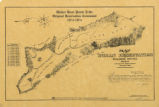
Map of Walker River Paiute Tribe Original Reservation Centennial 1874-1974
1874
Image/StillImage
uaida_main
97
Map of Western Indian Territory Before 1850
Image/StillImage
uaida_main
98
Map of Western Shoshone and Northern Paiute Territory
Image/StillImage
uaida_main
99
Map showing boundaries of Northern Paiute, Southern Paiute, Shoshone Bannock and Ute
Image/StillImage
uaida_main
100
Map showing the boundary of the Shoshone Indian territory
1941
Image/StillImage
uaida_main
76
-
100
of
181
<
1
2
3
4
5
6
7
8
>