| Title | Date | Type | Setname | ||
|---|---|---|---|---|---|
| 76 |
 |
Base of Straight Cliffs formation (Cretaceous) at Orderville. Tropic shale forms slope at bottom. Kane County, UT, 1939 | 1939 | Image | uum_map |
| 77 |
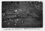 |
Basketball game in Orderville | Image | uum_map | |
| 78 |
 |
Baskets quilt, by Gertrude Frees Westfall | 1900; 1901; 1902; 1903; 1904; 1905; 1906; 1907; 1908; 1909; 1910; 1911; 1912; 1913; 1914; 1915; 1916; 1917; 1918; 1919; 1920; 1921; 1922; 1923; 1924; 1925; 1926; 1927; 1928; 1929; 1930 | Text | uum_uqhr |
| 79 |
 |
Bathing in a waterfall | 1963 | Image | uum_map |
| 80 |
 |
Bed of little Creek, sunk 10 feet to 40 feet into alluvium since 1890, Kane County, UT, 1939 | 1939 | Image | uum_map |
| 81 |
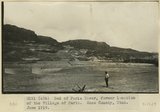 |
Bed of Paria River, former location of the Village of Paria. Kane County, UT. June 1918 | 1918 | Image | uum_map |
| 82 |
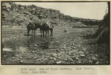 |
Bed of Upper Wahweap. Kane County, UT. June 1918 | 1918 | Image | uum_map |
| 83 |
 |
Below to Gregory Bridge from large cove downstream | 1963-04-23 | Image | uum_map |
| 84 |
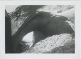 |
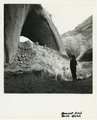
Bement Arch | 1963 | Image | uum_map |
| 85 |
 |
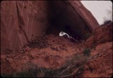
Bement Arch, Davis Gulch | 1940; 1941; 1942; 1943; 1944; 1945; 1946; 1947; 1948; 1949; 1950; 1951; 1952; 1953; 1954; 1955; 1956; 1957; 1958; 1959; 1960; 1961; 1962; 1963; 1964; 1965; 1966; 1967; 1968; 1969; 1970; 1971; 1972; 1973; 1974; 1975; 1976; 1977; 1978; 1979; 1980 | Image | uum_map |
| 86 |
 |
Bement Arch, Davis Gulch | 1940; 1941; 1942; 1943; 1944; 1945; 1946; 1947; 1948; 1949; 1950; 1951; 1952; 1953; 1954; 1955; 1956; 1957; 1958; 1959; 1960; 1961; 1962; 1963; 1964; 1965; 1966; 1967; 1968; 1969; 1970; 1971; 1972; 1973; 1974; 1975; 1976; 1977; 1978; 1979; 1980 | Image | uum_map |
| 87 |
 |
Bement Arch, Davis Gulch | 1964-05 | Image | uum_map |
| 88 |
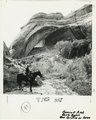 |
Bement Arch, Davis Gulch, Don Griffin on horse | 1940; 1941; 1942; 1943; 1944; 1945; 1946; 1947; 1948; 1949; 1950; 1951; 1952; 1953; 1954; 1955; 1956; 1957; 1958; 1959; 1960; 1961; 1962; 1963; 1964; 1965; 1966; 1967; 1968; 1969; 1970; 1971; 1972; 1973; 1974; 1975; 1976; 1977; 1978; 1979; 1980 | Image | uum_map |
| 89 |
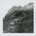 |
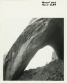
Bement Arch, January 1963 | 1963-01 | Image | uum_map |
| 90 |
 |
Bench extending from Kaiparowits Plateau near Fifty Mile Point. Kane County, UT. June 1918 | 1918 | Image | uum_map |
| 91 |
 |
Benjamin Perkins, January 14, 1844--March 30, 1926 | 1944; 1945; 1946; 1947; 1948; 1949; 1950; 1951; 1952 | Text | uum_uhrf |
| 92 |
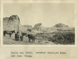 |
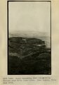
Between Gunsight Pass and Kane Creek | 1922 | Image | uum_map |
| 93 |
 |
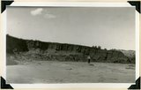
Beveled erosion surface above alluvium flat into which is cut Deer Range wash. Kane County, Utah, 1934. | 1934 | Image | uum_map |
| 94 |
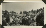 |
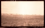
Big Meadow Canyon. Carmel formation. Kane County, Utah. | 1930 | Image | uum_map |
| 95 |
 |
Big Plains, west dipping surface eroded on east dipping Chinle beds, now coated with coalescing fans. Little Creek Terrace in right background, Kane County, UT, 1939 | 1939 | Image | uum_map |
| 96 |
 |
Blackbrush in bloom, Hidden Passage Bar [1] | 1963-04-25 | Image | uum_map |
| 97 |
 |
Blackbrush in bloom, Hidden Passage Bar [2] | 1963-04-25 | Image | uum_map |
| 98 |
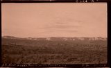 |
Block mesas from south, panorama. | 1937 | Image | uum_map |
| 99 |
 |
Block mesas from south, panorama. | 1937 | Image | uum_map |
| 100 |
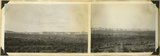 |
Block mesas from the south, panorama. | 1937 | Image | uum_map |