Home
Browse
Ask Us
Chat
Harmful Language Statement
Log in
Advanced Search
Year
1849
1850
1851
1852
1853
1854
1855
1856
1857
1858
1859
1860
1861
1862
1863
1864
1865
1866
1867
1868
1869
1870
1871
1872
1873
1874
1875
1876
1877
1878
1879
1880
1881
1882
1883
1884
1885
1886
1887
1888
1889
1890
1891
1892
1893
1894
1895
1896
1897
1898
1899
1900
1901
1902
1903
1904
1905
1906
1907
1908
1909
1910
1911
1912
1913
1914
1915
1916
1917
1918
1919
1920
1921
1922
1923
1924
1925
1926
1927
1928
1929
1930
1931
1932
1933
1934
1935
1936
1937
1938
1939
1940
1941
1942
1943
1944
1945
1946
1947
1948
1949
1950
1951
1952
1953
1954
1955
1956
1957
1958
1959
1960
1961
1962
1963
1964
1965
1966
1967
1968
1969
1970
1971
1972
1973
1974
1975
1976
1977
1978
1979
1980
1981
1982
1983
1984
1985
1986
1987
1988
1989
1990
1991
1992
1993
1994
1995
1996
1997
1998
1999
2000
2001
2002
2003
2004
2005
2006
2007
2008
2009
2010
2011
2012
2013
2014
2015
2016
2017
2018
2019
2020
TO
1849
1850
1851
1852
1853
1854
1855
1856
1857
1858
1859
1860
1861
1862
1863
1864
1865
1866
1867
1868
1869
1870
1871
1872
1873
1874
1875
1876
1877
1878
1879
1880
1881
1882
1883
1884
1885
1886
1887
1888
1889
1890
1891
1892
1893
1894
1895
1896
1897
1898
1899
1900
1901
1902
1903
1904
1905
1906
1907
1908
1909
1910
1911
1912
1913
1914
1915
1916
1917
1918
1919
1920
1921
1922
1923
1924
1925
1926
1927
1928
1929
1930
1931
1932
1933
1934
1935
1936
1937
1938
1939
1940
1941
1942
1943
1944
1945
1946
1947
1948
1949
1950
1951
1952
1953
1954
1955
1956
1957
1958
1959
1960
1961
1962
1963
1964
1965
1966
1967
1968
1969
1970
1971
1972
1973
1974
1975
1976
1977
1978
1979
1980
1981
1982
1983
1984
1985
1986
1987
1988
1989
1990
1991
1992
1993
1994
1995
1996
1997
1998
1999
2000
2001
2002
2003
2004
2005
2006
2007
2008
2009
2010
2011
2012
2013
2014
2015
2016
2017
2018
2019
2020
Type
Text
666
Image/StillImage
606
Image
6
Image/MovingImage
2
Sound
1
Format
application/pdf
1,174
image/jpeg
78
video/mp4
1
Collection
Classified Photographs
1
College of Law Publications
3
Theses & Dissertations
1
UAIDA Main Collection
1,269
Utah COVID-19
4
Utah Historical Society Oral History ...
1
Western Waters Electronic Resources
2
More
Filters:
Subject:
"Indian reservations"
676
-
700
of
1,281
<
23
24
25
26
27
28
29
30
31
32
>
Gallery view
Number of results to display per page
10
25
50
100
200
Sort by Relevance
Sort by Title A-Z
Sort by Title Z-A
Sort by Date Ascending
Sort by Date Descending
Sort by Last Modified Ascending
Sort by Last Modified Descending
Title
Date
Type
Setname
676
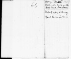
List of items at Deep Creek dated October 25, 1860
1860-10-25
Text
uaida_main
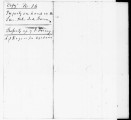
677
List of items at San Pete farm dated October 25, 1860
1860-10-25
Text
uaida_main
678
List of items at Spanish Fork dated September 1, 1860
1860-09-01
Text
uaida_main
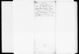
679
List of lost items dated May 22, 1959
1859-05-22
Text
uaida_main
680
List of lost items dated November 1, 1860
1860-11-01
Text
uaida_main
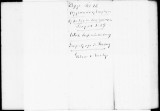
681
List of lost items dated October 20, 1860
1860-10-20
Text
uaida_main
682
List of lost items dated October 24, 1860
1860-10-24
Text
uaida_main
683
List of lost or used items on San Pete farm dated October 24, 1860
1860-10-24
Text
uaida_main
684
List of lost or used items on San Pete farm dated October 24, 1860
1860-10-24
Text
uaida_main
685
List of lost, stolen or used items dated October 24, 1860
1860-10-24
Text
uaida_main
686
List of Most Prominent Indians of the Uintah and Ouray Indian Reservation
1913-01-01
Text
uaida_main
687
List of payments to John Fairbank dated 1863
1863
Text
uaida_main
688
List of purchased hardware dated April, 1865
1865-04
Text
uaida_main
689
List of Witnesses and Jurors and copy of Indictment, and Defendant's Receipt Therefor June 29, 1915
Text
uaida_main
690
Major General Terry to General of the Army
1887-08-23
Text
uaida_main
691
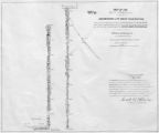
Map of a portion of the Uncompahgre Ute Indian Reservation, surveyed and subdivided for allotments to the Uncompahgre Ute Indians in accordance with the Act approved June 1880 by authority of Honorable N. C. McFarland, Commissioner General Land Office Daniel G. Major U.S. Surveyor 1882-1883
1882; 1883
Image/StillImage
uaida_main
692
Map of Dry Gulch Irrigation District, Uintah Indian Reservation, Utah
Image/StillImage
uaida_main
693
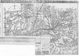
Map of East Central Utah, Uintah Ouray Reservation, Utah Valley
Image/StillImage
uaida_main
694
Map of Indian Reservation in the West, 1929
Image/StillImage
uaida_main
695
Map of Indian Reservation. 1884
Image/StillImage
uaida_main
696
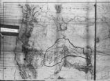
Map of Indian Reservations in the Western United States
Image/StillImage
uaida_main
697
Map of Part of the West Boundary of the Uncompahgre Ute Indian Reservation as Surveyed by William B. Dougall
Image/StillImage
uaida_main
698
Map of Reservations of the Western United States and the Religions that Worked on the Reservations 1870's
1873
Image/StillImage
uaida_main
699
Map of Shoshone Territory; Prepared by Doty, 1859
Image/StillImage
uaida_main
700
Map of Southern Colorado and the Ute Mountain Ute Reservation
Image/StillImage
uaida_main
676
-
700
of
1,281
<
23
24
25
26
27
28
29
30
31
32
>