Home
Browse
Ask Us
Chat
Harmful Language Statement
Log in
Advanced Search
Year
1849
1850
1851
1852
1853
1854
1855
1856
1857
1858
1859
1860
1861
1862
1863
1864
1865
1866
1867
1868
1869
1870
1871
1872
1873
1874
1875
1876
1877
1878
1879
1880
1881
1882
1883
1884
1885
1886
1887
1888
1889
1890
1891
1892
1893
1894
1895
1896
1897
1898
1899
1900
1901
1902
1903
1904
1905
1906
1907
1908
1909
1910
1911
1912
1913
1914
1915
1916
1917
1918
1919
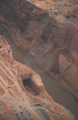
1920
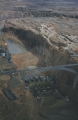
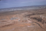
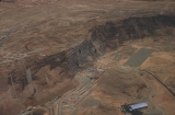
1921
1922
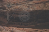
1923
1924
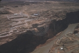
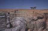
1925
1926
1927
1928
1929
1930
1931
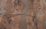
1932
1933
1934
1935
1936
1937
1938
1939
1940
1941
1942
1943
1944
1945
1946
1947
1948
1949
1950
1951
1952
1953
1954
1955
1956
1957
1958
1959
1960
1961
1962
1963
1964
1965
1966
1967
1968
1969
1970
1971
1972
1973
1974
1975
1976
1977
1978
1979
1980
1981
1982
1983
1984
1985
1986
1987
1988
1989
1990
1991
1992
1993
1994
1995
1996
1997
1998
1999
2000
2001
2002
2003
2004
2005
2006
2007
2008
2009
2010
2011
2012
2013
2014
2015
2016
2017
2018
2019
2020
2021
2022
2023
TO
1849
1850
1851
1852
1853
1854
1855
1856
1857
1858
1859
1860
1861
1862
1863
1864
1865
1866
1867
1868
1869
1870
1871
1872
1873
1874
1875
1876
1877
1878
1879
1880
1881
1882
1883
1884
1885
1886
1887
1888
1889
1890
1891
1892
1893
1894
1895
1896
1897
1898
1899
1900
1901
1902
1903
1904
1905
1906
1907
1908
1909
1910
1911
1912
1913
1914
1915
1916
1917
1918
1919
1920
1921
1922
1923
1924
1925
1926
1927
1928
1929
1930
1931
1932
1933
1934
1935
1936
1937
1938
1939
1940
1941
1942
1943
1944
1945
1946
1947
1948
1949
1950
1951
1952
1953
1954
1955
1956
1957
1958
1959
1960
1961
1962
1963
1964
1965
1966
1967
1968
1969
1970
1971
1972
1973
1974
1975
1976
1977
1978
1979
1980
1981
1982
1983
1984
1985
1986
1987
1988
1989
1990
1991
1992
1993
1994
1995
1996
1997
1998
1999
2000
2001
2002
2003
2004
2005
2006
2007
2008
2009
2010
2011
2012
2013
2014
2015
2016
2017
2018
2019
2020
2021
2022
2023
Type
Image
2,506
Image/StillImage
2,475
Text
293
Sound
147
Image/MovingImage
9
Format
image/jpeg
4,832
application/pdf
586
video/mp4
112
audio/mpeg
44
Collection
Al W. Morton Collection, 1930s-1950s
55
American Westward Migration
3
Audio-Visual Archives Collections
2
Beckwith Photograph Collection
6
Classified Photographs
336
College of Law Publications
1
George A. Smith Papers
1
Glen Canyon
1
Land Use - Transportation Scenario Pl...
4
Mormon Settlement in Arizona
212
Photo Archives
1,943
Shipler Commercial Photographers
2
Ski and Snow Sports Archives
7
UAIDA Main Collection
141
UMNH Vertebrate Zoology Voucher Images
141
Uintah County Regional History Center...
3
Utah Artists Project
2
Utah Humanities Research Foundation
5
Utah River Running Photo Archives
2,584
Vernal Express Photographs
1
Western Soundscape
152
Western Waters Documents
2
Western Waters Electronic Resources
38
More
Filters:
Spatial Coverage:
"Arizona"
76
-
100
of
5,642
<
1
2
3
4
5
6
7
8
9
10
>
Gallery view
Number of results to display per page
10
25
50
100
200
Sort by Relevance
Sort by Title A-Z
Sort by Title Z-A
Sort by Date Ascending
Sort by Date Descending
Sort by Last Modified Ascending
Sort by Last Modified Descending
Title
Date
Type
Setname
76
Above Unkar [rapid]
1970-04; 1970-05
Image
uum_map_rr
77
Above Unkar [rapid]
1970-04; 1970-05
Image
uum_map_rr
78
Accounting system for water use by vegetation in the lower Colorado River Valley
1992
Text
wwdl_er
79
Across from Grand View Point, Grand Canyon National Park, Arizona
1930; 1931; 1932; 1933; 1934; 1935; 1936; 1937; 1938; 1939; 1940; 1941; 1942; 1943; 1944; 1945
Image
uum_map
80
Aerial of construction camp
1958-10
Image
uum_map_rr
81
Aerial of construction camp
1958-04
Image
uum_map_rr
82
Aerial of dam site with rising dam
1961-05
Image
uum_map_rr
83
Aerial of north side of canyon, paved view area.
1962-08
Image
uum_map_rr
84
Aerial photo of dam site.
1958-04
Image
uum_map_rr
85
Aerial photo of dam site.
1958-10
Image
uum_map_rr
86
Aerial photo of dam site.
1958-04
Image
uum_map_rr
87
Aerial photo of dam site.
1958-10
Image
uum_map_rr
88
Aerial photo of dam site.
1958-04
Image
uum_map_rr
89
Aerial photo of dam site.
1958-10
Image
uum_map_rr
90
Aerial photo of dam site.
1958-04
Image
uum_map_rr
91
Aerial photos of dam site and bridge construction.
1958-10
Image
uum_map_rr
92
Aerial photos of dam site and bridge construction.
1958-10
Image
uum_map_rr
93
Aerial photos of dam site and bridge construction.
1958-10
Image
uum_map_rr
94
Aerial photos of dam site and bridge construction.
1958-10
Image
uum_map_rr
95
Aerial photos of dam site and bridge construction.
1958-10
Image
uum_map_rr
96
Aerial photos of dam site and bridge construction.
1958-10
Image
uum_map_rr
97
Aerial photos of dam site and bridge construction.
1958-10
Image
uum_map_rr
98
Aerial photos of dam site and bridge construction.
1958-10
Image
uum_map_rr
99
Aerial photos of dam site and Page, Arizona
1958-10
Image
uum_map_rr
100
Aerial tramway, batch plant
1962-08
Image
uum_map_rr
76
-
100
of
5,642
<
1
2
3
4
5
6
7
8
9
10
>