Home
Browse
Ask Us
Chat
Harmful Language Statement
Log in
Uintah County Regional History Center Maps
Advanced Search
Year
1825
1826
1827
1828
1829
1830
1831
1832
1833
1834
1835
1836
1837
1838
1839
1840
1841
1842
1843
1844
1845
1846
1847
1848
1849
1850
1851
1852
1853
1854
1855
1856
1857
1858
1859
1860
1861
1862
1863
1864
1865
1866
1867
1868
1869
1870
1871
1872
1873
1874
1875
1876
1877
1878
1879
1880
1881
1882
1883
1884
1885
1886
1887
1888
1889
1890
1891
1892
1893
1894
1895
1896
1897
1898
1899
1900
1901
1902
1903
1904
1905
1906
1907
1908
1909
1910
1911
1912
1913
1914
1915
1916
1917
1918
1919
1920
1921
1922
1923
1924
1925
1926
1927
1928
1929
1930
1931
1932
1933
1934
1935
1936
1937
1938
1939
1940
1941
1942
1943
1944
1945
1946
1947
1948
1949
1950
1951
1952
1953
1954
1955
1956
1957
1958
1959
1960
1961
1962
1963
1964
1965
1966
1967
1968
1969
1970
1971
1972
1973
1974
1975
1976
1977
1978
1979
1980
1981
1982
1983
1984
1985
1986
1987
1988
1989
1990
1991
1992
1993
1994
1995
1996
1997
1998
1999
2000
2001
2002
2003
2004
2005
2006
2007
2008
2009
2010
2011
2012
2013
2014
TO
1825
1826
1827
1828
1829
1830
1831
1832
1833
1834
1835
1836
1837
1838
1839
1840
1841
1842
1843
1844
1845
1846
1847
1848
1849
1850
1851
1852
1853
1854
1855
1856
1857
1858
1859
1860
1861
1862
1863
1864
1865
1866
1867
1868
1869
1870
1871
1872
1873
1874
1875
1876
1877
1878
1879
1880
1881
1882
1883
1884
1885
1886
1887
1888
1889
1890
1891
1892
1893
1894
1895
1896
1897
1898
1899
1900
1901
1902
1903
1904
1905
1906
1907
1908
1909
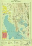
1910
1911
1912
1913
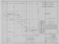
1914
1915
1916
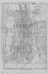
1917
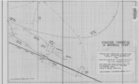
1918
1919
1920
1921
1922
1923
1924
1925
1926
1927
1928
1929
1930
1931
1932
1933
1934
1935
1936
1937
1938
1939
1940
1941
1942
1943
1944
1945
1946
1947
1948
1949
1950
1951
1952
1953
1954
1955
1956
1957
1958
1959
1960
1961
1962
1963
1964
1965
1966
1967
1968
1969
1970
1971
1972
1973
1974
1975
1976
1977
1978
1979
1980
1981
1982
1983
1984
1985
1986
1987
1988
1989
1990
1991
1992
1993
1994
1995
1996
1997
1998
1999
2000
2001
2002
2003
2004
2005
2006
2007
2008
2009
2010
2011
2012
2013
2014
Type
Image/StillImage
474
Format
image/jpeg
329
application/pdf
145
Collection
Uintah County Regional History Center...
474
Filters:
Collection:
"ucl_maps"
276
-
300
of
474
<
7
8
9
10
11
12
13
14
15
16
>
Gallery view
Number of results to display per page
10
25
50
100
200
Sort by Relevance
Sort by Title A-Z
Sort by Title Z-A
Sort by Date Ascending
Sort by Date Descending
Sort by Last Modified Ascending
Sort by Last Modified Descending
Title
Date
Type
276
Plat of the Townsite of Avalon, Utah 1923
1923
Image/StillImage
277
Plat of the Townsite of Lapoint, Utah - 1913
1913
Image/StillImage
278
Plat of the Townsite of Leota 1911
1911
Image/StillImage
279
Plat of the Townsite of Leota, Utah 1927
1927
Image/StillImage
280
Plat of the Townsite of Randlett, Utah 1905
1905
Image/StillImage
281
Pony Express Needles Station Camp Floyd
Image/StillImage
282
Pony Express Route - April 3, 1860 to October 24, 1861
1860; 1861; 1960
Image/StillImage
283
Pony Express Stations Deep Creek
Image/StillImage
284
Pony Express Stations in Utah - April 3, 1860 - October 24, 1861
1860; 1861
Image/StillImage
285
Price River, Utah 1886
1886
Image/StillImage
286
Price, Utah 1980
1980
Image/StillImage
287
Profile Map of the Country Boy Mine (copy of original)
Image/StillImage
288
Promontory US DOI BLM 1973
1973
Image/StillImage
289
Property Survey - Ziegler Chemical & Mineral Corp
2000
Image/StillImage
290
Property Survey of the MS 5688 Hardaway & MS 5689 Harris Mining Claims - Ziegler Chemical & Mineral Corp
2000
Image/StillImage
291
Proposed Mine Plan for the Tom Taylor Mine on the Little Emma Gilsonite Vein - Section 3, T10S, R24E, Uinta County, Utah
1997
Image/StillImage
292
Railroads in Utah 1896
1896
Image/StillImage
293
Rainbow Area Topographic Map Showing Gilsonite Veins, Leases & Claims - Ziegler Chemical & Mineral Corp
1979; 1996
Image/StillImage
294
Randlett, Utah - 1964
1964
Image/StillImage
295
Rangely, Colorado 1979
1979; 1987
Image/StillImage
296
Recreation Map - Ashley National Forest - Utah and Wyoming 1955
1955
Image/StillImage
297
Reservation Map of Fort Duchesne, Utah, 1907
1907
Image/StillImage
298
Ride the Pony Express Trail National Back Country Byway
Image/StillImage
299
Road Commission - Highway 40 Jensen To Vernal 1930
1930
Image/StillImage
300
Roan Plateau (Pianimetric) SE-3 (US DOI BLM) 1977 (revised)
1977
Image/StillImage
276
-
300
of
474
<
7
8
9
10
11
12
13
14
15
16
>