Home
Browse
Ask Us
Chat
Harmful Language Statement
Log in
Advanced Search
Year
1840
1841
1842
1843
1844
1845
1846
1847
1848
1849
1850
1851
1852
1853
1854
1855
1856
1857
1858
1859
1860
1861
1862
1863
1864
1865
1866
1867
1868
1869
1870
1871
1872
1873
1874
1875
1876
1877
1878
1879
1880
1881
1882
1883
1884
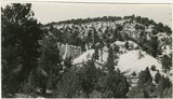
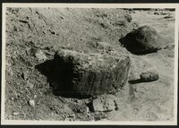
1885
1886
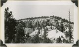
1887
1888
1889
1890
1891
1892
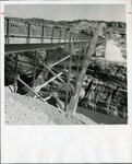
1893
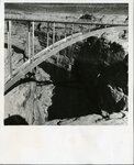
1894
1895
1896
1897
1898
1899
1900
1901
1902
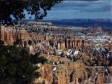
1903
1904
1905
1906
1907
1908
1909
1910
1911
1912
1913
1914
1915
1916
1917
1918
1919
1920
1921
1922
1923
1924
1925
1926
1927
1928
1929
1930
1931
1932
1933
1934
1935
1936
1937
1938
1939
1940
1941
1942
1943
1944
1945
1946
1947
1948
1949
1950
1951
1952
1953
1954
1955
1956
1957
1958
1959
1960
1961
1962
1963
1964
1965
1966
1967
1968
1969
1970
1971
1972
1973
1974
1975
1976
1977
1978
1979
1980
1981
1982
1983
1984
1985
1986
1987
1988
1989
1990
1991
1992
1993
1994
1995
1996
1997
1998
1999
2000
2001
2002
2003
2004
2005
2006
2007
2008
2009
2010
TO
1840
1841
1842
1843
1844
1845
1846
1847
1848
1849
1850
1851
1852
1853
1854
1855
1856
1857
1858
1859
1860
1861
1862
1863
1864
1865
1866
1867
1868
1869
1870
1871
1872
1873
1874
1875
1876
1877
1878
1879
1880
1881
1882
1883
1884
1885
1886
1887
1888
1889
1890
1891
1892
1893
1894
1895
1896
1897
1898
1899
1900
1901
1902
1903
1904
1905
1906
1907
1908
1909
1910
1911
1912
1913
1914
1915
1916
1917
1918
1919
1920
1921
1922
1923
1924
1925
1926
1927
1928
1929
1930
1931
1932
1933
1934
1935
1936
1937
1938
1939
1940
1941
1942
1943
1944
1945
1946
1947
1948
1949
1950
1951
1952
1953
1954
1955
1956
1957
1958
1959
1960
1961
1962
1963
1964
1965
1966
1967
1968
1969
1970
1971
1972
1973
1974
1975
1976
1977
1978
1979
1980
1981
1982
1983
1984
1985
1986
1987
1988
1989
1990
1991
1992
1993
1994
1995
1996
1997
1998
1999
2000
2001
2002
2003
2004
2005
2006
2007
2008
2009
2010
Type
Image
304
Image/StillImage
131
Text
64
Sound
10
Format
image/jpeg
473
application/pdf
82
video/mp4
7
audio/mpeg
3
Collection
Beckwith Photograph Collection
7
Daughters of Utah Pioneers, Phillips ...
1
Photo Archives
322
UAIDA Main Collection
1
Utah Humanities Research Foundation
1
Utah Quilt Heritage Records
62
Utah River Running Photo Archives
158
Western Soundscape
10
Westminster University Photographs
3
More
Filters:
Spatial Coverage:
"Garfield County (Utah)"
51
-
75
of
565
<
1
2
3
4
5
6
7
8
9
10
>
Gallery view
Number of results to display per page
10
25
50
100
200
Sort by Relevance
Sort by Title A-Z
Sort by Title Z-A
Sort by Date Ascending
Sort by Date Descending
Sort by Last Modified Ascending
Sort by Last Modified Descending
Title
Date
Type
Setname
51
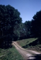
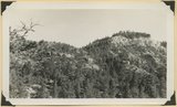
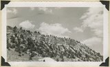
Boulder Mountain, Garfield County, Utah [7]
1940; 1941; 1942; 1943; 1944; 1945; 1946; 1947; 1948; 1949; 1950; 1951; 1952; 1953; 1954; 1955; 1956; 1957; 1958; 1959
Image
uum_map
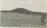
52
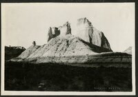
Bowers Knoll; Volcano viewed from northwest. Garfield County, UT. 1944
1944
Image
uum_map
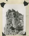
53
Brian Head formation at the 'Castles,' Castle Creek. Garfield County, UT, 1944
1944
Image
uum_map
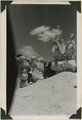
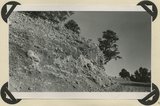
54
Brian Head formation at the 'Castles,' Castle Creek. Garfield County, UT, 1944. Details of erosion
1944
Image
uum_map
55
Brian Head formation capped by lava (rhyolite?): Cliff on upthrown side of Paunsaugunt fault. East fork of Sevier River near the mouth of Deer Creek. Garfield County, UT. 1943
1943
Image
uum_map
56
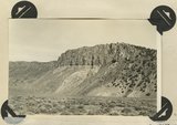
Brian Head formation capped by lava. Branch of Limekiln Canyon. Garfield County, UT. 1942
1942
Image
uum_map
57
Brian Head formation in the walls of Panguitch Canyon near power house. Garfield County, UT. 1943
1943
Image
uum_map
58
Brian Head formation underlain by pink Wasatch limestone on Highway 89, 2± miles north of Castle Creek. Garfield County, UT, 1944
1944
Image
uum_map
59
Brian Head formation, branch of Asay Creek; lies beneath basalt flows. Garfield County, UT, 1944
1944
Image
uum_map
60
Brian Head formation, branch of Asay Creek; lies beneath basalt flows. Garfield County, UT, 1944
1944
Image
uum_map
61
Bridge over Colorado River
1966-05
Image/StillImage
uum_map
62
Bridge over Dirty Devil River
1966-05
Image/StillImage
uum_map
63
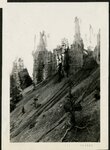
Bryce
1928-11
uum_map
64
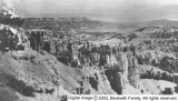
Bryce Canyon
Image
dc_bpc
65
Bryce Canyon and Mount Carmel Highway dedication, Zion National Park, 1930 [35]
1930-07
uum_map
66
Bryce Canyon and Mount Carmel Highway dedication, Zion National Park, 1930 [36]
1930-07
uum_map
67
Bryce Canyon and Mount Carmel Highway dedication, Zion National Park, 1930 [37]
1930
uum_map
68
Bryce Canyon National Park [1]
Image
dc_bpc
69
Bryce Canyon National Park from Sunset Point
1930; 1931; 1932; 1933; 1934; 1935; 1936; 1937; 1938; 1939; 1940; 1941; 1942; 1943; 1944; 1945; 1946; 1947; 1948; 1949; 1950
Image/StillImage
uaida_main
70
Bryce Canyon road sign, early 1920s
1920; 1921; 1922; 1923
uum_map
71
Bryce Canyon Rock Formations
Image
uum_map
72
Bryce Canyon, Escalante, Utah, Nov. 1928 [03]
1928-11
uum_map
73
Bryce Canyon, Escalante, Utah, Nov. 1928 [04]
1928-11
uum_map
74
Bryce Canyon, Escalante, Utah, Nov. 1928 [05]
1928-11
uum_map
75
Bryce Canyon, Escalante, Utah, Nov. 1928 [06]
1928-11
uum_map
51
-
75
of
565
<
1
2
3
4
5
6
7
8
9
10
>