TO
Filters: Spatial Coverage: "West (U.S.)"
| Title | Date | Type | Setname | ||
|---|---|---|---|---|---|
| 76 |
 |
Open Hand and Mailed Fist: Mormon-Indian Relations In Utah, 1847-52 | 1978 | Text | uaida_main |
| 77 |
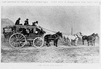 |
Overland coach | 1850; 1851; 1852; 1853; 1854; 1855; 1856; 1857; 1858; 1859; 1860 | uum_map | |
| 78 |
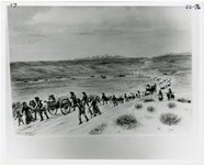 |
Overland trail | 1850; 1851; 1852; 1853; 1854; 1855; 1856; 1857; 1858; 1859; 1860 | uum_map | |
| 79 |
 |
Policty Analysis of Produced Water Issues Associated with In-Situ Thermal Technologies | 2011-01 | Text | ir_uspace |
| 80 |
 |
Policty Analysis of Water Availability and Use Issues for Domestic Oil Shale and Oil Sands Development | 2012-03 | Text | ir_uspace |
| 81 |
 |
Policy Analysis of Produced Water Issues Associated with In-Situ Thermal Technologies | 2011-01 | Text | uu_law_clp |
| 82 |
 |
Policy Analysis of Water Availability and Use Issues for Domestic Oil Shale and Oil Sands Development | 2012-03 | Text | uu_law_clp |
| 83 |
 |
Stalagmites and stalactites in unidentified cave [1] | 1937; 1938; 1939; 1940; 1941; 1942; 1943; 1944; 1945; 1946; 1947; 1948; 1949; 1950; 1951; 1952; 1953; 1954; 1955; 1956; 1957; 1958; 1959; 1960; 1961; 1962; 1963; 1964; 1965; 1966; 1967; 1968; 1969; 1970; 1971; 1972; 1973; 1974; 1975; 1976; 1977; 1978; 1979; 1980 | Image | uum_map_rr |
| 84 |
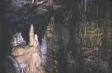 |
Stalagmites and stalactites in unidentified cave [2] | 1937; 1938; 1939; 1940; 1941; 1942; 1943; 1944; 1945; 1946; 1947; 1948; 1949; 1950; 1951; 1952; 1953; 1954; 1955; 1956; 1957; 1958; 1959; 1960; 1961; 1962; 1963; 1964; 1965; 1966; 1967; 1968; 1969; 1970; 1971; 1972; 1973; 1974; 1975; 1976; 1977; 1978; 1979; 1980 | Image | uum_map_rr |
| 85 |
 |
Stalagmites and stalactites in unidentified cave [3] | 1937; 1938; 1939; 1940; 1941; 1942; 1943; 1944; 1945; 1946; 1947; 1948; 1949; 1950; 1951; 1952; 1953; 1954; 1955; 1956; 1957; 1958; 1959; 1960; 1961; 1962; 1963; 1964; 1965; 1966; 1967; 1968; 1969; 1970; 1971; 1972; 1973; 1974; 1975; 1976; 1977; 1978; 1979; 1980 | Image | uum_map_rr |
| 86 |
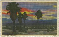 |
Sunset on the desert | 1930; 1931; 1932; 1933; 1934; 1935; 1936; 1937; 1938; 1939; 1940; 1941; 1942; 1943; 1944; 1945 | Image | uum_map |
| 87 |
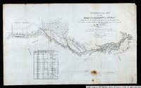 |
Topographical Map of the Road From Missouri To Oregon Commencing at the Mouth of the Kansas in the Missouri River and Ending at the Mouth of the Wallah-Wallah in the Columbia. Section 1 | 1846 | Image/StillImage | uu_awm |
| 88 |
 |
Topographical Map of the Road From Missouri To Oregon Commencing at the Mouth of the Kansas in the Missouri River and Ending at the Mouth of the Wallah-Wallah in the Columbia. Section 2 | 1846 | Image/StillImage | uu_awm |
| 89 |
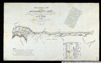 |
Topographical Map of the Road From Missouri To Oregon Commencing at the Mouth of the Kansas in the Missouri River and Ending at the Mouth of the Wallah-Wallah in the Columbia. Section 3 | 1846 | Image/StillImage | uu_awm |
| 90 |
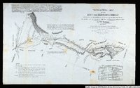 |
Topographical Map of the Road From Missouri To Oregon Commencing at the Mouth of the Kansas in the Missouri River and Ending at the Mouth of the Wallah-Wallah in the Columbia. Section 4 | 1846 | Image/StillImage | uu_awm |
| 91 |
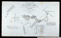 |
Topographical Map of the Road From Missouri To Oregon Commencing at the Mouth of the Kansas in the Missouri River and Ending at the Mouth of the Wallah-Wallah in the Columbia. Section 5 | 1846 | Image/StillImage | uu_awm |
| 92 |
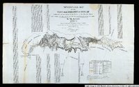 |
Topographical Map of the Road From Missouri To Oregon Commencing at the Mouth of the Kansas in the Missouri River and Ending at the Mouth of the Wallah-Wallah in the Columbia. Section 7 | 1846 | Image/StillImage | uu_awm |
| 93 |
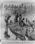 |
Trappers and Indians [1] | 1800; 1801; 1802; 1803; 1804; 1805; 1806; 1807; 1808; 1809; 1810; 1811; 1812; 1813; 1814; 1815; 1816; 1817; 1818; 1819; 1820; 1821; 1822; 1823; 1824; 1825; 1826; 1827; 1828; 1829; 1830; 1831; 1832; 1833; 1834; 1835; 1836; 1837; 1838; 1839; 1840; 1841; 1842; 1843; 1844; 1845; 1846; 1847; 1848; 1849; ... | uum_map | |
| 94 |
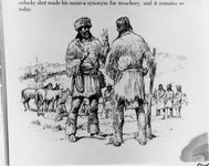 |
Trappers and Indians [2] | 1800; 1801; 1802; 1803; 1804; 1805; 1806; 1807; 1808; 1809; 1810; 1811; 1812; 1813; 1814; 1815; 1816; 1817; 1818; 1819; 1820; 1821; 1822; 1823; 1824; 1825; 1826; 1827; 1828; 1829; 1830; 1831; 1832; 1833; 1834; 1835; 1836; 1837; 1838; 1839; 1840; 1841; 1842; 1843; 1844; 1845; 1846; 1847; 1848; 1849; ... | uum_map | |
| 95 |
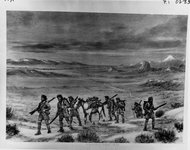 |
Trappers and Indians [4] | 1800; 1801; 1802; 1803; 1804; 1805; 1806; 1807; 1808; 1809; 1810; 1811; 1812; 1813; 1814; 1815; 1816; 1817; 1818; 1819; 1820; 1821; 1822; 1823; 1824; 1825; 1826; 1827; 1828; 1829; 1830; 1831; 1832; 1833; 1834; 1835; 1836; 1837; 1838; 1839; 1840; 1841; 1842; 1843; 1844; 1845; 1846; 1847; 1848; 1849; ... | uum_map | |
| 96 |
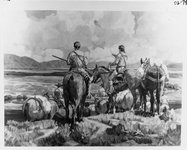 |
Trappers and Indians [5] | 1800; 1801; 1802; 1803; 1804; 1805; 1806; 1807; 1808; 1809; 1810; 1811; 1812; 1813; 1814; 1815; 1816; 1817; 1818; 1819; 1820; 1821; 1822; 1823; 1824; 1825; 1826; 1827; 1828; 1829; 1830; 1831; 1832; 1833; 1834; 1835; 1836; 1837; 1838; 1839; 1840; 1841; 1842; 1843; 1844; 1845; 1846; 1847; 1848; 1849; ... | uum_map | |
| 97 |
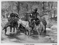 |
Trappers and Indians [6] | 1800; 1801; 1802; 1803; 1804; 1805; 1806; 1807; 1808; 1809; 1810; 1811; 1812; 1813; 1814; 1815; 1816; 1817; 1818; 1819; 1820; 1821; 1822; 1823; 1824; 1825; 1826; 1827; 1828; 1829; 1830; 1831; 1832; 1833; 1834; 1835; 1836; 1837; 1838; 1839; 1840; 1841; 1842; 1843; 1844; 1845; 1846; 1847; 1848; 1849; ... | uum_map | |
| 98 |
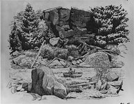 |
Trappers and Indians [7] | 1800; 1801; 1802; 1803; 1804; 1805; 1806; 1807; 1808; 1809; 1810; 1811; 1812; 1813; 1814; 1815; 1816; 1817; 1818; 1819; 1820; 1821; 1822; 1823; 1824; 1825; 1826; 1827; 1828; 1829; 1830; 1831; 1832; 1833; 1834; 1835; 1836; 1837; 1838; 1839; 1840; 1841; 1842; 1843; 1844; 1845; 1846; 1847; 1848; 1849; ... | uum_map | |
| 99 |
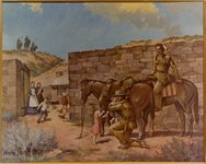 |
Trappers and Indians [8] | 1840; 1841; 1842; 1843; 1844; 1845; 1846; 1847; 1848; 1849; 1850; 1851; 1852; 1853; 1854; 1855; 1856; 1857; 1858; 1859; 1860; 1861; 1862; 1863; 1864; 1865; 1866; 1867; 1868; 1869; 1870 | uum_map | |
| 100 |
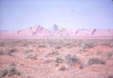 |
Unidentified desert scene with distant rock formations | 1950; 1951; 1952; 1953; 1954; 1955; 1956; 1957; 1958; 1959; 1960; 1961; 1962; 1963; 1964; 1965; 1966; 1967; 1968; 1969; 1970; 1971; 1972; 1973; 1974; 1975; 1976; 1977; 1978; 1979; 1980 | Image | uum_map_rr |
