|
|
Title | Date | Type | Setname |
| 1 |
 |
Map drawn by Barfoot of Rainbow Bridge detail | 1952 | Image | uum_map_rr |
| 2 |
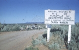 |
Outskirts of Blanding | 1952-08-11 | Image | uum_map_rr |
| 3 |
 |
Map drawn by Barfoot of formation of Rainbow Bridge | 1952 | Image | uum_map_rr |
| 4 |
 |
Map drawn by Barfoot of Hole in Rock detail | 1952-08-14 | Image | uum_map_rr |
| 5 |
 |
Map drawn by Barfoot of mid-Glen Canyon detail | 1952 | Image | uum_map_rr |
| 6 |
 |
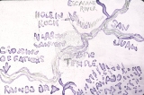
Map drawn by Barfoot of Narrow Canyon, Music Temple | 1952 | Image | uum_map_rr |
| 7 |
 |
Map drawn by Barfoot of Glen Canyon Detail | 1952 | Image | uum_map_rr |
| 8 |
 |
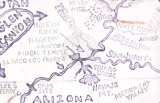
Map drawn by Barfoot of the Four Corner's Area | 1952 | Image | uum_map_rr |
| 9 |
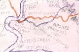 |
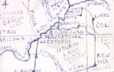
Map drawn by Barfoot of Hite's Landing, White Canyon, Red Canyon, Loper's Cabin, and Bear's Ear | 1952 | Image | uum_map_rr |
| 10 |
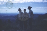 |
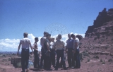
Boys overlook arches scenery | 1952-08-11 | Image | uum_map_rr |
| 11 |
 |
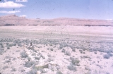
Little Colorado, Shadow Mountain, Marble Platform | 1952-08 | Image | uum_map_rr |
| 12 |
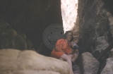 |
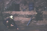
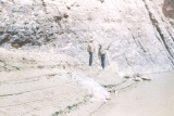
Unidentified woman and child in a canyon | 1952-08 | Image | uum_map_rr |
| 13 |
 |
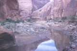
Aztec Canyon | 1952-08-16 | Image | uum_map_rr |
| 14 |
 |
Aztec Canyon | 1952-08-16 | Image | uum_map_rr |
| 15 |
 |
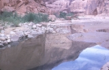
Bert Loper's cabin, irrigation lift | 1952-08-12 | Image | uum_map_rr |
| 16 |
 |
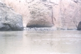
Boys look around a bit, Lower White Canyon | 1952-08-11 | Image | uum_map_rr |
| 17 |
 |
Monument Valley, August, 1955 | 1952-08 | Image | uum_map_rr |
| 18 |
 |
Petrified log on desert near Gap | 1952-08 | Image | uum_map_rr |
| 19 |
 |
Petrified Wood, Marble Platform | 1952-08 | Image | uum_map_rr |
| 20 |
 |
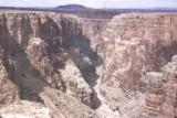
At Marble Canyon dam site | 1952-08-18 | Image | uum_map_rr |
| 21 |
 |
Aztec Canyon | 1952-08-16 | Image | uum_map_rr |
| 22 |
 |
Aztec Canyon | 1952-08-16 | Image | uum_map_rr |
| 23 |
 |
Aztec Canyon | 1952-08-16 | Image | uum_map_rr |
| 24 |
 |
Aztec Canyon | 1952-08-16 | Image | uum_map_rr |
| 25 |
 |
Aztec Canyon | 1952-08-16 | Image | uum_map_rr |