Home
Browse
Ask Us
Chat
Harmful Language Statement
Log in
Advanced Search
Year
1915
1916
1917
1918
1919
1920
1921
1922
1923
1924
1925
1926
1927
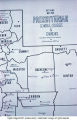
1928
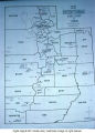
1929
1930
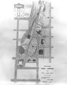
1931
1932
1933
1934
1935
1936
1937
1938
1939
1940
1941
1942
1943
1944
1945
1946
1947
1948
1949
1950
1951
1952
1953
1954
1955
1956
1957
1958
1959
1960
1961
1962
1963
1964
1965
1966
1967
1968
1969
1970
1971
1972
1973
1974
1975
1976
1977
1978
1979
1980
1981
1982
1983
1984
1985
1986
1987
1988
1989
1990
1991
1992
1993
1994
1995
1996
1997
1998
1999
2000
2001
2002
TO
1915
1916
1917
1918
1919
1920
1921
1922
1923
1924
1925
1926
1927
1928
1929
1930
1931
1932
1933
1934
1935
1936
1937
1938
1939
1940
1941
1942
1943
1944
1945
1946
1947
1948
1949
1950
1951
1952
1953
1954
1955
1956
1957
1958
1959
1960
1961
1962
1963
1964
1965
1966
1967
1968
1969
1970
1971
1972
1973
1974
1975
1976
1977
1978
1979
1980
1981
1982
1983
1984
1985
1986
1987
1988
1989
1990
1991
1992
1993
1994
1995
1996
1997
1998
1999
2000
2001
2002
Type
Image
270
Text
2
Format
image/jpeg
269
application/pdf
1
Collection
Art and Art History
169
Beckwith Photograph Collection
8
Classified Photographs
52
Clifton Bray Film Negatives
10
Extractions from the Land: Mining and...
2
Olympic Legacy
5
Peoples of Utah Revisited
2
Photo Archives
8
Shipler Commercial Photographers
6
Ski and Snow Sports Archives
1
Vernal Express Photographs
2
Westminster College Photographs
5
More
Filters:
Subject:
"Maps"
Type:
"Image"
1
-
25
of
270
<
1
2
3
4
5
6
7
8
9
10
>
Gallery view
Number of results to display per page
10
25
50
100
200
Sort by Relevance
Sort by Title A-Z
Sort by Title Z-A
Sort by Date Ascending
Sort by Date Descending
Sort by Last Modified Ascending
Sort by Last Modified Descending
Title
Date
Type
Setname
1
1833 Hyrum Reclamation Project Map
1933-01
Image; Text
dha_pour
2
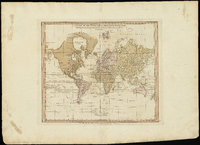
A chart of the world upon Mercator's projection : describing the tracks of Capt. Cook in the year 1768, 69, 70, 71, and in 1772, 73, 74, 75, with the new discoveries
Image
uu_aah_art
3
A new plan of ye great town of Boston in New England in America, with the many additionall [sic] buildings, & new streets, to the year, 1769
Image
uu_aah_art
4
A Plan of the Town of New Haven with all the Buildings in 1748
Image
uu_aah_art
5
Air View Map
1951-11-07
Image
dha_scp
6
Air View Map
1951-11-07
Image
dha_scp
7
Americae sive Novi Orbis, Noca Descripto (A New Description of America or the New World)
Image
uu_aah_art
8
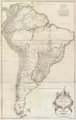
Amerique Meridionale Publiee sous les Auspices de Monseigneur le Duc d'Orleans
Image
uu_aah_art
9
Athens, Greece, plan
Image
uu_aah_art
10
Atlas of Maritime Charts (The Catalan Atlas)
Image
uu_aah_art
11
Atlas of Maritime Charts (The Catalan Atlas), detail showing Mansa Musa
Image
uu_aah_art
12
Avalanche tower and map
1940; 1941; 1942; 1943; 1944; 1945; 1946; 1947; 1948; 1949; 1950; 1951; 1952; 1953; 1954; 1955; 1956; 1957; 1958; 1959; 1960; 1961; 1962; 1963; 1964; 1965; 1966; 1967; 1968; 1969
Image
uum_map_usa
13
Battle of Bear River--Map P.1
Image
dha_cp
14
Birdseye View of Salt Lake City P.1
Image
dha_cp
15
Boston, its environs and harbour, with the rebels works raised against that town in 1775
Image
uu_aah_art
16
British North America P.1
Image
dha_cp
17
Cache Valley Relief Map P.1
Image
dha_cp
18
Camp Floyd Mining District P.1
Image
dha_cp
19
Cantino Planisphere
Image
uu_aah_art
20
Carbon County, Utah P.1
Image
dha_cp
21
Churches, Schools NE
Image
wc_pc
22
Churches, Schools, Missions in Utah.
Image
wc_pc
23
City of Zion--Map P.1
Image
dha_cp
24
Civic Center, Salt Lake City P.1
Image
dha_cp
25
Clarkston, Utah P.1
Image
dha_cp
1
-
25
of
270
<
1
2
3
4
5
6
7
8
9
10
>