Home
Browse
Ask Us
Chat
Harmful Language Statement
Log in
Advanced Search
Year
1901
1902
1903
1904
1905
1906
1907
1908
1909
1910
1911
1912
1913
1914
1915
1916
1917
1918
1919
1920
1921
1922
1923
1924
1925
1926
1927
1928
1929
1930
1931
1932
1933
1934
1935
1936
1937
1938
1939
1940
1941
1942
1943
1944
1945
1946
1947
1948
1949
1950
1951
1952
1953
1954
1955
1956
1957
1958
1959
1960
1961
1962
1963
1964
1965
1966
1967
1968
1969
1970
1971
1972
1973
1974
1975
1976
1977
1978
1979
1980
1981
1982
1983
1984
1985
1986
1987
1988
1989
1990
1991
1992
1993
1994
1995
1996
1997
1998
1999
2000
2001
2002
2003
2004
2005
2006
2007
2008
TO
1901
1902
1903
1904
1905
1906
1907
1908
1909
1910
1911
1912
1913
1914
1915
1916
1917
1918
1919
1920
1921
1922
1923
1924
1925
1926
1927
1928
1929
1930
1931
1932
1933
1934
1935
1936
1937
1938
1939
1940
1941
1942
1943
1944
1945
1946
1947
1948
1949
1950
1951
1952
1953
1954
1955
1956
1957
1958
1959
1960
1961
1962
1963
1964
1965
1966
1967
1968
1969
1970
1971
1972
1973
1974
1975
1976
1977
1978
1979
1980
1981
1982
1983
1984
1985
1986
1987
1988
1989
1990
1991
1992
1993
1994
1995
1996
1997
1998
1999
2000
2001
2002
2003
2004
2005
2006
2007
2008
Type
Image/StillImage
7
Image
6
Text
4
Format
image/jpeg
6
application/pdf
5
application/vnd.google-earth.kmz
2
application/zip
2
Collection
Electronic University Archive
1
Theses & Dissertations
7
Uintah County Regional History Center...
7
Filters:
Subject:
"Grand County"
1
-
25
of
15
Gallery view
Number of results to display per page
10
25
50
100
200
Sort by Relevance
Sort by Title A-Z
Sort by Title Z-A
Sort by Date Ascending
Sort by Date Descending
Sort by Last Modified Ascending
Sort by Last Modified Descending
Title
Date
Type
Setname
1
A study of primary sedimentary structures around the Moab anticline, Grand County, Utah (Google Earth map overlay KMZ file)
1965-08
Image
ir_etd
2
A study of primary sedimentary structures around the Moab anticline, Grand County, Utah (Thesis and maps)
1965-08
Text; Image
ir_etd
3
A study of primary sedimentary structures around the Moab anticline, Grand County, Utah: Georeferenced map files
1965-08
Image
ir_etd
4
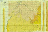
Book Cliffs US DOI BLM 1979
1979
Image/StillImage
ucl_maps
5
Ecoshale: Environmental alternative fuels
2008-11-13
Text
ir_eua
6
Geologic Map of Uintah County, Utah - South Half - 1950s
1950; 1951; 1952; 1953; 1954; 1955; 1956; 1957; 1958; 1959
Image/StillImage
ucl_maps
7
Geology of the San Arroyo gas Field Grand County, Utah
1972-08
Text
ir_etd
8
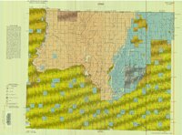
Roan Plateau (Pianimetric) SE-3 (US DOI BLM) 1977 (revised)
1977
Image/StillImage
ucl_maps
9
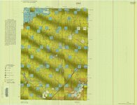
Roan Plateau (Planimetric) SE-3 (US DOI BLM) 1975
1975
Image/StillImage
ucl_maps
10
Subsurface geology of the Mesozoic formations overlying the Uncompahgre Uplift in Grand County, Utah
1961-06
Text; Image
ir_etd
11
Subsurface geology of the Mesozoic formations overlying the Uncompahgre Uplift in Grand County, Utah (Google Earth map overlay KMZ file)
1961-06
Image
ir_etd
12
Subsurface geology of the Mesozoic formations overlying the Uncompahgre Uplift in Grand County, Utah: Georeferenced map files
1961-06
Image
ir_etd
13
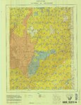
Uintah And Grand Counties 1901
1901
Image/StillImage
ucl_maps
14
Westwater (Planimetric) SE-4 (US DOI BLM) 1975 (revised)
1975
Image/StillImage
ucl_maps
15
Westwater (Planimetric) SE-4 (US DOI BLM) 1977
1977
Image/StillImage
ucl_maps
1
-
25
of
15