Home
Browse
Ask Us
Chat
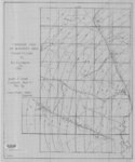
Harmful Language Statement
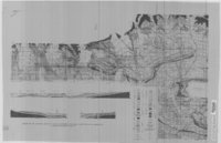
Log in
Advanced Search
Year
1830
1831
1832
1833
1834
1835
1836
1837
1838
1839
1840
1841
1842
1843
1844
1845
1846
1847
1848
1849
1850
1851
1852
1853
1854
1855
1856
1857
1858
1859
1860
1861
1862
1863
1864
1865
1866
1867
1868
1869
1870
1871
1872
1873
1874
1875
1876
1877
1878
1879
1880
1881
1882
1883
1884
1885
1886
1887
1888
1889
1890
1891
1892
1893
1894
1895
1896
1897
1898
1899
1900
1901
1902
1903
1904
1905
1906
1907
1908
1909
1910
1911
1912
1913
1914
1915
1916
1917
1918
1919
1920
1921
1922
1923
1924
1925
1926
1927
1928
1929
1930
1931
1932
1933
1934
1935
1936
1937
1938
1939
1940
1941
1942
1943
1944
1945
1946
1947
1948
1949
1950
1951
1952
1953
1954
1955
1956
1957
1958
1959
1960
1961
1962
1963
1964
1965
1966
1967
1968
1969
1970
1971
1972
1973
1974
1975
1976
1977
1978
1979
1980
1981
1982
1983
1984
1985
1986
1987
1988
1989
1990
1991
1992
1993
1994
1995
1996
1997
1998
1999
2000
2001
2002
2003
2004
2005
2006
2007
2008
2009
2010
2011
2012
2013
2014
2015
2016
2017
2018
2019
2020
2021
2022
TO
1830
1831
1832
1833
1834
1835
1836
1837
1838
1839
1840
1841
1842
1843
1844
1845
1846
1847
1848
1849
1850
1851
1852
1853
1854
1855
1856
1857
1858
1859
1860
1861
1862
1863
1864
1865
1866
1867
1868
1869
1870
1871
1872
1873
1874
1875
1876
1877
1878
1879
1880
1881
1882
1883
1884
1885
1886
1887
1888
1889
1890
1891
1892
1893
1894
1895
1896
1897
1898
1899
1900
1901
1902
1903
1904
1905
1906
1907
1908
1909
1910
1911
1912
1913
1914
1915
1916
1917
1918
1919
1920
1921
1922
1923
1924
1925
1926
1927
1928
1929
1930
1931
1932
1933
1934
1935
1936
1937
1938
1939
1940
1941
1942
1943
1944
1945
1946
1947
1948
1949
1950
1951
1952
1953
1954
1955
1956
1957
1958
1959
1960
1961
1962
1963
1964
1965
1966
1967
1968
1969
1970
1971
1972
1973
1974
1975
1976
1977
1978
1979
1980
1981
1982
1983
1984
1985
1986
1987
1988
1989
1990
1991
1992
1993
1994
1995
1996
1997
1998
1999
2000
2001
2002
2003
2004
2005
2006
2007
2008
2009
2010
2011
2012
2013
2014
2015
2016
2017
2018
2019
2020
2021
2022
Type
Image
73
Text
67
Image/StillImage
19
Sound
5
Image/MovingImage
2
Dataset
1
More
Format
application/pdf
76
image/jpeg
44
application/vnd.google-earth.kmz
14
application/zip
13
video/mp4
1
Collection
Beckwith Photograph Collection
16
Classified Photographs
14
Electronic University Archive
3
Electronic University Archive (Restri...
1
Great Salt Lake Oral History Collection
5
Park City Historical Society & Museum
1
Rare Books Collection
4
Regional History Center
5
Rock Climbers Oral History Project
1
Theses & Dissertations
76
UAIDA Main Collection
2
Uintah County Regional History Center...
12
Utah Historical Society Oral History ...
4
Western Waters Books
1
Western Waters Electronic Resources
4
More
Filters:
Subject:
"Geology"
1
-
25
of
149
<
1
2
3
4
5
6
>
Gallery view
Number of results to display per page
10
25
50
100
200
Sort by Relevance
Sort by Title A-Z
Sort by Title Z-A
Sort by Date Ascending
Sort by Date Descending
Sort by Last Modified Ascending
Sort by Last Modified Descending
Title
Date
Type
Setname
1
Oral history interview of Larry Coats, conducted by Tallie Casucci (audio and transcript)
2022-11-14
Text; Sound
uum_rcohp
2
Geologic North-South Cross Profile Whiterocks Area 1957
1957
Image/StillImage
ucl_maps
3
Geologic Map of Bonanza Area, Uintah County, Utah 1976
1976
Image/StillImage
ucl_maps
4
Geologic Map of the Blue Mountain Area 1963
1963
Image/StillImage
ucl_maps
5
Geologic Map and Structure Sections of the Uinta River-Brush Creek Area, Duchesne and Uintah Counties, Utah
1947
Image/StillImage
ucl_maps
6
Cat Creek & Pebble Puppy Placer Gold Claims, Uintah County, Utah 1994
1994
Image/StillImage
ucl_maps
7
Characterizing background seismicity in the region surrounding Milford, Utah
2017
Text
ir_etd
8
Coastal margin reservoir quality: subsurface analysis of the late cretaceous John Henry member, Kaiparowits Plateau, Southern Utah
2017
Text
ir_etd
9
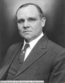
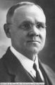
James E. Talmage
Image
dha_cp
10
James E. Talmage
Image
dha_cp
11
James E. Talmage
1904; 1900; 1901; 1902; 1903; 1905; 1906; 1907; 1908
Image
dha_cp
12
James E. Talmage
Image
dha_cp
13
James E. Talmage
Image
dha_cp
14
James E. Talmage
Image
dha_cp
15
Journal of Researches in Geology and Natural History of the Various Countries Visted by H.M.S. Beagle
1839
Text
uum_rbc
16
Three-dimensional forward modeling and inversion of magnetic induced polarization (MIP) data using the integral equation method
2018
Text
ir_etd
17
Geology of a part of Northwestern Uinta County, Wyoming
1961-06
Text
ir_etd
18
Clarence King
Image
dha_cp
19
Geology of the San Arroyo gas Field Grand County, Utah
1972-08
Text
ir_etd
20
Geology of the Morgan-Henefer area Morgan and Summit Counties, Utah
1955-05
Text
ir_etd
21
The Needles Range Formation in Southwestern Utah: paleomagnetism and stratigraphic correlation
1975-03
Text
ir_etd
22
Stratigraphic analysis of the Mesaverde Group, Uinta Basin, Utah: Georeferenced map files
1961-05
Image
ir_etd
23
Stratigraphic analysis of the Mesaverde Group, Uinta Basin, Utah
1961-05
Text; Image
ir_etd
24
Tertiary Salt Lake group in the Great Salt Lake Basin: Georeferenced map files
1955-07
Image
ir_etd
25
Tertiary Salt Lake group in the Great Salt Lake Basin
1955-07
Text; Image
ir_etd
1
-
25
of
149
<
1
2
3
4
5
6
>