Home
Browse
Ask Us
Chat
Harmful Language Statement
Log in
Advanced Search
Year
1950
1951
1952
1953
1954
1955
1956
1957
1958
1959
1960
1961
1962
1963
1964
1965
1966
1967
1968
1969
1970
1971
1972
1973
1974
1975
1976
1977
1978
1979
1980
1981
1982
1983
1984
1985
1986
1987
1988
1989
1990
1991
1992
1993
1994
1995
1996
1997
1998
1999
2000
2001
2002
2003
2004
2005
2006
2007
2008
2009
2010
TO
1950
1951
1952
1953
1954
1955
1956
1957
1958
1959
1960
1961
1962
1963
1964
1965
1966
1967
1968
1969
1970
1971
1972
1973
1974
1975
1976
1977
1978
1979
1980
1981
1982
1983
1984
1985
1986
1987
1988
1989
1990
1991
1992
1993
1994
1995
1996
1997
1998
1999
2000
2001
2002
2003
2004
2005
2006
2007
2008
2009
2010
Type
Image/StillImage
8
Text
5
Image
3
Format
image/jpeg
7
application/pdf
6
application/vnd.google-earth.kmz
1
application/zip
1
Collection
Electronic University Archive
4
Theses & Dissertations
3
Uintah County Regional History Center...
8
Filters:
Subject:
"Carbon County"
1
-
25
of
15
Gallery view
Number of results to display per page
10
25
50
100
200
Sort by Relevance
Sort by Title A-Z
Sort by Title Z-A
Sort by Date Ascending
Sort by Date Descending
Sort by Last Modified Ascending
Sort by Last Modified Descending
Title
Date
Type
Setname
1
Ashley National Forest - Uinta National Forest - Wasatch National Forest - Manti La Sal National Forest
Image/StillImage
ucl_maps
2
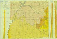
Carbon US DOI BLM 1978
1978
Image/StillImage
ucl_maps
3
Critical Habitat Polygons for Penstemon Grahamii
Image/StillImage
ucl_maps
4
Ecoshale: Environmental alternative fuels
2008-11-13
Text
ir_eua
5
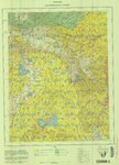
Geologic Map of Uintah County, Utah - South Half - 1950s
1950; 1951; 1952; 1953; 1954; 1955; 1956; 1957; 1958; 1959
Image/StillImage
ucl_maps
6
Geology of the Soldier Summit quadrangle, Utah (Thesis and maps)
1965-06
Text; Image
ir_etd
7
Geology of the Soldier Summit quadrangle, Utah: Georeferenced map files
1965-06
Image
ir_etd
8
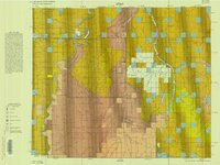
Hill Creek (Planimetric) NE-17 (US DOI BLM) 1975 (revised)
1975
Image/StillImage
ucl_maps
9
Lease & Structure Map Uintah Basin, Utah for Ziegler Chemical & Mineral Corp (Showing Leases & Lines of Strat Columns)
1978
Image/StillImage
ucl_maps
10
Map 1 Geologic map of the Soldier Summit Quadrangle, Utah (Google Earth map overlay KMZ file)
1965-06
Image
ir_etd
11
Oil impregnated sandstone study near Bruin Point and Range Creek--Sunnyside Quadrangle
1972-06
Text
ir_eua
12
Overburden map and thickness determinations, Sunnyside oil-impregnated sandstone deposit, Carbon and Duchesne Counties, Utah
1986
Text
ir_eua
13
The structure and economic impact of Utah's coal industry
2010-05
Text
ir_eua
14
Sunnyside (Planimetric) NE-16 (US DOI BLM) 1974
1974
Image/StillImage
ucl_maps
15
Sunnyside (Planimetric) NE-16 (US DOI BLM) 1975 (revised)
1975
Image/StillImage
ucl_maps
1
-
25
of
15