| Title | Date | Type | Setname | ||
|---|---|---|---|---|---|
| 1 |
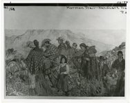 |
"Mormon Trail, handcart travel" | 1856; 1857; 1858; 1859; 1860 | uum_map | |
| 2 |
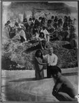 |
Baptizing Indians. | 1850; 1851; 1852; 1853; 1854; 1855; 1856; 1857; 1858; 1859; 1860 | uum_map | |
| 3 |
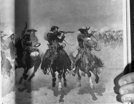 |
Cowboys [1] | 1870; 1871; 1872; 1873; 1874; 1875; 1876; 1877; 1878; 1879; 1880; 1881; 1882; 1883; 1884; 1885; 1886; 1887; 1888; 1889; 1890; 1891; 1892; 1893; 1894; 1895; 1896; 1897; 1898; 1899 | uum_map | |
| 4 |
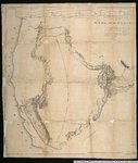
 |
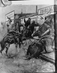
Cowboys [2] | 1870; 1871; 1872; 1873; 1874; 1875; 1876; 1877; 1878; 1879; 1880; 1881; 1882; 1883; 1884; 1885; 1886; 1887; 1888; 1889; 1890; 1891; 1892; 1893; 1894; 1895; 1896; 1897; 1898; 1899 | uum_map | |
| 5 |
 |
Cowboys [3] | 1870; 1871; 1872; 1873; 1874; 1875; 1876; 1877; 1878; 1879; 1880; 1881; 1882; 1883; 1884; 1885; 1886; 1887; 1888; 1889; 1890; 1891; 1892; 1893; 1894; 1895; 1896; 1897; 1898; 1899 | uum_map | |
| 6 |
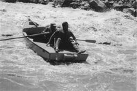 |
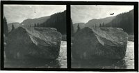
Dallas Wayne Nichol on cataract boat | 1940; 1941; 1942; 1943; 1944; 1945; 1946; 1947; 1948; 1949; 1950; 1951; 1952; 1953; 1954; 1955; 1956; 1957; 1958; 1959; 1960 | uum_map_usa | |
| 7 |
 |
Desert landscape with mesas | 1945; 1946; 1947; 1948; 1949; 1950; 1951; 1952; 1953; 1954; 1955; 1956; 1957; 1958; 1959; 1960; 1961; 1962; 1963; 1964; 1965; 1966; 1967; 1968; 1969; 1970; 1971; 1972; 1973; 1974; 1975; 1976; 1977; 1978; 1979; 1980 | Image | uum_map |
| 8 |
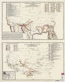 |
Exploration routes and trails--Spanish, 1512-1675, 1675-1811 | 1982 | Image/StillImage | uaida_main |
| 9 |
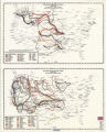 |
Exploration routes and trails: 1800-1820, and 1820-1835 | 1982 | Image/StillImage | uaida_main |
| 10 |
 |
Fremont Map. | 1910; 1911; 1912; 1913; 1914; 1915; 1916; 1917; 1918; 1919; 1920; 1921; 1922; 1923; 1924; 1925; 1926; 1927; 1928; 1929; 1930; 1931; 1932; 1933; 1934; 1935; 1936; 1937; 1938; 1939 | Image | uum_map |
| 11 |
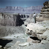 |
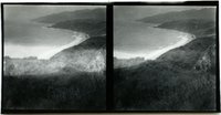
Man looking down at river with mesa in background | 1945; 1946; 1947; 1948; 1949; 1950; 1951; 1952; 1953; 1954; 1955; 1956; 1957; 1958; 1959; 1960; 1961; 1962; 1963; 1964; 1965; 1966; 1967; 1968; 1969; 1970; 1971; 1972; 1973; 1974; 1975; 1976; 1977; 1978; 1979; 1980 | Image | uum_map |
| 12 |
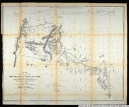 |
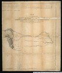
Map exhibiting the routes between Fort Dalles and the Great Salt Lake. | 1859 | Image/StillImage | uu_awm |
| 13 |
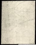 |
Map no. 2, from the mouth of Trap Creek to the Santa Fe crossing. | 1855 | Image/StillImage | uu_awm |
| 14 |
 |
Map no. 3, Rocky Mountains to Puget Sound. | 1855 | Image/StillImage | uu_awm |
| 15 |
 |
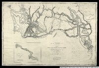
Map of an exploring expedition to the Rocky Mountains in the year 1842 and to Oregon & North California in the years 1843-4 | 1845 | Image/StillImage | uu_awm |
| 16 |
 |
Map of an exploring expedition to the Rocky Mountains in the year 1842 and to Oregon & North California in the years 1843-44 | 1845 | Image/StillImage | uu_awm |
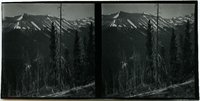
| 17 |
 |
Mountain scenery [01] | 1928; 1929; 1930; 1931; 1932; 1933 | uum_map | |
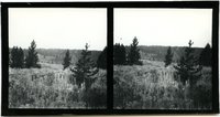
| 18 |
 |
Mountain scenery [02] | 1928; 1929; 1930; 1931; 1932; 1933 | uum_map | |
| 19 |
 |
Mountain scenery [03] | 1928; 1929; 1930; 1931; 1932; 1933 | uum_map | |
| 20 |
 |
Mountain scenery [04] | 1928; 1929; 1930; 1931; 1932; 1933 | uum_map | |
| 21 |
 |
Mountain scenery [05] | 1928; 1929; 1930; 1931; 1932; 1933 | uum_map | |
| 22 |
 |
Mountain scenery [06] | 1928; 1929; 1930; 1931; 1932; 1933 | uum_map | |
| 23 |
 |
Mountain scenery [07] | 1928; 1929; 1930; 1931; 1932; 1933 | uum_map | |
| 24 |
 |
Mountain scenery [08] | 1928; 1929; 1930; 1931; 1932; 1933 | uum_map | |
| 25 |
 |
Mountain scenery [09] | 1928; 1929; 1930; 1931; 1932; 1933 | uum_map |