Home
Browse
Ask Us
Chat
Harmful Language Statement
Log in
Advanced Search
Year
1847
1848
1849
1850
1851
1852
1853
1854
1855
1856
1857
1858
1859
1860
1861
1862
1863
1864
1865
1866
1867
1868
1869
1870
1871
1872
1873
1874
1875
1876
1877
1878
1879
1880
1881
1882
1883
1884
1885
1886
1887
1888
1889
1890
1891
1892
1893
1894
1895
1896
1897
1898
1899
1900
1901
1902
1903
1904
1905
1906
1907
1908
1909
1910
1911
1912
1913
1914
1915
1916
1917
1918
1919
1920
1921
1922
1923
1924
1925
1926
1927
1928
1929
1930
1931
1932
1933
1934
1935
1936
1937
1938
1939
1940
1941
1942
1943
1944
1945
1946
1947
1948
1949
1950
1951
1952
1953
1954
1955
1956
1957
1958
1959
1960
1961
1962
1963
1964
1965
1966
1967
1968
1969
1970
1971
1972
1973
1974
1975
1976
1977
1978
1979
1980
1981
1982
1983
1984
1985
1986
1987
1988
1989
1990
1991
1992
1993
1994
1995
1996
1997
1998
1999
2000
2001
2002
2003
2004
2005
2006
2007
2008
2009
2010
TO
1847
1848
1849
1850
1851
1852
1853
1854
1855
1856
1857
1858
1859
1860
1861
1862
1863
1864
1865
1866
1867
1868
1869
1870
1871
1872
1873
1874
1875
1876
1877
1878
1879
1880
1881
1882
1883
1884
1885
1886
1887
1888
1889
1890
1891
1892
1893
1894
1895
1896
1897
1898
1899
1900
1901
1902
1903
1904
1905
1906
1907
1908
1909
1910
1911
1912
1913
1914
1915
1916
1917
1918
1919
1920
1921
1922
1923
1924
1925
1926
1927
1928
1929
1930
1931
1932
1933
1934
1935
1936
1937
1938
1939
1940
1941
1942
1943
1944
1945
1946
1947
1948
1949
1950
1951
1952
1953
1954
1955
1956
1957
1958
1959
1960
1961
1962
1963
1964
1965
1966
1967
1968
1969
1970
1971
1972
1973
1974
1975
1976
1977
1978
1979
1980
1981
1982
1983
1984
1985
1986
1987
1988
1989
1990
1991
1992
1993
1994
1995
1996
1997
1998
1999
2000
2001
2002
2003
2004
2005
2006
2007
2008
2009
2010
Type
Image
483
Image/StillImage
279
Text
52
Sound
46
Image/MovingImage
3
Format
image/jpeg
833
application/pdf
78
audio/mpeg
30
video/mp4
19
Collection
Beckwith Photograph Collection
45
College of Law Publications
1
Hiram B. Clawson Papers
4
Home Movie Collection
3
Jacob Myers Sr. Papers, 1801-2009
1
Photo Archives
611
Ski and Snow Sports Archives
13
UAIDA Main Collection
19
Uintah County Regional History Center...
1
Utah Humanities Research Foundation
23
Utah Quilt Heritage Records
6
Utah River Running Photo Archives
164
Western Soundscape
46
Western Waters NEH
16
Westminster College Photographs
24
More
Filters:
Spatial Coverage:
"Washington County (Utah)"
1
-
25
of
977
<
1
2
3
4
5
6
7
8
9
10
>
Gallery view
Number of results to display per page
10
25
50
100
200
Sort by Relevance
Sort by Title A-Z
Sort by Title Z-A
Sort by Date Ascending
Sort by Date Descending
Sort by Last Modified Ascending
Sort by Last Modified Descending
Title
Date
Type
Setname
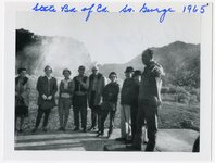
1
St. George, State Board of Education, 1965 [05]
1965
Image/StillImage
uum_map
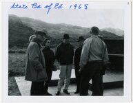
2
St. George, State Board of Education, 1965 [03]
1965
Image/StillImage
uum_map
3
St. George, State Board of Education, 1965 [02]
1965
Image/StillImage
uum_map
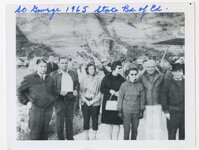
4
St. George, State Board of Education, 1965 [01]
1965
Image/StillImage
uum_map
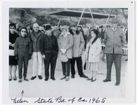
5
St. George, State Board of Education, 1965 [04]
1965
Image/StillImage
uum_map
6
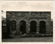
Wells Fargo building, Silver Reef, Utah
1970; 1971; 1972; 1973; 1974; 1975; 1976; 1977; 1978; 1979; 1980
Image/StillImage
uum_map
7
Shoal Creek Dam : Excavation for Shoal Creek diversion dam above Enterprise [and] The same after dam was finally completed
1930; 1931; 1932
Image/StillImage
uum_map
8
Shoal Creek Dam : Looking up stream through spillway of Shoal Creek diversion dam [and] The same looking down stream
1930; 1931; 1932
Image/StillImage
uum_map
9
Shoal Creek Dam : Equalizing reservoir no. 1 on Shoal Creek [and] Equalizing reservoir no. 2 on Shoal Creek
1930; 1931; 1932
Image/StillImage
uum_map
10
Erosion on Santa Clara Creek is a problem of great concern to the farmers of St. George and Santa Clara
1923; 1924; 1925; 1926; 1927; 1928; 1929; 1930; 1931; 1932; 1933
Image/StillImage
uum_map
11
Erosion on Santa Clara Creek : an attempt at control on Santa Clara Creek
1923; 1924; 1925; 1926; 1927; 1928; 1929; 1930; 1931; 1932; 1933
Image/StillImage
uum_map
12
Enterprise flood dam in process of construction
1924; 1925; 1926
Image/StillImage
uum_map
13
Needle palm (Yucca brevifolia), growing on the desert south of St. George, southern Utah
1870; 1871; 1872; 1873; 1874; 1875; 1876; 1877; 1878; 1879; 1880; 1881; 1882; 1883; 1884; 1885; 1886; 1887; 1888; 1889; 1890
Image/StillImage
uum_map
14
Postcard of the St. George LDS Temple
1910; 1911; 1912; 1913; 1914; 1915; 1916; 1917; 1918; 1919; 1920; 1921; 1922; 1923; 1924; 1925; 1926; 1927; 1928; 1929; 1930; 1931; 1932; 1933; 1934; 1935; 1936; 1937
Image/StillImage
uum_map
15
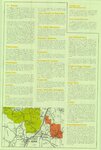
Zion National Park, Washington County (Brochure and Map)
Image/StillImage
ucl_maps
16
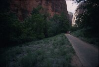
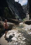
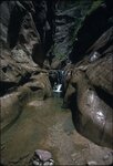
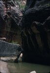
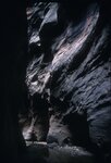
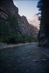
Zion Narrows and Orderville Canyon, 1971 [02]
1971
Image/StillImage
uum_map_rr
17
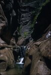
Zion Narrows and Orderville Canyon, 1971 [01]
1971
Image/StillImage
uum_map_rr
18
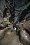
Zion Narrows and Orderville Canyon, 1971 [06]
1971
Image/StillImage
uum_map_rr
19
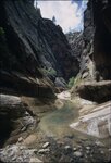
Zion Narrows and Orderville Canyon, 1971 [08]
1971
Image/StillImage
uum_map_rr
20
Zion Narrows and Orderville Canyon, 1971 [10]
1971
Image/StillImage
uum_map_rr
21
Zion Narrows and Orderville Canyon, 1971 [09]
1971
Image/StillImage
uum_map_rr
22
Zion Narrows and Orderville Canyon, 1971 [07]
1971
Image/StillImage
uum_map_rr
23
Zion Narrows and Orderville Canyon, 1971 [04]
1971
Image/StillImage
uum_map_rr
24
Zion Narrows and Orderville Canyon, 1971 [05]
1971
Image/StillImage
uum_map_rr
25
Zion Narrows and Orderville Canyon, 1971 [03]
1971
Image/StillImage
uum_map_rr
1
-
25
of
977
<
1
2
3
4
5
6
7
8
9
10
>