Home
Browse
Ask Us
Chat
Harmful Language Statement
Log in
Advanced Search
Year
1776
1777
1778
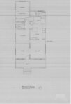
1779
1780
1781
1782
1783
1784
1785
1786
1787
1788
1789
1790
1791
1792
1793
1794
1795
1796
1797
1798
1799
1800
1801
1802
1803
1804
1805
1806
1807
1808
1809
1810
1811
1812
1813
1814
1815
1816
1817
1818
1819
1820
1821
1822
1823
1824
1825
1826
1827
1828
1829
1830
1831
1832
1833
1834
1835
1836
1837
1838
1839
1840
1841
1842
1843
1844
1845
1846
1847
1848
1849
1850
1851
1852
1853
1854
1855
1856
1857
1858
1859
1860
1861
1862
1863
1864
1865
1866
1867
1868
1869
1870
1871
1872
1873
1874
1875
1876
1877
1878
1879
1880
1881
1882
1883
1884
1885
1886
1887
1888
1889
1890
1891
1892
1893
1894
1895
1896
1897
1898
1899
1900
1901
1902
1903
1904
1905
1906
1907
1908
1909
1910
1911
1912
1913
1914
1915
1916
1917
1918
1919
1920
1921
1922
1923
1924
1925
1926
1927
1928
1929
1930
1931
1932
1933
1934
1935
1936
1937
1938
1939
1940
1941
1942
1943
1944
1945
1946
1947
1948
1949
1950
1951
1952
1953
1954
1955
1956
1957
1958
1959
1960
1961
1962
1963
1964
1965
1966
1967
1968
1969
1970
1971
1972
1973
1974
1975
1976
1977
1978
1979
1980
1981
1982
1983
1984
1985
1986
1987
1988
1989
1990
1991
1992
1993
1994
1995
1996
1997
1998
1999
2000
2001
2002
2003
2004
2005
2006
2007
2008
2009
2010
2011
2012
TO
1776
1777
1778
1779
1780
1781
1782
1783
1784
1785
1786
1787
1788
1789
1790
1791
1792
1793
1794
1795
1796
1797
1798
1799
1800
1801
1802
1803
1804
1805
1806
1807
1808
1809
1810
1811
1812
1813
1814
1815
1816
1817
1818
1819
1820
1821
1822
1823
1824
1825
1826
1827
1828
1829
1830
1831
1832
1833
1834
1835
1836
1837
1838
1839
1840
1841
1842
1843
1844
1845
1846
1847
1848
1849
1850
1851
1852
1853
1854
1855
1856
1857
1858
1859
1860
1861
1862
1863
1864
1865
1866
1867
1868
1869
1870
1871
1872
1873
1874
1875
1876
1877
1878
1879
1880
1881
1882
1883
1884
1885
1886
1887
1888
1889
1890
1891
1892
1893
1894
1895
1896
1897
1898
1899
1900
1901
1902
1903
1904
1905
1906
1907
1908
1909
1910
1911
1912
1913
1914
1915
1916
1917
1918
1919
1920
1921
1922
1923
1924
1925
1926
1927
1928
1929
1930
1931
1932
1933
1934
1935
1936
1937
1938
1939
1940
1941
1942
1943
1944
1945
1946
1947
1948
1949
1950
1951
1952
1953
1954
1955
1956
1957
1958
1959
1960
1961
1962
1963
1964
1965
1966
1967
1968
1969
1970
1971
1972
1973
1974
1975
1976
1977
1978
1979
1980
1981
1982
1983
1984
1985
1986
1987
1988
1989
1990
1991
1992
1993
1994
1995
1996
1997
1998
1999
2000
2001
2002
2003
2004
2005
2006
2007
2008
2009
2010
2011
2012
Type
Image/StillImage
9,420
Format
image/jpeg
9,420
Collection
Al W. Morton Collection, 1930s-1950s
428
American Westward Migration
14
Classified Photographs
5,469
College of Law Publications
7
George M. Ottinger Photograph Collection
2
Kent Day Family Collection
7
Life Story Library collection
2
Multimedia Archives Photographs - Res...
648
Photo Archives
337
Regional History Center
3
Schools of the Salt Lake Valley
100
Ski and Snow Sports Archives
24
Taylor A. Woolley Papers
91
UAIDA Main Collection
1,157
Uintah County Regional History Center...
121
Utah Artists Project
72
Utah River Running Photo Archives
120
Utah State Legislators Photographs, 1...
814
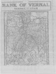
Vernal Express Photographs
2
We Remember, We Celebrate, We Believe...
2
More
Filters:
Spatial Coverage:
"Utah"
Type:
"Image/StillImage"
Format:
"image/jpeg"
1
-
25
of
9,420
<
1
2
3
4
5
6
7
8
9
10
>
Gallery view
Number of results to display per page
10
25
50
100
200
Sort by Relevance
Sort by Title A-Z
Sort by Title Z-A
Sort by Date Ascending
Sort by Date Descending
Sort by Last Modified Ascending
Sort by Last Modified Descending
Title
Date
Type
Setname
1
Bighorn sheep pictographs
1925
Image/StillImage
uum_map_rr
2
Flute player petroglyph
1925
Image/StillImage
uum_map_rr
3
Flute player petroglyphs
1925
Image/StillImage
uum_map_rr
4
Flute player petroglyphs
1925
Image/StillImage
uum_map_rr
5
Petroglyphs
1925
Image/StillImage
uum_map_rr
6
Petroglyphs, Utah
1925
Image/StillImage
uum_map_rr
7
Partial Map of Gusher, Utah
1963; 1964
Image/StillImage
ucl_maps
8
Partial Map of Gusher, Utah
Image/StillImage
ucl_maps
9
The Strip - no date
Image/StillImage
ucl_maps
10
The Strip - no date (2)
Image/StillImage
ucl_maps
11
Caldwell Home Floor Plan
1989
Image/StillImage
ucl_maps
12
Collett Francke Home Floor Plan
1989
Image/StillImage
ucl_maps
13
Coltharp Home 1989
1989
Image/StillImage
ucl_maps
14
Bennion - Valora Home Floor Plans
1989
Image/StillImage
ucl_maps
15
Bennion - Feltch Home Floor Plans
1989
Image/StillImage
ucl_maps
16
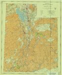
Froiseth's New Sectional and Mineral Map of Utah 1878
1878
Image/StillImage
ucl_maps
17
Map of Utah with the 1920 Census Index
1920
Image/StillImage
ucl_maps
18
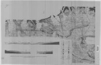
Map 37 - Simple Bouguer Gravity Anomaly Map of Utah
1975
Image/StillImage
ucl_maps
19
State of Utah - Minerals Status 1983
1983
Image/StillImage
ucl_maps
20
Phase 1 Inventory of Undeveloped Areas - State of Utah
1927
Image/StillImage
ucl_maps
21
Geological Map of the Dinosaur National Monument
1965
Image/StillImage
ucl_maps
22
Geologic Map and Structure Sections of the Uinta River-Brush Creek Area, Duchesne and Uintah Counties, Utah
1947
Image/StillImage
ucl_maps
23
Alta Stage P.1
1920
Image/StillImage
dha_cp
24
Hatch Freeman House Floor Plan
1989
Image/StillImage
ucl_maps
25
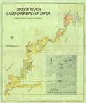
Green River Land Ownership Data - Generated From FWS Maps
Image/StillImage
ucl_maps
1
-
25
of
9,420
<
1
2
3
4
5
6
7
8
9
10
>