| Title | Date | Type | Setname | ||
|---|---|---|---|---|---|
| 1 |
 |
Mirror Lake in the Uintas [04] | 1925; 1926; 1927; 1928; 1929; 1930; 1931; 1932; 1933; 1934; 1935; 1936; 1937; 1938; 1939; 1940 | Image/StillImage | uum_map |
| 2 |
 |
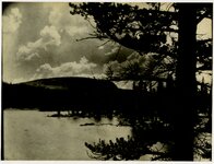
Mirror Lake in the Uintas [03] | 1925; 1926; 1927; 1928; 1929; 1930; 1931; 1932; 1933; 1934; 1935; 1936; 1937; 1938; 1939; 1940 | Image/StillImage | uum_map |
| 3 |
 |
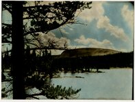
Mirror Lake in the Uintas [01] | 1925; 1926; 1927; 1928; 1929; 1930; 1931; 1932; 1933; 1934; 1935; 1936; 1937; 1938; 1939; 1940 | Image/StillImage | uum_map |
| 4 |
 |
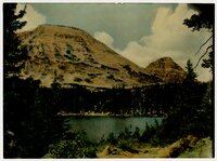
Mirror Lake in the Uintas [02] | 1925; 1926; 1927; 1928; 1929; 1930; 1931; 1932; 1933; 1934; 1935; 1936; 1937; 1938; 1939; 1940 | Image/StillImage | uum_map |
| 5 |
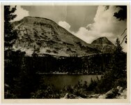 |
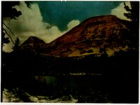
Mirror Lake and Bald Mountain | 1930; 1931; 1932; 1933; 1934; 1935; 1936; 1937; 1938; 1939; 1940 | Image/StillImage | uum_map |
| 6 |
 |
Current Creek Dam Construction | 1974-10-03 | Image/StillImage | ucl_vep |
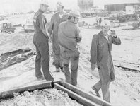
| 7 |
 |
Postcard view of Myton, Utah | 1910; 1911; 1912; 1913; 1914; 1915; 1916; 1917; 1918; 1919; 1920; 1921; 1922; 1923; 1924; 1925; 1926; 1927; 1928; 1929; 1930; 1931; 1932; 1933; 1934; 1935; 1936; 1937 | Image/StillImage | uum_map |
| 8 |
 |
Man on a horse cart on the dirt road | 1912-05-18 | Image/StillImage | uum_map |
| 9 |
 |
Horse buggy on the dirt road | 1912-05-18 | Image/StillImage | uum_map |
| 10 |
 |
Duchesne US DOI BLM 1977 | 1977 | Image/StillImage | ucl_maps |
| 11 |
 |
Myton, Utah - 1964 | 1964 | Image/StillImage | ucl_maps |
| 12 |
 |
Ouray, Utah - 1964 | 1964 | Image/StillImage | ucl_maps |
| 13 |
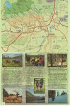 |
Duchesne County Tourism Map | Image/StillImage | ucl_maps | |
| 14 |
 |
Duchesne County Road Map | 2004 | Image/StillImage | ucl_maps |
| 15 |
 |
Ashley National Forest Wilderness Proposal 1967 - South Slope Plan - Roadless Areas - Alternative 4 | 1967 | Image/StillImage | ucl_maps |
| 16 |
 |
Ashley National Forest Wilderness Proposal 1967 - South Slope Plan - Roadless Areas - Alternative 2 | 1967 | Image/StillImage | ucl_maps |
| 17 |
 |
Ashley National Forest Wilderness Proposal 1967 - South Slope Plan - Roadless Areas - Alternative 1 | 1967 | Image/StillImage | ucl_maps |
| 18 |
 |
Ashley National Forest Wilderness Proposal 1967 - South Slope Plan - Roadless Areas - Alternative 3 | 1967 | Image/StillImage | ucl_maps |
| 19 |
 |
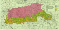
Ashley National Forest Wilderness Proposal 1967 - South Slope Plan | 1967 | Image/StillImage | ucl_maps |
| 20 |
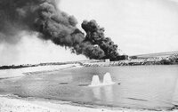 |
Oil Well Fire in Altamont | 1971-09-16 | Image/StillImage | ucl_vep |
| 21 |
 |
Firefighters at Altamont Oil Fire | 1971-09-16 | Image/StillImage | ucl_vep |
| 22 |
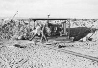 |
Equipment for Oil Well Fire | 1971-09-16 | Image/StillImage | ucl_vep |
| 23 |
 |
Utah Wildlife Resource Fish Biologists | 1971-05-20 | Image/StillImage | ucl_vep |
| 24 |
 |
Myton, Duchesne County, Utah; Sanborn Map Company, April 1917 | 1917 | Image/StillImage | ucl_maps |
| 25 |
 |
Blaine Bailey | 1954; 1955; 1956 | Image/StillImage | ucl_tp |