Home
Browse
Ask Us
Chat
Harmful Language Statement
Log in
Advanced Search
Year
1872
1873
1874
1875
1876
1877
1878
1879
1880
1881
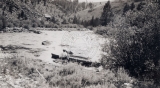
1882
1883
1884
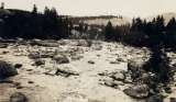
1885
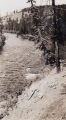
1886
1887
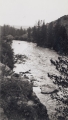
1888
1889
1890
1891
1892
1893
1894
1895
1896
1897
1898
1899
1900
1901
1902
1903
1904
1905
1906
1907
1908
1909
1910
1911
1912
1913
1914
1915
1916
1917
1918
1919
1920
1921
1922
1923
1924
1925
1926
1927
1928
1929
1930
1931
1932
1933
1934
1935
1936
1937
1938
1939
1940
1941
1942
1943
1944
1945
1946
1947
1948
1949
1950
1951
1952
1953
1954
1955
1956
1957
1958
1959
1960
1961
1962
1963
1964
1965
1966
1967
1968
1969
1970
1971
1972
1973
1974
1975
1976
1977
1978
1979
1980
1981
1982
1983
1984
1985
1986
1987
1988
1989
1990
1991
1992
1993
1994
1995
1996
1997
1998
1999
2000
2001
2002
2003
2004
2005
2006
TO
1872
1873
1874
1875
1876
1877
1878
1879
1880
1881
1882
1883
1884
1885
1886
1887
1888
1889
1890
1891
1892
1893
1894
1895
1896
1897
1898
1899
1900
1901
1902
1903
1904
1905
1906
1907
1908
1909
1910
1911
1912
1913
1914
1915
1916
1917
1918
1919
1920
1921
1922
1923
1924
1925
1926
1927
1928
1929
1930
1931
1932
1933
1934
1935
1936
1937
1938
1939
1940
1941
1942
1943
1944
1945
1946
1947
1948
1949
1950
1951
1952
1953
1954
1955
1956
1957
1958
1959
1960
1961
1962
1963
1964
1965
1966
1967
1968
1969
1970
1971
1972
1973
1974
1975
1976
1977
1978
1979
1980
1981
1982
1983
1984
1985
1986
1987
1988
1989
1990
1991
1992
1993
1994
1995
1996
1997
1998
1999
2000
2001
2002
2003
2004
2005
2006
Type
Image
1,441
Text
1
Format
image/jpeg
1,381
application/pdf
59
Collection
Classified Photographs
96
Photo Archives
335
Shipler Commercial Photographers
40
Ski and Snow Sports Archives
355
Utah River Running Photo Archives
543
Vernal Express Photographs
1
Western Waters Electronic Resources
1
William Edward Hook Glass Negatives
70
More
Filters:
Spatial Coverage:
"Colorado"
Type:
"Image"
1
-
25
of
1,441
<
1
2
3
4
5
6
7
8
9
10
>
Gallery view
Number of results to display per page
10
25
50
100
200
Sort by Relevance
Sort by Title A-Z
Sort by Title Z-A
Sort by Date Ascending
Sort by Date Descending
Sort by Last Modified Ascending
Sort by Last Modified Descending
Title
Date
Type
Setname
1
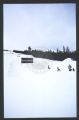
Micah McGinnity at Breckenridge ski resort; [1]
2000
Image
uum_map_usa
2
"Baxter Pass - U.[intah] R.[ail wa]Y."
1920; 1921; 1922; 1923; 1924; 1925; 1926; 1927; 1928; 1929
Image
uum_map
3
"Clyde Reedy / River customer w/ Bus"
1950; 1951; 1952; 1953; 1954; 1955; 1956; 1957; 1958; 1959; 1960; 1961; 1962; 1963; 1964; 1965; 1966; 1967; 1968; 1969
Image
uum_map_rr
4
"Independence Pass between Leadville & Aspen, Colo. - Elevation 12,095 above sea"
1918; 1919; 1920; 1921; 1922; 1923; 1924; 1925; 1926; 1927; 1928; 1929; 1930; 1931; 1932
Image
uum_map
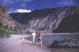
5
"Jack Reynolds, Dennis Massey" Lunch table at Deer Lodge Park, Yampa River
1950; 1951; 1952; 1953; 1954; 1955; 1956; 1957; 1958; 1959; 1960; 1961; 1962; 1963; 1964; 1965; 1966; 1967; 1968; 1969; 1970; 1971; 1972; 1973; 1974; 1975; 1976; 1977; 1978; 1979; 1980; 1981; 1982; 1983; 1984; 1985; 1986; 1987; 1988; 1989; 1990
Image
uum_map_rr
6
"Jo & Don on shore. Yes, she was a problem"
1950; 1951; 1952; 1953; 1954; 1955; 1956; 1957; 1958; 1959; 1960
Image
uum_map_rr
7
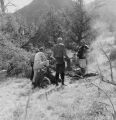
"May 22, 1951. Upper Lodore Canyon, Green River. Left to Right: Harry Ratliff, Grant Merrell [sic; spelled differently on previous photo], Leon Christensen, C.C. Manion, Bill Slaugh, Bus Hatch, Gil Hunter, Sam Hatch, George Andrews, K. Kaye"
1951-05-22
Image
uum_map_rr
8
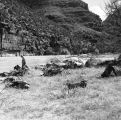
"May 22, 1951. Disaster Flat, below Lower Disaster Falls, Lodore Canyon, Green River. Left to Right: Bill Slaugh, C.C. (Bubbles) Manion, K. Kaye, Harry Ratliff, and the beef stew."
1951-05-22
Image
uum_map_rr
9
"May 22, 1951. Disaster Flat, below Lower Disaster Falls, Lodore Canyon, Green River. Otto Roach, ? , Bill Slaugh
1951-05-22
Image
uum_map_rr
10
"May 23, 1951. Triplet Falls, Lodore Canyon, Green River. Lining a boat through. Grant Merrell, Frank Hatch, Bus Hatch"
1951-05-23
Image
uum_map_rr
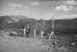
11
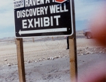
"Rio Blanco County - color - Raven A-1 Discovery Well Exhibit sign"
1970; 1971; 1972; 1973; 1974; 1975; 1976; 1977; 1978; 1979; 1980
Image
uum_map
12
"Rob Roy" at the outlet of Grand Lake
1933
Image
uum_map_rr
13
"Rob Roy" in dry-dock at Azure camp
1933
Image
uum_map_rr
14
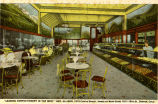
Reproduction of an earlier color Postcard - "Leading Confectionary in the West"; Geo. Allison; 1515 Curtis Street, Annex of Main Store 1011-15th Street.. Denver, Colorado
1910; 1911; 1912; 1913; 1914; 1915; 1916; 1917; 1918; 1919; 1920; 1921; 1922; 1923; 1924; 1925; 1926; 1927; 1928; 1929; 1930
Image
uum_map
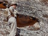
15
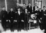
Reproduction of earlier photograph of Cretan Creek Coal Miners, Southern Colorado; 1912 ( before Ludlow Massacre); photograph by Mike Lingos
1912
Image
uum_map
16
500 Peace Officers Open Meeting Here (newspaper article)
1951; 1952; 1953; 1954; 1955
Image
uum_map
17
500 Peace Officers Open Meeting Here (newspaper article)
1951; 1952; 1953; 1954; 1955
Image
uum_map
18
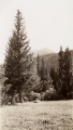
A North Fork meadow
1933
Image
uum_map_rr
19
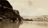
A hot August afternoon in Horsethief Canyon
1933
Image
uum_map_rr
20
A.M.C. Greene, Lodore Canyon. Don Hatch taking raft through 'Hell's Half Mile.'
1930; 1931; 1932; 1933; 1934; 1935; 1936; 1937; 1938; 1939; 1940; 1941; 1942; 1943; 1944; 1945; 1946; 1947; 1948; 1949; 1950; 1951; 1952; 1953; 1954; 1955; 1956; 1957; 1958; 1959; 1960; 1961; 1962; 1963; 1964; 1965; 1966; 1967; 1968; 1969
Image
uum_map_rr
21
Above Granby to above Byers Canyon - Above the Arapaho Bridge. River drops 85 feet in a mile, but made this without portage or lining, bumping down through.
1933
Image
uum_map_rr
22
Above Granby to above Byers Canyon - Below Sleepy Hollow, near Trout Rapids
1933
Image
uum_map_rr
23
Above Granby to above Byers Canyon - Colo. R. Near Sleepy Hollow-above S[outh] Fork (2 copies)
1933
Image
uum_map_rr
24
Above Granby to above Byers Canyon - Colorado River above Columbine Cr[eek]
1933
Image
uum_map_rr
25
Above Granby to above Byers Canyon - Colorado River above the Arapaho
1933
Image
uum_map_rr
1
-
25
of
1,441
<
1
2
3
4
5
6
7
8
9
10
>