Filters: Collection: "ucl_maps"
| Title | Date | Type | ||
|---|---|---|---|---|
| 1 |
 |
Uintah School 1906-1940 | 1906; 1907; 1908; 1909; 1910; 1911; 1912; 1913; 1914; 1915; 1916; 1917; 1918; 1919; 1920; 1921; 1922; 1923; 1924; 1925; 1926; 1927; 1928; 1929; 1930; 1931; 1932; 1933; 1934; 1935; 1936; 1937; 1938; 1939; 1940 | Image/StillImage |
| 2 |
 |
Uintah School District 1 thru 7, 1910-1917 | 1910; 1911; 1912; 1913; 1914; 1915; 1916; 1917 | Image/StillImage |
| 3 |
 |
Uintah School District 12 and 13, 1910-1917 | 1910; 1911; 1912; 1913; 1914; 1915; 1916; 1917 | Image/StillImage |
| 4 |
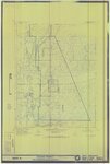 |
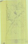
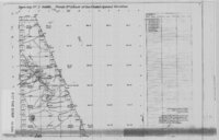
Gusher, Lapoint, Tridell, Utah - Reconnaissance Survey Map A | 1964 | Image/StillImage |
| 5 |
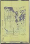 |
Gusher, Lapoint, Tridell, Utah - Reconnaissance Survey Map B | 1964 | Image/StillImage |
| 6 |
 |
Gusher, Lapoint, Tridell, Utah - Reconnaissance Survey Maps C, D, & E | 1964 | Image/StillImage |
| 7 |
 |
Gusher, Utah - The Strip | 1927 | Image/StillImage |
| 8 |
 |
Uintah Railway Stagecoach and Toll Road | 2003 | Image/StillImage |
| 9 |
 |
Road Commission - Highway 40 Jensen To Vernal 1930 | 1930 | Image/StillImage |
| 10 |
 |
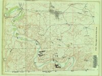
Uintah County - Early 1980s | 1980; 1981; 1982; 1983; 1984 | Image/StillImage |
| 11 |
 |
Uintah County Recorder's Office Road Maintenance 1989 | 1989 | Image/StillImage |
| 12 |
 |
Uintah County Fairgrounds | 1987 | Image/StillImage |
| 13 |
 |
Uintah County Transportation Travel Atlas 2008 | 2008 | Image/StillImage |
| 14 |
 |
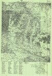
Map Pages of the White River | Image/StillImage | |
| 15 |
 |
Uintah Railway Elevation Map 1930 | 1930 | Image/StillImage |
| 16 |
 |
Route of Highway 40, 1920s | 1920; 1921; 1922; 1923; 1924; 1925; 1926; 1927; 1928; 1929 | Image/StillImage |
| 17 |
 |
Diamond Mountain 2001 | 2001 | Image/StillImage |
| 18 |
 |
Gusher Home Sites | Image/StillImage | |
| 19 |
 |
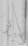
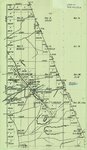
Partial Map of Gusher, Utah | Image/StillImage | |
| 20 |
 |
Partial Map of Gusher, Utah | 1963; 1964 | Image/StillImage |
| 21 |
 |
The Strip - no date | Image/StillImage | |
| 22 |
 |
The Strip - no date (2) | Image/StillImage | |
| 23 |
 |
Canyon of Lodore, Colorado 1979 | 1979 | Image/StillImage |
| 24 |
 |
Craig, Colorado 1979 | 1979 | Image/StillImage |
| 25 |
 |
Douglas Pass, Colorado 1981 | 1981 | Image/StillImage |