Home
Browse
Ask Us
Chat
Harmful Language Statement
Log in
Advanced Search
Year
1930
1931
1932
1933
1934
1935
1936
1937
1938
1939
1940
1941
1942
1943
1944
1945
1946
1947
1948
1949
1950
1951
1952
1953
1954
1955
1956
1957
1958
1959
1960
1961
1962
1963
1964
1965
1966
1967
1968
1969
1970
1971
1972
1973
1974
1975
1976
1977
1978
1979
1980
1981
1982
1983
1984
1985
1986
1987
1988
1989
1990
1991
1992
1993
1994
1995
1996
1997
1998
1999
2000
2001
2002
2003
2004
2005
2006
2007
2008
2009
2010
2011
TO
1930
1931
1932
1933
1934
1935
1936
1937
1938
1939
1940
1941
1942
1943
1944
1945
1946
1947
1948
1949
1950
1951
1952
1953
1954
1955
1956
1957
1958
1959
1960
1961
1962
1963
1964
1965
1966
1967
1968
1969
1970
1971
1972
1973
1974
1975
1976
1977
1978
1979
1980
1981
1982
1983
1984
1985
1986
1987
1988
1989
1990
1991
1992
1993
1994
1995
1996
1997
1998
1999
2000
2001
2002
2003
2004
2005
2006
2007
2008
2009
2010
2011
Type
Image
14
Image/StillImage
1
Format
image/jpeg
21
Collection
Beckwith Photograph Collection
1
Classified Photographs
1
Hidden Water - Salt Lake County Water...
11
Photo Archives
8
Filters:
Format:
"image/jpeg"
1
-
25
of
21
Gallery view
Number of results to display per page
10
25
50
100
200
Sort by Relevance
Sort by Title A-Z
Sort by Title Z-A
Sort by Date Ascending
Sort by Date Descending
Sort by Last Modified Ascending
Sort by Last Modified Descending
Title
Date
Type
Setname
1
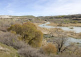
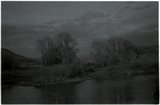
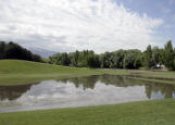
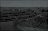
Flood plain
2011-05-02
Image
uu_hw_slcwd
2
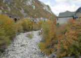
Canyon mouth
2008-06-27
Image
uu_hw_slcwd
3
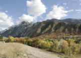
Mouth Little Cottonwood Canyon
2008-10-20
Image
uu_hw_slcwd
4
Flooding from snow runoff, mouth of Weber Canyon. Weber River has overtopped its normal channel banks and covers its flood plain. Periodically, structures situated on this flood plain become inundated. Note: ancient Lake Bonneville terraces may be seen on the mountain front.
Image
uum_map
5
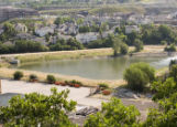
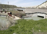
Joint Dam
2011-05-02
Image
uu_hw_slcwd
6
Cache Valley: House in flood plain above Riverdale Road (negative)
2001-11
uum_map
7
Cache Valley: House in flood plain above Riverdale Road (negative)
2001-11
uum_map
8
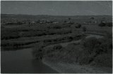
Flood basin
2008-06-27
Image
uu_hw_slcwd
9
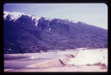
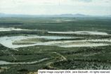
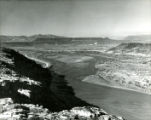
Sevier River flood of 1983, vicinity of Delta, Utah [229]
1983-06
Image
dc_bpc
10
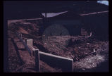
Expensive new house being constructed on banks of perennial stream which is subject to flood each spring and throughout the summer. Should not a form of flood plain zoning be in effect?
Image
uum_map
11
Mile wide flood over road and plain
1930; 1931; 1932; 1933; 1934; 1935; 1936
uum_map
12
Murray Park flooding
2010-06-10
Image
uu_hw_slcwd
13
Virgin River p. 3
1936; 1937; 1938; 1939; 1940; 1941; 1942; 1943; 1944; 1945; 1946; 1947; 1948; 1949
Image/StillImage
dha_cp
14
Canal at Jordan Narrows
2011-05-02
Image
uu_hw_slcwd
15
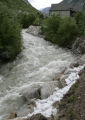
Flooding mouth Little Cottonwood Canyon
2010-06-09
Image
uu_hw_slcwd
16
Dry bed mouth Little Cottonwood Canyon
2008-10-20
Image
uu_hw_slcwd
17
Reynolds Flat
2008-10-31
Image
uu_hw_slcwd
18
Ranchettes in floodplain, Uinta County Road 103 (negative) [1]
2001-09-19
uum_map
19
Ranchettes in floodplain, Uinta County Road 103 (negative) [2]
2001-09-19
uum_map
20
Ranchettes in floodplain, Uinta County Road 103 (negative) [3]
2001-09-19
uum_map
21
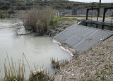
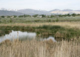
Adjacent wetlands
2009-05-22
Image
uu_hw_slcwd
1
-
25
of
21