|
|
Author | Title | Subject | Date | Publication Type |
| 1 |
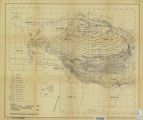 |
Murany, Ernest E. | Subsurface stratigraphy of the Wasatch Formation of the Uinta Basin, Utah (Maps) | Stratigraphic geology; Natural gas | 1963-05 | map |
| 2 |
 |
Morris, Stacy Randolph | After the Fremont: fire and vegetation history of prehistoric abandonment and historic occupation of Range Creek Canyon, Utah | Fire, Fremont; Native American; Range Creek Canyon; Vegetation | 2010-08 | thesis |
| 3 |
 |
Ackroyd, Chelsea Seutatia | Snow cover trends over high Mountain asia from modis snow cover and grain size | | 2019 | thesis |
| 4 |
 |
Xiao, Weiye | Walkability, amenity, and physical activity: a study of Salt Lake County | Social sciences | 2017 | thesis |
| 5 |
 |
Prince, Donald Gail | Utah coal industry: a study in economic geography | Coal trade, Utah | | thesis |
| 6 |
 |
Koll, Rebecca Ann | Long-term vegetation, climate, and fire history in the Eastern Uinta Mountains, Utah, U.S.A. | | 2012-05 | thesis |
| 7 |
 |
Jin, Zhenyu | Mapping and spatial-temporal modeling of Bromus tectorum invasion in Central Utah | Cheatgrass; NDVI time-series; Remote sensing; Spatial-temporal modeling; Utah; Bromus tectorum | 2011-11 | dissertation |
| 8 |
 |
Smith, Gregory E | Development of a flash flood potential index using physiographic data sets within a geographic information system | Flash flood; Storm runoff | 2010 | thesis |
| 9 |
 |
Turrin, James Bradley | Measuring glacier velocities on the Kenai Peninsula, Alaska, using multispectral satellite imagery with feature tracking | Glaciers--Alaska; Glaciology; Aerial photography | 2010-03-20 | thesis |
| 10 |
 |
Dudley, Kenneth | Mapping species across multiple dates of hyperspectral imagery using iterative endmember selection and multiple endmember spectral mixture analysis | Endmember selection; Hyperspectral time series; HyspIRI; MESMA; Species classification; Vegetation phenology | 2014-12 | thesis |
| 11 |
 |
Siebeneck, Laura Kathryn | Examining the geographic dimensions of risk perception, communication, and response during the evacuation and return-entry process | Cedar rapids; Evacuation; Flood; Hazards; Return-entry; Geography; Urban planning | 2010 | dissertation |
| 12 |
 |
Graves, Scott Andrew | Examining vegetation phenology of Ugandan dambos using spectral mixture modeling fractions | Vegetation mapping, Uganda;Wetland ecology, Uganda; Methane, Environmental aspects, Uganda | 2008-05 | thesis |
| 13 |
 |
Kimball, James Patrick | Late quaternary environmental change as inferred from diatoms of the sediments of Bear Lake, Utah/Idaho | | | thesis |
| 14 |
 |
Butler, Jared Thomas | The role of early life socioeconomic status in female breast cancer incidence | Breast cancer; Clustering; Incidence; Life course; Socioeconomic; Utah | 2013-12 | thesis |
| 15 |
 |
Morris, Jesse L | Sedimentological evidence of late holocene disturbance on the Wasatch Plateau, Utah, USA | Forest ecology; Paleoecology | 2008-05 | thesis |
| 16 |
 |
Balzotti, Christopher Stephen | Exploring the use of fine resolution nested ecological niche models to identify greater sage-grouse (Centrocercus urophasianus) habitat and connectivity potential across a diverse landscape | Climate change; Habitat model; Landscape ecology; Niche model; Sagebrush; Sage-grouse | 2014-12 | dissertation |
| 17 |
 |
Li, Dapeng | Modeling wildfire evacuation as a coupled human-environmental system using triggers | fire spread modeling; GIS; reverse geocoding; traffic simulation; triggers; wildfire evacuation | 2016 | dissertation |
| 18 |
 |
Bishop, Seth Arthur | Spatial access and local demand for emergency medical services in utah | 2SFCA; accessibility; ambulance; emergency medical service; floating catchment area; spatial access | 2016 | thesis |
| 19 |
 |
Davis, Andrea Nicole | Childhood undernutrition within the dry zone of Myanamr: does geographic location influence health outcomes? | Southeast Asian studies; Geography; Nutrition | 2017 | thesis |
| 20 |
 |
Meadows, Michelle Kristine | High frequency variability in glacier meltwater patterns in the rhone watershed, switzerland | Glacier hydrology; Glacier meltwater; Glaciology | 2017 | thesis |
| 21 |
 |
Pulver, Aaron Thomas | Locating automated external defibrillator enabled medical drones to reduce response times to out-of-hospital cardiac arrests | backup coverage; geographic information systems; location modeling; medical drone; out-of-hospital cardiac arrest; spatial optimization | 2017 | thesis |
| 22 |
 |
Li, Dapeng | Modeling wildfire evacuation as a coupled human-environmental system using triggers | fire spread modeling; GIS; reverse geocoding; traffic simulation; triggers; wildfire evacuation | 2016 | dissertation |
| 23 |
 |
Qi, Yi | New physical foundations for remote sensing estimation of live fuel moisture content and fire danger | live fuel moisture content; remote sensing | 2014 | dissertation |
| 24 |
 |
Lund, Jewell | Synthetic aperture radar snow conditions: seasonal and diurnal signals in the upper Indus Basin | Geography | 2018 | thesis |
| 25 |
 |
Campbell, Michael James | Remote sensing and geospatial modeling of wildland firefighter safety | Remote sensing | 2018 | dissertation |