Home
Browse
Ask Us
Chat
Harmful Language Statement
Log in
Advanced Search
Year
1872
1873
1874
1875
1876
1877
1878
1879
1880
1881
1882
1883
1884
1885
1886
1887
1888
1889
1890
1891
1892
1893
1894
1895
1896
1897
1898
1899
1900
1901
1902
1903
1904
1905
1906
1907
1908
1909
1910
1911
1912
1913
1914
1915
1916
1917
1918
1919
1920
1921
1922
1923
1924
1925
1926
1927
1928
1929
1930
1931
1932
1933
1934
1935
1936
1937
1938
1939
1940
1941
1942
1943
1944
1945
1946
1947
1948
1949
1950
1951
1952
1953
1954
1955
1956
1957
1958
1959
1960
1961
1962
1963
1964
1965
1966
1967
1968
1969
1970
1971
1972
1973
1974
1975
1976
1977
1978
1979
1980
1981
1982
1983
1984
1985
1986
1987
1988
1989
1990
1991
1992
1993
TO
1872
1873
1874
1875
1876
1877
1878
1879
1880
1881
1882
1883
1884
1885
1886
1887
1888
1889
1890
1891
1892
1893
1894
1895
1896
1897
1898
1899
1900
1901
1902
1903
1904
1905
1906
1907
1908
1909
1910
1911
1912
1913
1914
1915
1916
1917
1918
1919
1920
1921
1922
1923
1924
1925
1926
1927
1928
1929
1930
1931
1932
1933
1934
1935
1936
1937
1938
1939
1940
1941
1942
1943
1944
1945
1946
1947
1948
1949
1950
1951
1952
1953
1954
1955
1956
1957
1958
1959
1960
1961
1962
1963
1964
1965
1966
1967
1968
1969
1970
1971
1972
1973
1974
1975
1976
1977
1978
1979
1980
1981
1982
1983
1984
1985
1986
1987
1988
1989
1990
1991
1992
1993
Type
Image
3,521
Image/StillImage
143
Format
image/jpeg
3,594
application/pdf
70
Collection
Photo Archives
3,521
UAIDA Main Collection
143
Filters:
Collection Name:
"Herbert E. Gregory"
1
-
25
of
3,664
<
1
2
3
4
5
6
7
8
9
10
>
Gallery view
Number of results to display per page
10
25
50
100
200
Sort by Relevance
Sort by Title A-Z
Sort by Title Z-A
Sort by Date Ascending
Sort by Date Descending
Sort by Last Modified Ascending
Sort by Last Modified Descending
Title
Date
Type
Setname
1
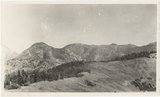
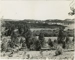
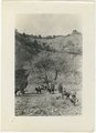
Panorama of head of Johnson Creek, from West Mountain. Abajo Mountains. 1915
1915
Image
uum_map
2
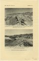
Kaibab limestone (lower wall,left, breccia (marks unconformable contact), and basal Moenkopi limestone and shales. Mouth of Kaibab Gulch. Kane County, UT, 1944
1944
Image
uum_map
3
East side of Lone Rock on Wah Weap Creek
1943; 1944; 1945
Image
uum_map
4
End of lava flow 6 miles long in Black Creek Valley
1943; 1944; 1945
Image
uum_map
5
Features of the East Kaibab monocline [and] Structural relations of rocks along Utah-Arizona boundary
1943; 1944; 1945
Image
uum_map
6
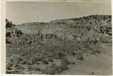
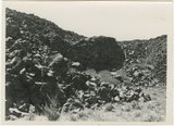
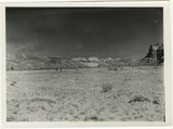
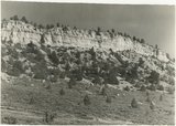
Hillside of eroded rock, Paria Valley, Utah
1943; 1944; 1945
Image
uum_map
7
Lava, Black Rock Valley
1943; 1944; 1945
Image
uum_map
8
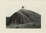
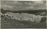
Mound of sedimentary material, vicinity of Paria River, Utah
1943; 1944; 1945
Image
uum_map
9
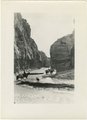
Paria Canyon, Utah
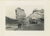
1943; 1944; 1945
Image
uum_map
10
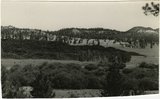
Paria Valley and east flank of East Kaibab monocline
1943; 1944; 1945
Image
uum_map
11
Road and lava field, Rock Creek Valley, Utah
1943; 1944; 1945
Image
uum_map
12
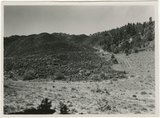
Rocky cliff near Hillsdale
1943; 1944; 1945
Image
uum_map
13
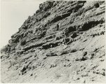
Sandstone outcrops, Paria Canyon, Utah
1943; 1944; 1945
Image
uum_map
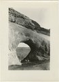
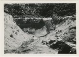
14
Upper Box in Paria Canyon just south of Cannonville
1943; 1944; 1945
Image
uum_map
15
Views along Vermilion Cliffs [and] Permian and Triassic rocks at the mouth of Limestone Gulch
1943; 1944; 1945
Image
uum_map
16
Views of the Moenkopi Formation [and] Triassic rocks
1943; 1944; 1945
Image
uum_map
17
White cliffs along highway south of Asay Creek, Brian Head formation
1943; 1944; 1945
Image
uum_map
18
White rocks on road to Panquitch, Utah
1943; 1944; 1945
Image
uum_map
19
Wingate Sandstone [and] Features of Jurassic and recent formation
1943; 1944; 1945
Image
uum_map
20
Bark Wash, Utah 1943
1943
Image
uum_map
21
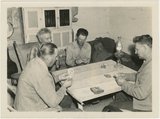
Card players, Paria Valley camp, 1943
1943
Image
uum_map
22
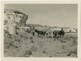
Herbert Gregory party at watering station in Paria Valley, Utah
1943
Image
uum_map
23
Kitchen Canyon, Utah 1943
1943
Image
uum_map
24
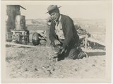
Man and cat, Paria Valley camp, 1943
1943
Image
uum_map
25
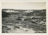
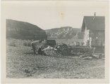
Paria Valley camp, 1943
1943
Image
uum_map
1
-
25
of
3,664
<
1
2
3
4
5
6
7
8
9
10
>