Home
Browse
Ask Us
Chat
Harmful Language Statement
Log in
Uintah County Regional History Center Maps
Advanced Search
Year
1927
1928
1929
1930
1931
1932
1933
1934
1935
1936
1937
1938
1939
1940
1941
1942
1943
1944
1945
1946
1947
1948
1949
1950
1951
1952
1953
1954
1955
1956
1957
1958
1959
1960
1961
1962
1963
1964
1965
1966
1967
1968
1969
1970
1971
1972
1973
1974
1975
1976
1977
1978
1979
1980
1981
1982
1983
1984
1985
1986
1987
1988
1989
1990
1991
1992
1993
1994
1995
1996
1997
1998
1999
2000
2001
2002
2003
2004
TO
1927
1928
1929
1930
1931
1932
1933
1934
1935
1936
1937
1938
1939
1940
1941
1942
1943
1944
1945
1946
1947
1948
1949
1950
1951
1952
1953
1954
1955
1956
1957
1958
1959
1960
1961
1962
1963
1964
1965
1966
1967
1968
1969
1970
1971
1972
1973
1974
1975
1976
1977
1978
1979
1980
1981
1982
1983
1984
1985
1986
1987
1988
1989
1990
1991
1992
1993
1994
1995
1996
1997
1998
1999
2000
2001
2002
2003
2004
Type
Image/StillImage
21
Format
image/jpeg
19
application/pdf
2
Collection
Uintah County Regional History Center...
21
Filters:
Collection:
"ucl_maps"
Subject:
"Green River"
1
-
25
of
21
Gallery view
Number of results to display per page
10
25
50
100
200
Sort by Relevance
Sort by Title A-Z
Sort by Title Z-A
Sort by Date Ascending
Sort by Date Descending
Sort by Last Modified Ascending
Sort by Last Modified Descending
Title
Date
Type
1
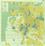
BLM Vernal Field Office Grazing Allotments 2004
2004
Image/StillImage
2
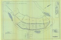
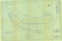
Brush Creek and Pot Creek Distribution Systems
Image/StillImage
3
Diamond Mountain (Planimetric) NE-10 (US DOI BLM) 1975
1975
Image/StillImage
4
Flaming Gorge Country (Brochure and Map)
1987
Image/StillImage
5
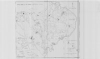
Grazing Service C.C.C. Range Surveys, 1927
1927
Image/StillImage
6
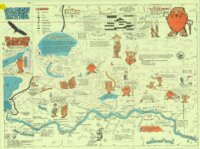
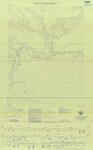
Green River - Flaming Gorge National Recreation Area, Ashley National Forest
Image/StillImage
7
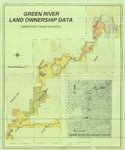
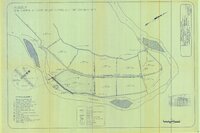
Green River Land Ownership Data - Generated From FWS Maps
Image/StillImage
8
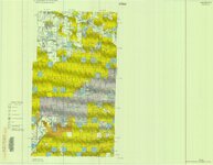
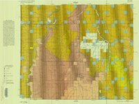
Hill Creek (Planimetric) NE-17 (US DOI BLM) 1975 (revised)
1975
Image/StillImage
9
Lease & Structure Map Uintah Basin, Utah for Ziegler Chemical & Mineral Corp (Showing Leases & Lines of Strat Columns)
1978
Image/StillImage
10
Ouray Wildlife Refuge Exhibit 7 - 1995 - Improvement of Existing Main Canal Inlet
1995
Image/StillImage
11
Ouray Wildlife Refuge Scheme 1 - 1995 - Natural Flood Inflow to Leota Odd-Numbered Ponds
1995
Image/StillImage
12
Ouray Wildlife Refuge Scheme 2 - 1995 - Semi-Natural Flood Inflows to Pond L-7
1995
Image/StillImage
13
Ouray Wildlife Refuge Scheme 3 - 1995 - Semi-Control of Flood Inflow to the Leota Odd-Numbered Ponds
1995
Image/StillImage
14
Ouray Wildlife Refuge Scheme 4 - 1995 - Semi-Control of Flood Inflow to Pond L-7, One Low Head Weir
1995
Image/StillImage
15
Ouray Wildlife Refuge Scheme 5 - 1995 - Semi-Control of Flood Inflow to Pond L-7, Two Low Head Weirs
1995
Image/StillImage
16
Ouray Wildlife Refuge Scheme 6 - 1995 - Control of Flood Inflow to the Nursery Habitat
1995
Image/StillImage
17
Ouray, Utah 1999 - National Wetlands Inventory
1999
Image/StillImage
18
Pelican Lake, Utah 1999 - National Wetlands Inventory
1999
Image/StillImage
19
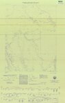
Veritus Seismec Surveying and Positioning
Image/StillImage
20
Woodside (Planimetric) SE-2 (US DOI BLM) 1977
1977
Image/StillImage
21
Woodside (Planimetric) SE-3 (US DOI BLM) 1975 (revised)
1975
Image/StillImage
1
-
25
of
21