| Title | Date | Type | Setname | ||
|---|---|---|---|---|---|
| 26 |
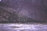 |
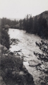
[Moonshine Rapid, Split Mountain Canyon] | 1966-07 | Image | uum_map_rr |
| 27 |
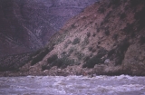 |
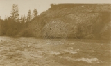
[Moonshine Rapid, Split Mountain Canyon] | 1966-07 | Image | uum_map_rr |
| 28 |
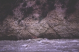 |
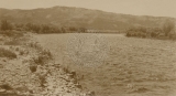
[Moonshine Rapid, Split Mountain Canyon] | 1966-07 | Image | uum_map_rr |
| 29 |
 |
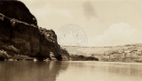
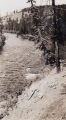
[postcard of Bitter Creek] "Baxter Pass - U.[intah] R.[ail wa]Y." | 1920; 1921; 1922; 1923; 1924; 1925; 1926; 1927; 1928; 1929; 1930 | Image | uum_map |
| 30 |
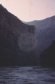 |
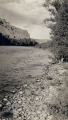
[Whirlpool Canyon] | 1966-07 | Image | uum_map_rr |
| 31 |
 |
A hot August afternoon in Horsethief Canyon | 1933 | Image | uum_map_rr |
| 32 |
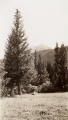 |
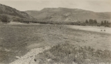
A North Fork meadow | 1933 | Image | uum_map_rr |
| 33 |
 |
A.M.C. Greene, Lodore Canyon. Don Hatch taking raft through 'Hell's Half Mile.' | 1930; 1931; 1932; 1933; 1934; 1935; 1936; 1937; 1938; 1939; 1940; 1941; 1942; 1943; 1944; 1945; 1946; 1947; 1948; 1949; 1950; 1951; 1952; 1953; 1954; 1955; 1956; 1957; 1958; 1959; 1960; 1961; 1962; 1963; 1964; 1965; 1966; 1967; 1968; 1969 | Image | uum_map_rr |
| 34 |
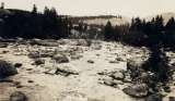 |
Above Granby to above Byers Canyon - Above the Arapaho Bridge. River drops 85 feet in a mile, but made this without portage or lining, bumping down through. | 1933 | Image | uum_map_rr |
| 35 |
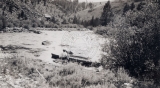 |
Above Granby to above Byers Canyon - Below Sleepy Hollow, near Trout Rapids | 1933 | Image | uum_map_rr |
| 36 |
 |
Above Granby to above Byers Canyon - Colo. R. Near Sleepy Hollow-above S[outh] Fork (2 copies) | 1933 | Image | uum_map_rr |
| 37 |
 |
Above Granby to above Byers Canyon - Colorado River above Columbine Cr[eek] | 1933 | Image | uum_map_rr |
| 38 |
 |
Above Granby to above Byers Canyon - Colorado River above the Arapaho | 1933 | Image | uum_map_rr |
| 39 |
 |
Above Granby to above Byers Canyon - Colorado River above the mouth of the Fraser [River], near Granby | 1933 | Image | uum_map_rr |
| 40 |
 |
Above Granby to above Byers Canyon - Confluence of Fraser [River] & Colo. Rivers below Granby, Colo. Looking into Windy Gap. | 1933 | Image | uum_map_rr |
| 41 |
 |
Above Granby to above Byers Canyon - Looking upstream into Windy Gap, after thunderstorm. Between Granby and Hot Sulphur Sp[rin]gs. | 1933 | Image | uum_map_rr |
| 42 |
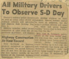 |
All Military Drivers To Observe S-D Day (newspaper article) | Image | uum_map | |
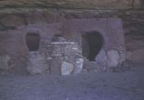
| 43 |
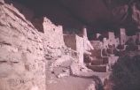 |
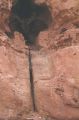
Anasazi cliff dwelling, Mesa Verde National Park | 1930; 1931; 1932; 1933; 1934; 1935; 1936; 1937; 1938; 1939; 1940; 1941; 1942; 1943; 1944; 1945; 1946; 1947; 1948; 1949; 1950 | Image | uum_map_rr |
| 44 |
 |
Anasazi ruins [1] | 1930; 1931; 1932; 1933; 1934; 1935; 1936; 1937; 1938; 1939; 1940; 1941; 1942; 1943; 1944; 1945; 1946; 1947; 1948; 1949; 1950 | Image | uum_map_rr |
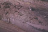
| 45 |
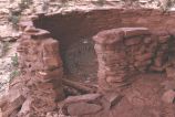 |
Anasazi ruins [2] | 1930; 1931; 1932; 1933; 1934; 1935; 1936; 1937; 1938; 1939; 1940; 1941; 1942; 1943; 1944; 1945; 1946; 1947; 1948; 1949; 1950 | Image | uum_map_rr |
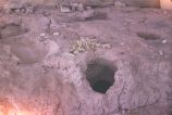
| 46 |
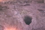 |
Anasazi storage cists [1] | 1930; 1931; 1932; 1933; 1934; 1935; 1936; 1937; 1938; 1939; 1940; 1941; 1942; 1943; 1944; 1945; 1946; 1947; 1948; 1949; 1950 | Image | uum_map_rr |
| 47 |
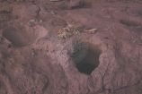 |
Anasazi storage cists [2] | 1930; 1931; 1932; 1933; 1934; 1935; 1936; 1937; 1938; 1939; 1940; 1941; 1942; 1943; 1944; 1945; 1946; 1947; 1948; 1949; 1950 | Image | uum_map_rr |
| 48 |
 |
Anasazi storage cists [3] | 1930; 1931; 1932; 1933; 1934; 1935; 1936; 1937; 1938; 1939; 1940; 1941; 1942; 1943; 1944; 1945; 1946; 1947; 1948; 1949; 1950 | Image | uum_map_rr |
| 49 |
 |
Anasazi storage cists [4] | 1930; 1931; 1932; 1933; 1934; 1935; 1936; 1937; 1938; 1939; 1940; 1941; 1942; 1943; 1944; 1945; 1946; 1947; 1948; 1949; 1950 | Image | uum_map_rr |
| 50 |
 |
Anasazi storage cists [5] | 1930; 1931; 1932; 1933; 1934; 1935; 1936; 1937; 1938; 1939; 1940; 1941; 1942; 1943; 1944; 1945; 1946; 1947; 1948; 1949; 1950 | Image | uum_map_rr |