TO
| Title | Date | Type | Setname | ||
|---|---|---|---|---|---|
| 1 |
 | Bear River Ranger Station | 1960; 1961; 1962; 1963; 1964; 1965; 1966; 1967; 1968; 1969; 1970; 1971; 1972; 1973; 1974; 1975; 1976; 1977; 1978; 1979 | Image/StillImage | uum_map_usa |
| 2 |
 | Bear River, Uintas | 1960; 1961; 1962; 1963; 1964; 1965; 1966; 1967; 1968; 1969; 1970; 1971; 1972; 1973; 1974; 1975; 1976; 1977; 1978; 1979 | Image/StillImage | uum_map_usa |
| 3 |
 | Big Cottonwood view, 1930s | 1930; 1931; 1932; 1933; 1934; 1935; 1936; 1937; 1938; 1939 | Image/StillImage | uum_map_usa |
| 4 |
 | Boy Scouts in woods | Image/StillImage | uum_map_usa | |
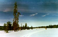
| 5 |
 | Christmas Meadows | 1960; 1961; 1962; 1963; 1964; 1965; 1966; 1967; 1968; 1969; 1970; 1971; 1972; 1973; 1974; 1975; 1976; 1977; 1978; 1979 | Image/StillImage | uum_map_usa |
| 6 |
 | Deseret Peak, Stansbury Range | Image/StillImage | uum_map_usa | |
| 7 |
 | Farmington Canyon | 1930; 1931; 1932; 1933; 1934; 1935; 1936; 1937; 1938; 1939; 1940; 1941; 1942; 1943; 1944; 1945; 1946; 1947; 1948; 1949; 1950; 1951; 1952; 1953; 1954; 1955; 1956; 1957; 1958; 1959 | Image/StillImage | uum_map_usa |
| 8 |
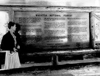 | Forest Service sign | Image/StillImage | uum_map_usa | |
| 9 |
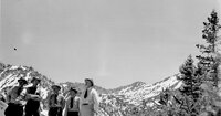 | Forest Service staff in mountains | Image/StillImage | uum_map_usa | |
| 10 |
 | Group of men on peak | Image/StillImage | uum_map_usa | |
| 11 |
 | Group of men on trail | Image/StillImage | uum_map_usa | |
| 12 |
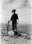 | Hunter with dead antelope | 1930; 1931; 1932; 1933; 1934; 1935; 1936; 1937; 1938; 1939; 1940; 1941; 1942; 1943; 1944; 1945; 1946; 1947; 1948; 1949; 1950; 1951; 1952; 1953; 1954; 1955; 1956; 1957; 1958; 1959 | Image/StillImage | uum_map_usa |
| 13 |
 | Julian Thomas, Ray Lindquist, and Bob Theodorsen | 1957-01 | Image/StillImage | uum_map_usa |
| 14 |
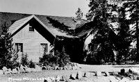 | Mann's Mirror Lake Chalet | 1930; 1931; 1932; 1933; 1934; 1935; 1936; 1937; 1938; 1939; 1940; 1941; 1942; 1943; 1944; 1945; 1946; 1947; 1948; 1949; 1950; 1951; 1952; 1953; 1954; 1955; 1956; 1957; 1958; 1959 | Image/StillImage | uum_map_usa |
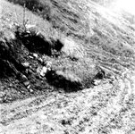
| 15 |
 | Road cuts and erosion [01] | 1930; 1931; 1932; 1933; 1934; 1935; 1936; 1937; 1938; 1939; 1940; 1941; 1942; 1943; 1944; 1945; 1946; 1947; 1948; 1949; 1950; 1951; 1952; 1953; 1954; 1955; 1956; 1957; 1958; 1959 | Image/StillImage | uum_map_usa |
| 16 |
 | Road cuts and erosion [02] | 1930; 1931; 1932; 1933; 1934; 1935; 1936; 1937; 1938; 1939; 1940; 1941; 1942; 1943; 1944; 1945; 1946; 1947; 1948; 1949; 1950; 1951; 1952; 1953; 1954; 1955; 1956; 1957; 1958; 1959 | Image/StillImage | uum_map_usa |
| 17 |
 | Road cuts and erosion [03] | 1930; 1931; 1932; 1933; 1934; 1935; 1936; 1937; 1938; 1939; 1940; 1941; 1942; 1943; 1944; 1945; 1946; 1947; 1948; 1949; 1950; 1951; 1952; 1953; 1954; 1955; 1956; 1957; 1958; 1959 | Image/StillImage | uum_map_usa |
| 18 |
 | Road cuts and erosion [04] | 1930; 1931; 1932; 1933; 1934; 1935; 1936; 1937; 1938; 1939; 1940; 1941; 1942; 1943; 1944; 1945; 1946; 1947; 1948; 1949; 1950; 1951; 1952; 1953; 1954; 1955; 1956; 1957; 1958; 1959 | Image/StillImage | uum_map_usa |
| 19 |
 | Road cuts and erosion [05] | 1930; 1931; 1932; 1933; 1934; 1935; 1936; 1937; 1938; 1939; 1940; 1941; 1942; 1943; 1944; 1945; 1946; 1947; 1948; 1949; 1950; 1951; 1952; 1953; 1954; 1955; 1956; 1957; 1958; 1959 | Image/StillImage | uum_map_usa |
| 20 |
 | Road cuts and erosion [06] | 1930; 1931; 1932; 1933; 1934; 1935; 1936; 1937; 1938; 1939; 1940; 1941; 1942; 1943; 1944; 1945; 1946; 1947; 1948; 1949; 1950; 1951; 1952; 1953; 1954; 1955; 1956; 1957; 1958; 1959 | Image/StillImage | uum_map_usa |
| 21 |
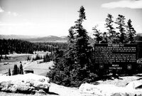 | Sign at Bald Mountain Pass | Image/StillImage | uum_map_usa | |
| 22 |
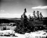 | Sign at Bald Mountain Pass | Image/StillImage | uum_map_usa | |
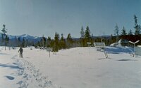
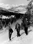
| 23 |
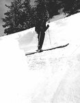 | Skier, Wasatch | 1930; 1931; 1932; 1933; 1934; 1935; 1936; 1937; 1938; 1939; 1940; 1941; 1942; 1943; 1944; 1945; 1946; 1947; 1948; 1949; 1950; 1951; 1952; 1953; 1954; 1955; 1956; 1957; 1958; 1959 | Image/StillImage | uum_map_usa |
| 24 |
 | Snow cave? | Image/StillImage | uum_map_usa | |
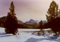
| 25 |
 | Stillwater Fork near Christmas Meadows | 1967 | Image/StillImage | uum_map_usa |