Home
Browse
Ask Us
Chat
Harmful Language Statement
Log in
Advanced Search
Year
1960
1961
1962
1963
1964
1965
1966
1967
1968
1969
1970
1971
1972
1973
1974
1975
1976
1977
1978
1979
1980
1981
1982
1983
1984
1985
1986
1987
1988
1989
1990
1991
1992
1993
1994
1995
1996
1997
1998
1999
2000
2001
2002
2003
2004
2005
2006
2007
2008
2009
2010
2011
2012
2013
2014
2015
TO
1960
1961
1962
1963
1964
1965
1966
1967
1968
1969
1970
1971
1972
1973
1974
1975
1976
1977
1978
1979
1980
1981
1982
1983
1984
1985
1986
1987
1988
1989
1990
1991
1992
1993
1994
1995
1996
1997
1998
1999
2000
2001
2002
2003
2004
2005
2006
2007
2008
2009
2010
2011
2012
2013
2014
2015
Type
Text
23
Image/StillImage
3
Image
1
Format
image/jpeg
98
application/pdf
43
Collection
American Flame Research Committee
1
Electronic University Archive
132
Electronic University Archive (Restri...
1
Theses & Dissertations
4
Uintah County Regional History Center...
3
Filters:
Subject:
"Green River Formation"
126
-
150
of
141
<
1
2
3
4
5
6
>
Gallery view
Number of results to display per page
10
25
50
100
200
Sort by Relevance
Sort by Title A-Z
Sort by Title Z-A
Sort by Date Ascending
Sort by Date Descending
Sort by Last Modified Ascending
Sort by Last Modified Descending
Title
Date
Type
Setname
126
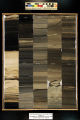
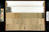
Skyline 16: SW SW sec. 10 11S 25E Uintah County, Utah. Box 90 Depth: 910.0 - 920.0 ft.
2015-07
ir_eua
127
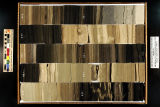
Skyline 16: SW SW sec. 10 11S 25E Uintah County, Utah. Box 91 Depth: 920.0 - 930.0 ft.
2015-07
ir_eua
128
Skyline 16: SW SW sec. 10 11S 25E Uintah County, Utah. Box 92 Depth: 930.0 - 940.0 ft.
2015-07
ir_eua
129
Skyline 16: SW SW sec. 10 11S 25E Uintah County, Utah. Box 93 Depth: 940.0 - 950.0 ft.
2015-07
ir_eua
130
Skyline 16: SW SW sec. 10 11S 25E Uintah County, Utah. Box 94 Depth: 950.0 - 960.0 ft.
2015-07
ir_eua
131
Skyline 16: SW SW sec. 10 11S 25E Uintah County, Utah. Box 95 Depth: 960.0 - 970.0 ft.
2015-07
ir_eua
132
Skyline 16: SW SW sec. 10 11S 25E Uintah County, Utah. Box 96 Depth: 970.0 - 980.0 ft.
2015-07
ir_eua
133
Skyline 16: SW SW sec. 10 11S 25E Uintah County, Utah. Box 97 Depth: 980.0 - 990.0 ft.
2015-07
ir_eua
134
Skyline 16: SW SW sec. 10 11S 25E Uintah County, Utah. Box 98 Depth: 990.0 - 1000.0 ft.
2015-07
ir_eua
135
Skyline 16: SW SW sec. 10 11S 25E Uintah County, Utah. Box 99 Depth: 1000.0 - 1006.25 ft.
2015-07
ir_eua
136
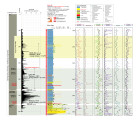
South Uinta Basin 12 core log - Plate 10
2014
ir_eua
137
Stratigraphic architecture of deltaic mouth bar deposits during the early eocene climatic optimum, Green River Formation, Uinta Basin, Utah
2015
Text
ir_etd
138
SUB 12 XRF depth plots
2014
ir_eua
139
University of Utah and Utah Geological Survey Green River coring project summary
2015-07
ir_eua
140
Utah State 1 - Plate 4
2014
ir_eua
141
West-East core-based cross section through the middle to upper Green River formation, Uinta Basin, Utah - Plate 1
2014
ir_eua
126
-
150
of
141
<
1
2
3
4
5
6
>