Home
Browse
Ask Us
Chat
Harmful Language Statement
Log in
Advanced Search
Year
1960
1961
1962
1963
1964
1965
1966
1967
1968
1969
1970
1971
1972
1973
1974
1975
1976
1977
1978
1979
1980
1981
1982
1983
1984
1985
1986
1987
1988
1989
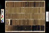
1990
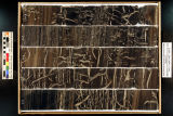
1991
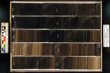
1992
1993
1994
1995
1996
1997
1998
1999
2000
2001
2002
2003
2004
2005
2006
2007
2008
2009
2010
2011
2012
2013
2014
2015
TO
1960
1961
1962
1963
1964
1965
1966
1967
1968
1969
1970
1971
1972
1973
1974
1975
1976
1977
1978
1979
1980
1981
1982
1983
1984
1985
1986
1987
1988
1989
1990
1991
1992
1993
1994
1995
1996
1997
1998
1999
2000
2001
2002
2003
2004
2005
2006
2007
2008
2009
2010
2011
2012
2013
2014
2015
Type
Text
23
Image/StillImage
3
Image
1
Format
image/jpeg
98
application/pdf
43
Collection
American Flame Research Committee
1
Electronic University Archive
132
Electronic University Archive (Restri...
1
Theses & Dissertations
4
Uintah County Regional History Center...
3
Filters:
Subject:
"Green River Formation"
26
-
50
of
141
<
1
2
3
4
5
6
>
Gallery view
Number of results to display per page
10
25
50
100
200
Sort by Relevance
Sort by Title A-Z
Sort by Title Z-A
Sort by Date Ascending
Sort by Date Descending
Sort by Last Modified Ascending
Sort by Last Modified Descending
Title
Date
Type
Setname
26
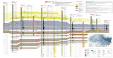
North-South core-based cross section through the middle to upper Green River Formation, Uinta Basin, Utah - Plate 2
2014
ir_eua
27
Occurrence of biomarkers in Green River shale oil
1983-03
Text
ir_eua
28
Oil-impregnated sandstone mapping project Nine Mile Canyon area Carbon and Duchesne Counties, Utah: A field examination for the Utah Geological Survey
1971-10-04
Text
ir_eua
29
Oil-impregnated sandstones of Raven Ridge, Vernal, Utah
1972
Text
ir_eua
30
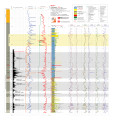
P4 Plate 6
2014
ir_eua
31
Petrology of bituminous sandstones in the Green River Formation, Southeastern Uinta Basin, Utah
1967-06
Text
ir_etd
32
Primary oil-shale resources of the Green River Formation in the eastern Uinta Basin, Utah
1983-03
ir_eua
33
QEMSCAN analysis of Green River Formation oil shale samples, Skyline 16 core, eastern Uinta basin, UT
2014
ir_eua
34
Red Wash 1 (U045) - Plate 8
2014
ir_eua
35
Redwash 1 XRF depth plots
2014
ir_eua
36
Skyline 16 - Plate 7
2014
ir_eua
37
Skyline 16 information
2015-07
ir_eua
38
Skyline 16: SW SW sec. 10 11S 25E Uintah County, Utah. Box 1 Depth: 20.0 - 30.0 ft.
2015-07
ir_eua
39
Skyline 16: SW SW sec. 10 11S 25E Uintah County, Utah. Box 10 Depth: 110.0 - 120.0 ft.
2015-07
ir_eua
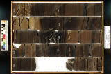
40
Skyline 16: SW SW sec. 10 11S 25E Uintah County, Utah. Box 11 Depth: 120.0 - 130.0 ft.
2015-07
ir_eua
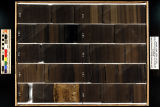
41
Skyline 16: SW SW sec. 10 11S 25E Uintah County, Utah. Box 12 Depth: 130.0 - 140.0 ft.
2015-07
ir_eua
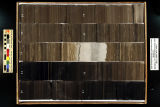
42
Skyline 16: SW SW sec. 10 11S 25E Uintah County, Utah. Box 13 Depth: 140.0 - 150.0 ft.
2015-07
ir_eua
43
Skyline 16: SW SW sec. 10 11S 25E Uintah County, Utah. Box 14 Depth: 150.0 - 160.0 ft.
2015-07
ir_eua
44
Skyline 16: SW SW sec. 10 11S 25E Uintah County, Utah. Box 15 Depth: 160.0 - 170.0 ft.
2015-07
ir_eua
45
Skyline 16: SW SW sec. 10 11S 25E Uintah County, Utah. Box 16 Depth: 170.0 - 180.0 ft.
2015-07
ir_eua
46
Skyline 16: SW SW sec. 10 11S 25E Uintah County, Utah. Box 17 Depth: 180.0 - 190.0 ft.
2015-07
ir_eua
47
Skyline 16: SW SW sec. 10 11S 25E Uintah County, Utah. Box 18 Depth: 190.0 - 200.0 ft.
2015-07
ir_eua
48
Skyline 16: SW SW sec. 10 11S 25E Uintah County, Utah. Box 19 Depth: 200.0 - 210.0 ft.
2015-07
ir_eua
49
Skyline 16: SW SW sec. 10 11S 25E Uintah County, Utah. Box 2 Depth: 30.0 - 40.0 ft.
2015-07
ir_eua
50
Skyline 16: SW SW sec. 10 11S 25E Uintah County, Utah. Box 20 Depth: 210.0 - 220.0 ft.
2015-07
ir_eua
26
-
50
of
141
<
1
2
3
4
5
6
>