TO
| Author | Title | Subject | Date | Publication Type | ||
|---|---|---|---|---|---|---|
| 276 |
 |
Dalness, William Michael | Parunuweap formation in the vicinity of Zion National Park, Utah (Google Earth map overlay KMZ file) | Thesis and dissertation georeferencing project | 1969-06 | map |
| 277 |
 |
Dalness, William Michael | Parunuweap formation in the vicinity of Zion National Park, Utah-Maps | 1969-06 | thesis | |
| 278 |
 |
Dalness, William Michael | Parunuweap formation in the vicinity of Zion National Park, Utah: Georeferenced map files | 1969-06 | thesis | |
| 279 |
 |
Heuscher, Sonja | Pennsylvanian depositional systems and geology of the Pecos River Canyon, Northern New Mexico | Pecos River Valley; Geology, Pennsylvanian; Stratigraphy | 2007-09-05 | thesis |
| 280 |
 |
Banks, Elizabeth Young | Petrographic characteristics and provenance of fluvial sandstone, sunnyside oil-impregnated sandstone deposit, Carbon County, Utah | Fluvial sandstone; Uinta Basin; Sunnyside oil-impregnated sandstone | 1981-12 | thesis |
| 281 |
 |
Ghassal, Bandar Ismail | Petroleum geochemistry and geology of the Midyan and Al Wajah basins, Northern Red Sea, Saudi Arabia | Petroleum--Saudi Arabia | 2010-01-28 | thesis |
| 282 |
 |
Martz, Alan Matthew | Petrology and Chemistry of tuffs from the Shungura Formation, Southwest Ethiopia | 1979 | thesis | |
| 283 |
 |
Neff, Thomas Rodney | Petrology and structure of the little willow series, Wasatch Mountains, Utah | Petrology -- Utah -- Wasatch Mountains; Thesis and dissertation georeferencing project | 1962-11 | thesis |
| 284 |
 |
Neff, Thomas Rodney | Petrology and structure of the little willow series, Wasatch Mountains, Utah (Google Earth map overlay KMZ file) | Petrology -- Utah -- Wasatch Mountains; Thesis and dissertation georeferencing project | 1962-11 | map |
| 285 |
 |
Neff, Thomas Rodney | Petrology and structure of the Little Willow Series, Wasatch Mountains, Utah-Maps | Petrology -- Utah -- Wasatch Mountains | 1962-11 | thesis |
| 286 |
 |
Neff, Thomas Rodney | Petrology and structure of the little willow series, Wasatch Mountains, Utah: Georeferenced map files | Petrology -- Utah -- Wasatch Mountains | 1962-11 | thesis |
| 287 |
 |
Wiley, Dennis Roy | Petrology of bituminous sandstones in the Green River Formation, Southeastern Uinta Basin, Utah | Petrology; Utah; Green River Formation; Sandstone; Thesis and dissertation georeferencing project | 1967-06 | thesis |
| 288 |
 |
Vlam, Heber Adolf Arien | Petrology of Lake Bonneville Gravels Salt Lake County, Utah | Petrology; Utah; Salt Lake County; Bonneville; Thesis and dissertation georeferencing project | 1963-05 | thesis |
| 289 |
 |
Vlam, Heber Adolf Arien | Petrology of Lake Bonneville Gravels Salt Lake County, Utah (Google Earth map overlay KMZ file) | Petrology; Utah; Salt Lake County; Bonneville; Lake; Thesis and dissertation georeferencing project | 1963-05 | map |
| 290 |
 |
Vlam, Heber Adolf Arien | Petrology of Lake Bonneville Gravels Salt Lake County, Utah: Georeferenced map files | Petrology; Utah; Salt Lake County; Bonneville; Lake | 1963-05 | thesis |
| 291 |
 |
Van Deventer, Bruce Robert | Petrology of the moenkopi formation (Early Triassic), Uinta Mountain Area, Northeastern Utah | Petrology; Utah; Moenkopi formation; Thesis and dissertation georeferencing project | 1974-06 | thesis |
| 292 |
 |
Gorenc, Marko Anton | Petrophysical and diagenetic characteristics of the permian white rim sandstone, southeast utah | Diagenesis; Hydrocarbons; Iron Oxide; Utah | 2015-08 | thesis |
| 293 |
 |
Smith, Hugh Preston | Plate 1 Fence diagram Moenkopi group (Google Earth map overlay KMZ file) | Geology; Utah; Thaynes Formation; Moenkopi group | 1969-06 | thesis |
| 294 |
 |
Mann, Daven Craig | Plate 1 Generalized geologic map of the Laramide orogenic sediments of the Wasatch Hinterland (Google Earth map overlay KMZ file) | Sediments (Geology); Utah; Wasatch Hinterland | 1974 | thesis |
| 295 |
 |
Chapusa, Frank W. P. | Plate 1 Geologic map of Stansbury Island, Tooele County, Utah (Google Earth map overlay KMZ file) | Geology; Utah; Stansbury Island | 1969-06 | thesis |
| 296 |
 |
Cohenour, Robert E. | Plate 1 Geologic map of the Sheeprock Mountains area, Utah (Google Earth map overlay KMZ file) | Geology -- Utah -- Sheeprock Mountains; Geology -- Utah -- Tooele County; Geology -- Utah -- Juab County; Thesis and dissertation georeferencing project | 1957-08 | thesis |
| 297 |
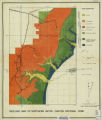 |
Brox, George Stanley | Plate 1: Geologic map of Northern Bryce Canyon National Park | 1961-06 | thesis | |
| 298 |
 |
Neff, Thomas Rodney | Plate 1: Geologic map of the Little Willow Series, Wasatch Mountains, Utah | 1962-11 | thesis | |
| 299 |
 |
Boschetto, Harold Bradley | Plate 1: Geologic map of the Lothidok Range, Kenya | Geology; Kenya; Lothidok Range | 1988-08 | map |
| 300 |
 |
Blakey, Ronald Clyde | Plate 1: Geologic map of the Paria NW quadrangle, Kane County, Utah | 1970-08 | thesis |
