| Title | Date | Type | Setname | ||
|---|---|---|---|---|---|
| 201 |
 |
Desert scene | 1910; 1911; 1912; 1913; 1914; 1915; 1916; 1917; 1918; 1919; 1920; 1921; 1922; 1923; 1924; 1925; 1926; 1927; 1928; 1929; 1930; 1931; 1932; 1933; 1934; 1935; 1936; 1937; 1938; 1939; 1940 | Image/StillImage | dha_gmo |
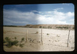
| 202 |
 |
Desert scene | 1910; 1911; 1912; 1913; 1914; 1915; 1916; 1917; 1918; 1919; 1920; 1921; 1922; 1923; 1924; 1925; 1926; 1927; 1928; 1929; 1930; 1931; 1932; 1933; 1934; 1935; 1936; 1937; 1938; 1939; 1940 | Image/StillImage | dha_gmo |
| 203 |
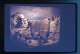 |
Diorama depicting Indigenous people and rock cliffs | Image/StillImage | uaida_main | |
| 204 |
 |
Distant View of Dordrecht with a Milkmaid and Four Cows and Other Figures (The Large Dort) | Image | uu_aah_art | |
| 205 |
 |
The Drive | Image | uu_aah_art | |
| 206 |
 |
Elephant's feet | Image/StillImage | uaida_main | |
| 207 |
 |
Entrance to Rio de Janeiro's Bay | Image | uu_aah_art | |
| 208 |
 |
Entry of the Barra de Rio de Janeiro Seen From Santa Teresa, Rua Aprazivel | Image | uu_aah_art | |
| 209 |
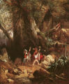 |
European Travelers Ambushed in a Forest | Image | uu_aah_art | |
| 210 |
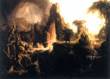 |
Expulsion from the Garden of Eden | Image | uu_aah_art | |
| 211 |
 |
Extensive Landscape with Ruins | Image | uu_aah_art | |
| 212 |
 |
Factory Butte | 1937-05-31 | Image/StillImage | dha_scnpp |
| 213 |
 |
Factory Butte | 1937-05-31 | Image/StillImage | dha_scnpp |
| 214 |
 |
The famous Ute Pass across the Rocky Mountains. The Utes came down this trail to fight the Arapahoes and other plains tribes | 1909 | Image/StillImage | uaida_main |
| 215 |
 |
Farm House | 1930; 1931; 1932; 1933; 1934; 1935; 1936; 1937; 1938; 1939; 1940 | Image/StillImage | dha_rkc |
| 216 |
 |
Farm scene, mountains | 1910; 1911; 1912; 1913; 1914; 1915; 1916; 1917; 1918; 1919; 1920; 1921; 1922; 1923; 1924; 1925; 1926; 1927; 1928; 1929; 1930; 1931; 1932; 1933; 1934; 1935; 1936; 1937; 1938; 1939; 1940 | Image/StillImage | dha_gmo |
| 217 |
 |
Farm, mountains | 1910; 1911; 1912; 1913; 1914; 1915; 1916; 1917; 1918; 1919; 1920; 1921; 1922; 1923; 1924; 1925; 1926; 1927; 1928; 1929; 1930; 1931; 1932; 1933; 1934; 1935; 1936; 1937; 1938; 1939; 1940 | Image/StillImage | dha_gmo |
| 218 |
 |
Farm, mountains | 1910; 1911; 1912; 1913; 1914; 1915; 1916; 1917; 1918; 1919; 1920; 1921; 1922; 1923; 1924; 1925; 1926; 1927; 1928; 1929; 1930; 1931; 1932; 1933; 1934; 1935; 1936; 1937; 1938; 1939; 1940 | Image/StillImage | dha_gmo |
| 219 |
 |
Field with Fence | 1930; 1931; 1932; 1933; 1934; 1935; 1936; 1937; 1938; 1939; 1940 | Image/StillImage | dha_rkc |
| 220 |
 |
Figure 01: Skull Valley, view from the northwest at, or near Timpie Junction. Jedediah Smith in 1827 climed {sic} the knob in the distance and obtained a glimpse of the Great Salt Lake | 1939 | Image/StillImage | uum_mapr |
| 221 |
|
Figure 02: Knolls, Utah. View southwest. This locality is on the eastern edge of the Great Salt Lake Desert | 1939 | Image/StillImage | uum_mapr |
| 222 |
|
Figure 03: The Bonneville Salt Flats on the Great Salt Lake Desert, Utah. Captain Cobb's world speed record car in the distance | 1939 | Image/StillImage | uum_mapr |
| 223 |
|
Figure 04: Sage Brush in a favorable living locality just south of Skull Valley. This brush is as much as fourteen feet high, indicating a rich soil and a considerable amount of moisture | 1939 | Image/StillImage | uum_mapr |
| 224 |
|
Figure 05: Deep Creek Valley from the Deep Creek Mountains. The Tippets Mountains appear twenty miles westward. The Gosiute village is the center of the picture | 1939 | Image/StillImage | uum_mapr |
| 225 |
|
Figure 06: The Deep Creek Mountains | 1939 | Image/StillImage | uum_mapr |