| Title | Date | Type | Setname | ||
|---|---|---|---|---|---|
| 151 |
 |
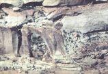
Ancestral Puebloan ruins, October 1997 [18] | 1997-10 | Image/StillImage | uum_map_rr |
| 152 |
 |
Ancestral Puebloan ruins, October 1997 [21] | 1997-10 | Image/StillImage | uum_map_rr |
| 153 |
 |
Ancestral Puebloan ruins, October 1997 [24] | 1997-10 | Image/StillImage | uum_map_rr |
| 154 |
 |
Ancient ladder some rungs recently nailed on leading to Cliff ruins 2 miles above Augusta Bridge, White Canyon | 1928 | Image | uum_map |
| 155 |
 |
Ancient tree along Trail to Bridge | 1957; 1958; 1959; 1960; 1961; 1962 | uum_map_rr | |
| 156 |
 |
Angel Arch | 1930; 1931; 1932; 1933; 1934; 1935; 1936; 1937; 1938; 1939; 1940; 1941; 1942; 1943; 1944; 1945; 1946; 1947; 1948; 1949; 1950 | Image | uum_map_rr |
| 157 |
 |
Angel Arch, Arch Canyon | 1935; 1936; 1937; 1938; 1939; 1940; 1941; 1942; 1943; 1944; 1945; 1946; 1947; 1948; 1949 | Image/StillImage | uum_map_rr |
| 158 |
 |
Angel Arch, Canyonlands National Park | 1930; 1931; 1932; 1933; 1934; 1935; 1936; 1937; 1938; 1939; 1940; 1941; 1942; 1943; 1944; 1945; 1946; 1947; 1948; 1949; 1950 | Image | uum_map_rr |
| 159 |
 |
Ann attempting big splash at SOCOTWA Pool | 1957; 1958; 1959; 1960; 1961; 1962 | uum_map_rr | |
| 160 |
 |
Ann Voorhees. Taken at Rainbow Bridge | 1954; 1955; 1956; 1957; 1958; 1959; 1960; 1961 | Image | uum_map_rr |
| 161 |
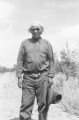 |
Anson Cantsee; Allen Canyon, San Juan County, Utah | 1936 | Image/StillImage | uaida_main |
| 162 |
 |
Anticline - Limestone - 25 miles West of Bluff | 1921-06 | Image/StillImage | uum_map |
| 163 |
 |
Anticline - Limestone - 25 miles West of Bluff | 1921-06 | Image/StillImage | uum_map |
| 164 |
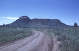 |
Approaching Bears Ear | 1952-08-11 | Image | uum_map_rr |
| 165 |
 |
Approaching Mexican Hat | 1935; 1936; 1937; 1938; 1939; 1940; 1941; 1942; 1943; 1944; 1945; 1946; 1947; 1948; 1949 | Image/StillImage | uum_map_rr |
| 166 |
 |
Approaching Narrows | 1957; 1958; 1959; 1960; 1961; 1962 | uum_map_rr | |
| 167 |
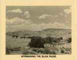 |
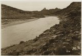
Approaching the Slick Rocks- Grey Mesa (Wild Horse Mesa, to Zane Grey) in the background. "It was off this Mesa the pioneers had to find a way- mountain goats showed them where!" | 1939 | Image | uum_map_rr |
| 168 |
 |
Approaching top of Bridge | 1957; 1958; 1959; 1960; 1961; 1962 | uum_map_rr | |
| 169 |
 |
Arch [2] | 1932 | Image | dc_bpc |
| 170 |
 |
Arch Canyon, Coconino over Supai | 1920; 1921; 1922; 1923; 1924; 1925; 1926; 1927; 1928; 1929; 1930 | Image | uum_map |
| 171 |
 |
Arch Canyon, Utah | 1930; 1931; 1932; 1933; 1934; 1935; 1936; 1937; 1938; 1939; 1940; 1941; 1942; 1943; 1944; 1945; 1946; 1947; 1948; 1949 | Image | uum_map_rr |
| 172 |
 |
Arch Canyon, Utah | 1920; 1921; 1922; 1923; 1924; 1925; 1926; 1927; 1928; 1929; 1930; 1931; 1932; 1933; 1934; 1935; 1936; 1937; 1938; 1939; 1940; 1941; 1942; 1943; 1944; 1945; 1946; 1947; 1948; 1949 | Image | uum_map_rr |
| 173 |
 |
Arch Country across from Hole in the Rock | 1957; 1958; 1959; 1960; 1961; 1962 | uum_map_rr | |
| 174 |
 |
Arch Country across from Hole in the Rock | 1957; 1958; 1959; 1960; 1961; 1962 | uum_map_rr | |
| 175 |
 |
Arch Country across from Hole in the Rock | 1957; 1958; 1959; 1960; 1961; 1962 | uum_map_rr |