Home
Browse
Ask Us
Chat
Harmful Language Statement
Log in
Advanced Search
Year
1902
1903
1904
1905
1906
1907
1908
1909
1910
1911
1912
1913
1914
1915
1916
1917
1918
1919
1920
1921
1922
1923
1924
1925
1926
1927
1928
1929
1930
1931
1932
1933
1934
1935
1936
1937
1938
1939
1940
1941
1942
1943
1944
1945
1946
1947
1948
1949
1950
1951
1952
1953
1954
1955
1956
1957
1958
1959
1960
1961
1962
1963
1964
1965
1966
1967
1968
1969
1970
1971
1972
1973
1974
1975
1976
1977
1978
1979
1980
1981
1982
1983
TO
1902
1903
1904
1905
1906
1907
1908
1909
1910
1911
1912
1913
1914
1915
1916
1917
1918
1919
1920
1921
1922
1923
1924
1925
1926
1927
1928
1929
1930
1931
1932
1933
1934
1935
1936
1937
1938
1939
1940
1941
1942
1943
1944
1945
1946
1947
1948
1949
1950
1951
1952
1953
1954
1955
1956
1957
1958
1959
1960
1961
1962
1963
1964
1965
1966
1967
1968
1969
1970
1971
1972
1973
1974
1975
1976
1977
1978
1979
1980
1981
1982
1983
Type
Image
112
Format
image/jpeg
111
application/pdf
1
Collection
Beckwith Photograph Collection
88
Photo Archives
24
Filters:
Spatial Coverage:
"Juab County (Utah)"
Type:
"Image"
1
-
25
of
112
<
1
2
3
4
5
>
Gallery view
Number of results to display per page
10
25
50
100
200
Sort by Relevance
Sort by Title A-Z
Sort by Title Z-A
Sort by Date Ascending
Sort by Date Descending
Sort by Last Modified Ascending
Sort by Last Modified Descending
Title
Date
Type
Setname
1
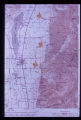
Ancient landslides show up on maps with scales as small as one inch to the mile. Three such ancient slides are pointed out along the mountain front in Juab County. Note swath of anomalous contours leading down to lowermost slide, obviously the path of bedrock which failed.
Image
uum_map
2
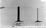
Best photo of Plug
1945-05-27
Image
dc_bpc
3
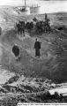
Brush mine
Image
dc_bpc
4
Callao, Utah
1956
Image
dc_bpc
5
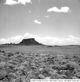
Cup Butte
Image
dc_bpc
6
Cup Butte [1]
Image
dc_bpc
7
Cup Butte [2]
Image
dc_bpc
8
Cup Butte [3]
Image
dc_bpc
9
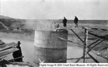
Delta, Utah water [01]
1913-11-23
Image
dc_bpc
10
Delta, Utah water [02]
Image
dc_bpc
11
Delta, Utah water [03]
Image
dc_bpc
12
Delta, Utah water [04]
1913-11-23
Image
dc_bpc
13
Delta, Utah water [05]
1913-11-23
Image
dc_bpc
14
Delta, Utah water [06]
Image
dc_bpc
15
Eastman, Sophia
Image
dc_bpc
16
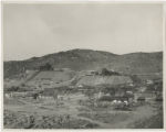
Eureka, Juab County, Utah [1]
Image
uum_map
17
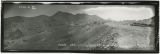
Eureka, Juab County, Utah [2]
1914-01-04
Image
uum_map
18
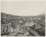
Eureka, Juab County, Utah [3]
Image
uum_map
19
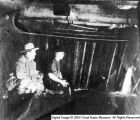
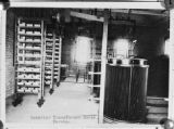
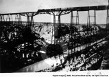
Eureka, Juab County, Utah [4]: Interior of transformer house
1910; 1911; 1912; 1913; 1914; 1915; 1916; 1917; 1918; 1919; 1920
Image
uum_map
20
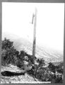
Eureka, Juab County, Utah [5]: Burnt transmission pole, Provo-Eureka line
1910; 1911; 1912; 1913; 1914; 1915; 1916; 1917; 1918; 1919; 1920
Image
uum_map
21
Eureka, Utah
Image
dc_bpc
22
Fossils and Geology scrapbook [69]
Image
dc_bpc
23
Hot Plug [01]
Image
dc_bpc
24
Hot Plug [02]
1945-05-27
Image
dc_bpc
25
Hot Plug [03]
1945-05-27
Image
dc_bpc
1
-
25
of
112
<
1
2
3
4
5
>