Home
Browse
Ask Us
Chat
Harmful Language Statement
Log in
Advanced Search
Year
1920
1921
1922
1923
1924
1925
1926
1927
1928
1929
1930
1931
1932
1933
1934
1935
1936
1937
1938
1939
1940
1941
1942
1943
1944
1945
1946
1947
1948
1949
1950
1951
1952
1953
1954
1955
1956
1957
1958
1959
1960
1961
1962
1963
1964
1965
1966
1967
1968
1969
1970
1971
1972
1973
1974
1975
1976
1977
1978
1979
1980
1981
1982
1983
1984
1985
1986
1987
1988
1989
1990
1991
1992
1993
1994
1995
1996
1997
1998
1999
2000
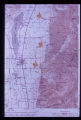
2001
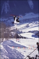
2002
TO
1920
1921
1922
1923
1924
1925
1926
1927
1928
1929
1930
1931
1932
1933
1934
1935
1936
1937
1938
1939
1940
1941
1942
1943
1944
1945
1946
1947
1948
1949
1950
1951
1952
1953
1954
1955
1956
1957
1958
1959
1960
1961
1962
1963
1964
1965
1966
1967
1968
1969
1970
1971
1972
1973
1974
1975
1976
1977
1978
1979
1980
1981
1982
1983
1984
1985
1986
1987
1988
1989
1990
1991
1992
1993
1994
1995
1996
1997
1998
1999
2000
2001
2002
Type
Image
738
Image/StillImage
102
Text
1
Format
image/jpeg
2,251
Collection
Peoples of Utah Revisited
30
Photo Archives
979
Ski and Snow Sports Archives
521
University Archival Photographs (P0305)
19
Utah River Running Photo Archives
702
Filters:
Format:
"image/jpeg"
Genre:
"color slides"
76
-
100
of
2,251
<
1
2
3
4
5
6
7
8
9
10
>
Gallery view
Number of results to display per page
10
25
50
100
200
Sort by Relevance
Sort by Title A-Z
Sort by Title Z-A
Sort by Date Ascending
Sort by Date Descending
Sort by Last Modified Ascending
Sort by Last Modified Descending
Title
Date
Type
Setname
76
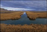
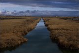
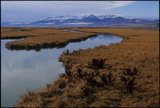
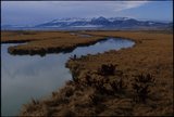
Amalga Barrens and Cutler Reservoir, Utah [04]
2001-11-07; 2001-11-08; 2001-11-09
uum_map
77
Amalga Barrens and Cutler Reservoir, Utah [05]
2001-11-07; 2001-11-08; 2001-11-09
uum_map
78
Amalga Barrens and Cutler Reservoir, Utah [06]
2001-11-07; 2001-11-08; 2001-11-09
uum_map
79
Amalga Barrens and Cutler Reservoir, Utah [07]
2001-11-07; 2001-11-08; 2001-11-09
uum_map
80
Amalga Barrens and Cutler Reservoir, Utah [08]
2001-11-07; 2001-11-08; 2001-11-09
uum_map
81
Amalga Barrens and Cutler Reservoir, Utah [09]
2001-11-07; 2001-11-08; 2001-11-09
uum_map
82
Amalga Barrens and Cutler Reservoir, Utah [10]
2001-11-07; 2001-11-08; 2001-11-09
uum_map
83
Amalga Barrens and Cutler Reservoir, Utah [11]
2001-11-07; 2001-11-08; 2001-11-09
uum_map
84
Amalga Barrens and Cutler Reservoir, Utah [12]
2001-11-07; 2001-11-08; 2001-11-09
uum_map
85
Amalga Barrens and Cutler Reservoir, Utah [13]
2001-11-07; 2001-11-08; 2001-11-09
uum_map
86
Amalga Barrens and Cutler Reservoir, Utah [14]
2001-11-07; 2001-11-08; 2001-11-09
uum_map
87
Amalga Barrens and Cutler Reservoir, Utah [15]
2001-11-07; 2001-11-08; 2001-11-09
uum_map
88
The ancient Green River carved deep rock whirlpools in the side of Lodore Canyon
1955
uum_map_rr
89
Ancient landslides show up on maps with scales as small as one inch to the mile. Three such ancient slides are pointed out along the mountain front in Juab County. Note swath of anomalous contours leading down to lowermost slide, obviously the path of bedrock which failed.
Image
uum_map
90
Andy Hetzel snowboarding at Crested Butte, CO.
1998
uum_map_usa
91
Another example of dynamic forces at work in the geologic environment: pressure ridges formed in the salt crust of Utah's Bonneville Salt Flats. These ridges grow and shrink seasonally.
Image
uum_map
92
Approaching 1st lunch stop. 6-11-55
1955-06-11
Image
uum_map_rr
93
Approaching Flaming Gorge
1955
uum_map_rr
94
Approaching Flaming Gorge. Susp[ension] bridge. 6-11-55 [sic]
1955-06-11
Image
uum_map_rr
95
Areas of carbonate rock (limestone) outcrops (in blue) in the vicinity of Bear Lake, Utah. Rocks range in age from Cambrian to Jurassic. Development on the outcrop area should be closely monitored to protect the underlying potable water aquifer.
Image
uum_map
96
Arizona waters, April 9, 1948
1948-04-09
Image/StillImage
uum_map
97
Arrow points to incipient failure of an excavation wall for a foundation for a multistory office building. Material is horizontally stratified Lake Bonneville silts and sands.
Image
uum_map
98
Ashley Falls. 6-13-55
1955-06-13
Image
uum_map_rr
99
At House Rock, Marble Canyon
1956
uum_map_rr
100
At Lee's Ferry, April 10, 1948 [01]
1948-04-10
Image/StillImage
uum_map
76
-
100
of
2,251
<
1
2
3
4
5
6
7
8
9
10
>