Home
Browse
Ask Us
Chat
Harmful Language Statement
Log in
Theses & Dissertations
Advanced Search
Year
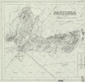
1951
1952
1953
1954
1955
1956
1957
1958
1959
1960
1961
1962
1963
1964
1965
1966
1967
1968
1969
1970
1971
1972
1973
1974
1975
1976
1977
1978
1979
1980
1981
1982
1983
1984
1985
1986
1987
1988
1989
1990
1991
1992
1993
1994
TO
1951
1952
1953
1954
1955
1956
1957
1958
1959
1960
1961
1962
1963
1964
1965
1966
1967
1968
1969
1970
1971
1972
1973
1974
1975
1976
1977
1978
1979
1980
1981
1982
1983
1984
1985
1986
1987
1988
1989
1990
1991
1992
1993
1994
Type
Image
58
Text
36
Format
application/pdf
58
Collection
Theses & Dissertations
58
Filters:
Department:
"Geology & Geophysics"
Format:
"application/pdf"
Publication Type:
"thesis"
Type:
"Image"
1
-
25
of
58
<
1
2
3
>
Gallery view
Number of results to display per page
10
25
50
100
200
Sort by Relevance
Sort by Title A-Z
Sort by Title Z-A
Sort by Date Ascending
Sort by Date Descending
Sort by Last Modified Ascending
Sort by Last Modified Descending
Title
Date
Type
1
A study of primary sedimentary structures around the Moab anticline, Grand County, Utah (Thesis and maps)
1965-08
Text; Image
2
Areal geology of the Coalville vicinity, Summit County, Utah
1953-06
Text; Image
3
Areal geology of the Upton region, Summit County, Utah-Maps
1953-06
Image
4
Clastic laramide sediments of the Wasatch Hinterland, Northeastern Utah (Thesis and maps)
1974
Text; Image
5
Geology and ground-water resources of Ogden Valley, Utah
1972-06
Text; Image
6
Geology and structure of Stansbury Island (Thesis and maps)
1969-06
Text; Image
7
Geology of the Big Piney area, Summit County, Utah
1953-06
Text; Image
8
Geology of the Cedar Mountains,Tooele County, Utah (Thesis and maps)
1970-06
Text; Image
9
Geology of the Central and Southern silver Island Mountains Tooele County, Utah and Elko County, Nevada-Maps
1961-06
Image
10
Geology of the Central Mineral Range, Beaver County, Utah
1957-08
Text; Image
11
Geology of the Cove Creek area Millard County and Beaver County, Utah
1961-06
Text; Image
12
Geology of the Davis Knolls and northern Big Davis Mountain area, Tooele County, Utah
1962-08
Text; Image
13
Geology of the East Canyon area, Morgan County, Utah
1954
Text; Image
14
Geology of the Keetley-Kamas volcanic area
1951
Text; Image
15
Geology of the Lost Creek-Echo Canyon Area, Morgan and Summit Counties, Utah
1959-06
Text; Image
16
Geology of the Newfoundland Mountains, Box Elder County, Utah
1956-12
Text; Image
17
Geology of the Northern Lakeside Mountains and the Grassy Mountains and vicinity, Tooele and Box Elder Counties, Utah
1964-06
Text; Image
18
Geology of the Northern Silver Island Mountains, Box Elder and Tooele Counties, Utah
1957-06
Text; Image
19
Geology of the Paria Northwest quadrangle Kane County, Utah-Maps
1970-08
Image
20
Geology of the Picture Rock Hills quadrangle, Southwestern Keg Mountains, Juab County, Utah (Thesis and maps)
1975
Text; Image
21
Geology of the Sheeprock Mountains, Tooele and Juab Counties, Utah
1957-08
Text; Image
22
Geology of the Smith and Morehouse-Hayden Fork area, Utah
1952
Text; Image
23
Geology of the Soldier Summit quadrangle, Utah (Thesis and maps)
1965-06
Text; Image
24
Geology of the Terrace and Hogup Mountains, Box Elder County, Utah
1964-06
Text; Image
25
Geology of the upper Ogden Canyon, Weber County, Utah
1960-06
Text; Image
1
-
25
of
58
<
1
2
3
>