Over 70,000 photos covering a variety of topics from Marriott Library Special Collections
TO
Filters: Date: "1945" Collection: "uum_map"
| Title | Collection Number And Name | Photo Number | ||
|---|---|---|---|---|
| 76 |
 |
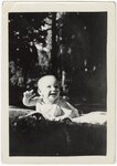
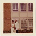
Lees Family [02] | P0005 C. Lowell Lees Photograph Collection | P0005n06_25_002 |
| 77 |
 |
Lees Family [03] | P0005 C. Lowell Lees Photograph Collection | P0005n06_25_003 |
| 78 |
 |
Lees Family [04] | P0005 C. Lowell Lees Photograph Collection | P0005n06_25_004 tif; P0005n06_25_004b.tif |
| 79 |
 |
Lees Family [05] | P0005 C. Lowell Lees Photograph Collection | P0005n06_25_005 |
| 80 |
 |
Lees Family [06] | P0005 C. Lowell Lees Photograph Collection | P0005n06_25_006 |
| 81 |
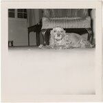 |
Dog [01] | P0005 C. Lowell Lees Photograph Collection | P0005n06_25_009 |
| 82 |
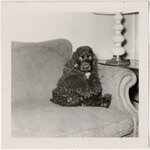 |
Dog [02] | P0005 C. Lowell Lees Photograph Collection | P0005n06_25_010 |
| 83 |
 |
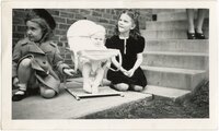
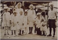
Lees Family [09] | P0005 C. Lowell Lees Photograph Collection | P0005n06_25_011 |
| 84 |
 |
Lees Family [11] | P0005 C. Lowell Lees Photograph Collection | P0005n06_25_014 |
| 85 |
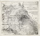 |
Plano geografico de la tierra descubierta y demarcada por Dn. Bernardo de Miera y Paceco al Yumbo del noroeste y oest del Nuevo Mexico, quien fue en compania de los R.R.s P.Ps. Fs. Fran.co Atanacio Dominguez... y Fr. Silvestre Velez de Escalante | P0013 Herbert E. Gregory Photograph Collection | P0013n16_09_04 |
| 86 |
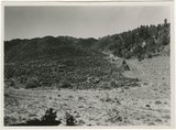
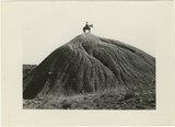
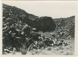 |
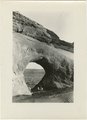
Hillside of eroded rock, Paria Valley, Utah | P0013 Herbert E. Gregory Photograph Collection | P0013n16_12_01 |
| 87 |
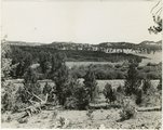
 |
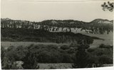
Road and lava field, Rock Creek Valley, Utah | P0013 Herbert E. Gregory Photograph Collection | P0013n16_12_02 |
| 88 |
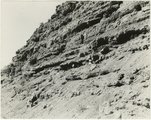 |
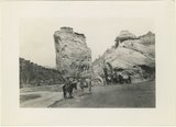
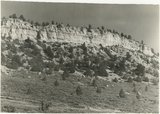
Rocky cliff near Hillsdale | P0013 Herbert E. Gregory Photograph Collection | P0013n16_12_03 |
| 89 |
 |
Lava, Black Rock Valley | P0013 Herbert E. Gregory Photograph Collection | P0013n16_12_04 |
| 90 |
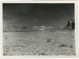 |
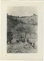
Paria Valley and east flank of East Kaibab monocline | P0013 Herbert E. Gregory Photograph Collection | P0013n16_12_05 |
| 91 |
 |
Mound of sedimentary material, vicinity of Paria River, Utah | P0013 Herbert E. Gregory Photograph Collection | P0013n16_12_06 |
| 92 |
 |
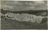
Sandstone outcrops, Paria Canyon, Utah | P0013 Herbert E. Gregory Photograph Collection | P0013n16_12_07 |
| 93 |
 |
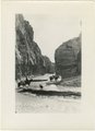
Paria Canyon, Utah | P0013 Herbert E. Gregory Photograph Collection | P0013n16_12_08 |
| 94 |
 |
White rocks on road to Panquitch, Utah | P0013 Herbert E. Gregory Photograph Collection | P0013n16_12_09 |
| 95 |
 |
East side of Lone Rock on Wah Weap Creek | P0013 Herbert E. Gregory Photograph Collection | P0013n16_12_10 |
| 96 |
 |
Upper Box in Paria Canyon just south of Cannonville | P0013 Herbert E. Gregory Photograph Collection | P0013n16_12_11 |
| 97 |
 |
End of lava flow 6 miles long in Black Creek Valley | P0013 Herbert E. Gregory Photograph Collection | P0013n16_12_12 |
| 98 |
 |
White cliffs along highway south of Asay Creek, Brian Head formation | P0013 Herbert E. Gregory Photograph Collection | P0013n16_12_13 |
| 99 |
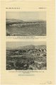 |
Views along Vermilion Cliffs [and] Permian and Triassic rocks at the mouth of Limestone Gulch | P0013 Herbert E. Gregory Photograph Collection | P0013n16_12_14 |
| 100 |
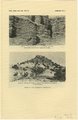 |
Views of the Moenkopi Formation [and] Triassic rocks | P0013 Herbert E. Gregory Photograph Collection | P0013n16_12_15 |