Home
Browse
Ask Us
Chat
Harmful Language Statement
Log in
Advanced Search
Year
1872
1873
1874
1875
1876
1877
1878
1879
1880
1881
1882
1883
1884
1885
1886
1887
1888
1889
1890
1891
1892
1893
1894
1895
1896
1897
1898
1899
1900
1901
1902
1903
1904
1905
1906
1907
1908
1909
1910
1911
1912
1913
1914
1915
1916
1917
1918
1919
1920
1921
1922
1923
1924
1925
1926
1927
1928
1929
1930
1931
1932
1933
1934
1935
1936
1937
1938
1939
1940
1941
1942
1943
1944
1945
1946
1947
1948
1949
1950
1951
1952
1953
1954
1955
1956
1957
1958
1959
1960
1961
1962
1963
1964
1965
1966
1967
1968
1969
1970
1971
1972
1973
1974
1975
1976
1977
1978
1979
1980
1981
1982
1983
1984
1985
1986
1987
1988
1989
1990
1991
1992
1993
TO
1872
1873
1874
1875
1876
1877
1878
1879
1880
1881
1882
1883
1884
1885
1886
1887
1888
1889
1890
1891
1892
1893
1894
1895
1896
1897
1898
1899
1900
1901
1902
1903
1904
1905
1906
1907
1908
1909
1910
1911
1912
1913
1914
1915
1916
1917
1918
1919
1920
1921
1922
1923
1924
1925
1926
1927
1928
1929
1930
1931
1932
1933
1934
1935
1936
1937
1938
1939
1940
1941
1942
1943
1944
1945
1946
1947
1948
1949
1950
1951
1952
1953
1954
1955
1956
1957
1958
1959
1960
1961
1962
1963
1964
1965
1966
1967
1968
1969
1970
1971
1972
1973
1974
1975
1976
1977
1978
1979
1980
1981
1982
1983
1984
1985
1986
1987
1988
1989
1990
1991
1992
1993
Type
Image
3,521
Image/StillImage
143
Format
image/jpeg
3,594
application/pdf
70
Collection
Photo Archives
3,521
UAIDA Main Collection
143
Filters:
Collection Name:
"Herbert E. Gregory"
426
-
450
of
3,664
<
13
14
15
16
17
18
19
20
21
22
>
Gallery view
Number of results to display per page
10
25
50
100
200
Sort by Relevance
Sort by Title A-Z
Sort by Title Z-A
Sort by Date Ascending
Sort by Date Descending
Sort by Last Modified Ascending
Sort by Last Modified Descending
Title
Date
Type
Setname
426
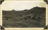
Boulders of lava on eroded surface of Moenkopi along Torrey-Fruita road, Wayne County, Utah, 1937.
1937
Image
uum_map
427
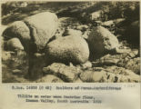
Boulders of Permo-Carboniferous tillite on water worn Cambrian floor, Inman Valley, South Australia, 1916
1916
Image
uum_map
428
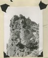
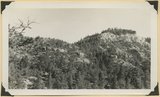
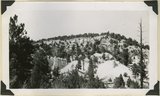
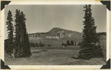
Bowers Knoll; Volcano viewed from northwest. Garfield County, UT. 1944
1944
Image
uum_map
429
Braffit Point. Mass of conglomerate in the Kaiparowits formation, branch of Parowan Canyon, Iron County, UT, 1942
1942
Image
uum_map
430
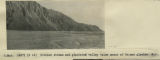
Braided stream and glaciated valley below snout of Tasman glacier, N.Z.
1916
Image
uum_map
431
Branch of Navajo Canyon, Ariz., 1910 (Photo G184)
1910
Image
uum_map
432
Branch of Navajo Canyon, Ariz., 1910 (Photo G184)
1910
Image
uum_map
433
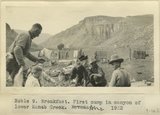
Breakfast. First camp in canyon of lower Kanab Creek, AZ. 1922
1922
Image
uum_map
434
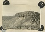
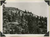
Brian Head formation at the 'Castles,' Castle Creek. Garfield County, UT, 1944
1944
Image
uum_map
435
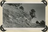
Brian Head formation at the 'Castles,' Castle Creek. Garfield County, UT, 1944. Details of erosion
1944
Image
uum_map
436
Brian Head formation capped by lava (rhyolite?): Cliff on upthrown side of Paunsaugunt fault. East fork of Sevier River near the mouth of Deer Creek. Garfield County, UT. 1943
1943
Image
uum_map
437
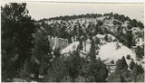
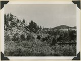
Brian Head formation capped by lava. Branch of Limekiln Canyon. Garfield County, UT. 1942
1942
Image
uum_map
438
Brian Head formation in the walls of Panguitch Canyon near power house. Garfield County, UT. 1943
1943
Image
uum_map
439
Brian Head formation underlain by pink Wasatch limestone on Highway 89, 2± miles north of Castle Creek. Garfield County, UT, 1944
1944
Image
uum_map
440
Brian Head formation, branch of Asay Creek; lies beneath basalt flows. Garfield County, UT, 1944
1944
Image
uum_map
441
Brian Head formation, branch of Asay Creek; lies beneath basalt flows. Garfield County, UT, 1944
1944
Image
uum_map
442
Brian Head formation, consolidated (white wall) and disintegrated (upper slopes), and pink Wasatch limestones (lowest slopes). Seamans Canyon west of Gravel Pass. Kane County, UT, 1944
1944
Image
uum_map
443
Brian Head formation, consolidated (white wall) and disintegrated (upper slopes), and pink Wasatch limestones (lowest slopes). Seamans Canyon west of Gravel Pass. Kane County, UT, 1944
1944
Image
uum_map
444
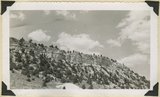
Brian Head, volcanic mass from the north rim of Cedar Breaks, Iron County, Utah, 1937.
1937
Image
uum_map
445
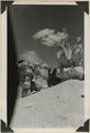
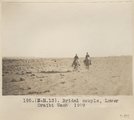
Bridal couple, Lower Oraibi Wash. 1909
1909
Image
uum_map
446
Bridal couple, Lower Oraibi Wash. 1909
1909
Image
uum_map
447
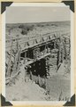
Bridge built by C.C.C. across recently eroded wash, near Pipe Springs. Mohave County, AZ. 1939
1939
Image
uum_map
448
Bridge Mountain. Navajo sandstone; view south base of East Temple across Pine Creek; Tunnel Road lower right. Zion National Park, 1938
1938
Image
uum_map
449
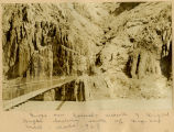
Bridge over Colorado, mouth of Bright Angel looking south up Zig-zag trail... 1928
1926
Image
uum_map
450
Bridge, Little Colorado
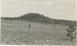
1913
Image
uum_map
426
-
450
of
3,664
<
13
14
15
16
17
18
19
20
21
22
>