| Title | Date | Type | Setname | ||
|---|---|---|---|---|---|
| 351 |
 | Navajos [X-33055] | 1910; 1911; 1912; 1913; 1914; 1915; 1916; 1917; 1918; 1919; 1920; 1921; 1922; 1923; 1924; 1925; 1926; 1927; 1928; 1929; 1930 | Image/StillImage | uaida_main |
| 352 |
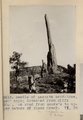 | Needle of LaPlata sandstone, 150' high; detached from cliff 300'. On road from Moore's to upper waters of Black Creek. VI, 38 (Photo G213) | 1911 | Image | uum_map |
| 353 |
 | Needle Peak (Shiprock) looking north 68° west from a distance of 1 1/2 mi. south of Shiprock, NM. Shaler, photo | 1890; 1891; 1892; 1893; 1894; 1895; 1896; 1897; 1898; 1899; 1900; 1901; 1902; 1903; 1904; 1905 | Image | uum_map |
| 354 |
 | New Mexico | Image | uum_map | |
| 355 |
 | New Mexico P.1 | Image | dha_cp | |
| 356 |
 | New Mexico desert | 1941; 1942; 1943; 1944; 1945; 1946; 1947 | Image | uum_map |
| 357 |
 | New Mexico desert | 1941; 1942; 1943; 1944; 1945; 1946; 1947 | Image | uum_map |
| 358 |
 | New Mexico Spadefoot 4 | 2008-08-05 | Sound | uu_wss |
| 359 |
| New Mexico Spadefoot 5 | 2008-08-05 | Sound | uu_wss |
| 360 |
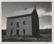 | New Mexico, Cimmaron, grist mill | 1945; 1946; 1947; 1948; 1949; 1950; 1951; 1952; 1953; 1954; 1955; 1956; 1957; 1958; 1959; 1960; 1961; 1962; 1963; 1964; 1965 | Image | uum_map |
| 361 |
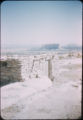
 | New Mexico, Indian ruins | 1945; 1946; 1947; 1948; 1949; 1950; 1951; 1952; 1953; 1954; 1955; 1956; 1957; 1958; 1959; 1960; 1961; 1962; 1963; 1964; 1965 | Image | uum_map |
| 362 |
 | New Mexico, Rock Formations | 1945; 1946; 1947; 1948; 1949; 1950; 1951; 1952; 1953; 1954; 1955; 1956; 1957; 1958; 1959; 1960; 1961; 1962; 1963; 1964; 1965 | Image | uum_map |
| 363 |
 | New Mexico, Rock formations near Gallup | 1945; 1946; 1947; 1948; 1949; 1950; 1951; 1952; 1953; 1954; 1955; 1956; 1957; 1958; 1959; 1960; 1961; 1962; 1963; 1964; 1965 | Image | uum_map |
| 364 |
 | New Mexico, Scenery | 1945; 1946; 1947; 1948; 1949; 1950; 1951; 1952; 1953; 1954; 1955; 1956; 1957; 1958; 1959; 1960; 1961; 1962; 1963; 1964; 1965 | Image | uum_map |
| 365 |
 | New Mexico, Taos | 1945; 1946; 1947; 1948; 1949; 1950; 1951; 1952; 1953; 1954; 1955; 1956; 1957; 1958; 1959; 1960; 1961; 1962; 1963; 1964; 1965 | Image | uum_map |
| 366 |
 | New Mexico; Middle Rio Grande basin study | 1999 | Text | wwdl_er |
| 367 |
 | Nick Cohee [01] | 2010-02 | Image/StillImage | uum_map_usa |
| 368 |
 | Nick Cohee [02] | 2010-02 | Image/StillImage | uum_map_usa |
| 369 |
 | Nitrogen and phosphorus data for surface water in the Upper Colorado River basin, Colorado, 1980-94 | 1997 | Text | wwdl_er |
| 370 |
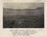 | North side of Baigaiche and entrance to Black Creek canyon looking southeast across Red Lake (Photo G377) | 1913 | Image | uum_map |
| 371 |
 | The Northern Navajo Frontier 1860-1900 | 1947 | Text | uaida_main |
| 372 |
 | Northern New Mexico Before 1846 | Image/StillImage | uaida_main | |
| 373 |
 | Northern New Mexico, Fall 2003 [01] | 2003 | Image/StillImage | uum_map_rr |
| 374 |
 | Northern New Mexico, Fall 2003 [02] | 2003 | Image/StillImage | uum_map_rr |
| 375 |
 | Northern New Mexico, Fall 2003 [03] | 2003 | Image/StillImage | uum_map_rr |