1 - 25 of 5
| Title | Date | Type | Setname | ||
|---|---|---|---|---|---|
| 1 | 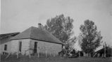 | Blanding, Utah ca.1920, looking southwest from Center Street in Blanding. | 1920 | Image | uum_map |
| 2 | 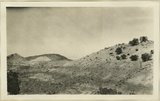 | Morrison shales 12 miles south of Blanding. San Juan County, UT, 1928 | 1928 | Image | uum_map |
| 3 | 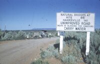 | Outskirts of Blanding | 1952-08-11 | Image | uum_map_rr |
| 4 |  | Survey headquarters, Blanding, UT. Lowrey | 1920; 1921; 1922; 1923; 1924; 1925; 1926; 1927; 1928; 1929; 1930 | Image | uum_map |
| 5 |  | West Canyon through the end of the trip - Camp at Blanding, Utah | 1962-07 | Image | uum_map_rr |
1 - 25 of 5