Home
Browse
Ask Us
Chat
Harmful Language Statement
Log in
Advanced Search
Year
1826
1827
1828
1829
1830
1831
1832
1833
1834
1835
1836
1837
1838
1839
1840
1841
1842
1843
1844
1845
1846
1847
1848
1849
1850
1851
1852
1853
1854
1855
1856
1857
1858
1859
1860
1861
1862
1863
1864
1865
1866
1867
1868
1869
1870
1871
1872
1873
1874
1875
1876
1877
1878
1879
1880
1881
1882
1883
1884
1885
1886
1887
1888
1889
1890
1891
1892
1893
1894
1895
1896
1897
1898
1899
1900
1901
1902
1903
1904
1905
1906
1907
1908
1909
1910
1911
1912
1913
1914
1915
1916
1917
1918
1919
1920
1921
1922
1923
1924
1925
1926
1927
1928
1929
1930
1931
1932
1933
1934
1935
1936
1937
1938
1939
1940
1941
1942
1943
1944
1945
1946
1947
1948
1949
1950
1951
1952
1953
1954
1955
1956
1957
1958
1959
1960
1961
1962
1963
1964
1965
1966
1967
1968
1969
1970
1971
1972
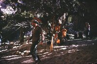
1973
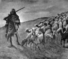
1974
1975
1976
1977
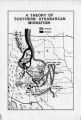
1978
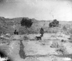
1979
1980
1981
1982
1983
1984
1985
1986
1987
1988
1989
1990
1991
1992
1993
1994
1995
1996
1997
1998
1999
2000
2001
2002
2003
2004
2005
2006
2007
2008
2009
2010
2011
2012
2013
2014
2015
2016
2017
2018
2019
2020
2021
2022
2023
TO
1826
1827
1828
1829
1830
1831
1832
1833
1834
1835
1836
1837
1838
1839
1840
1841
1842
1843
1844
1845
1846
1847
1848
1849
1850
1851
1852
1853
1854
1855
1856
1857
1858
1859
1860
1861
1862
1863
1864
1865
1866
1867
1868
1869
1870
1871
1872
1873
1874
1875
1876
1877
1878
1879
1880
1881
1882
1883
1884
1885
1886
1887
1888
1889
1890
1891
1892
1893
1894
1895
1896
1897
1898
1899
1900
1901
1902
1903
1904
1905
1906
1907
1908
1909
1910
1911
1912
1913
1914
1915
1916
1917
1918
1919
1920
1921
1922
1923
1924
1925
1926
1927
1928
1929
1930
1931
1932
1933
1934
1935
1936
1937
1938
1939
1940
1941
1942
1943
1944
1945
1946
1947
1948
1949
1950
1951
1952
1953
1954
1955
1956
1957
1958
1959
1960
1961
1962
1963
1964
1965
1966
1967
1968
1969
1970
1971
1972
1973
1974
1975
1976
1977
1978
1979
1980
1981
1982
1983
1984
1985
1986
1987
1988
1989
1990
1991
1992
1993
1994
1995
1996
1997
1998
1999
2000
2001
2002
2003
2004
2005
2006
2007
2008
2009
2010
2011
2012
2013
2014
2015
2016
2017
2018
2019
2020
2021
2022
2023
Type
Image/StillImage
1,440
Image
1,430
Text
348
Sound
64
Format
image/jpeg
2,916
application/pdf
483
audio/mpeg
43
video/mp4
21
Institution
University of Utah Marriott Library
2,253
Utah American Indian Digital Archive
595
Department of Cultural and Community ...
382
Utah Museum of Natural History
337
Uintah County Library
89
Western Waters Digital Library
69
University of Utah Partnerships
68
Utah State Archives
12
More
Collection
Al W. Morton Collection, 1930s-1950s
5
Alta Avalanche
2
American Westward Migration
1
Chieko N Okazaki papers
2
Classified Photographs
267
Colorado Riverbed Case
12
David Oman McKay Papers
1
John Hamilton Morgan Papers
43
Land Use - Transportation Scenario Pl...
1
Marriner S. Eccles Papers
1
Photo Archives
591
Regional History Center
46
Shipler Commercial Photographers
40
Ski and Snow Sports Photo Archives
787
Taylor A. Woolley Papers
2
Thorne Photographs
5
UAIDA Main Collection
595
Uintah County Regional History Center...
35
Utah Humanities Research Foundation
1
Utah Quilt Heritage Records
4
Utah River Running Photo Archives
821
Vernal Express Photographs
3
Vertebrate Zoology Voucher Images
337
Western Soundscape
64
Western Waters Electronic Resources
69
William Edward Hook Glass Negatives
70
More
Filters:
Spatial Coverage:
"Colorado"
151
-
175
of
3,805
<
2
3
4
5
6
7
8
9
10
11
>
Gallery view
Number of results to display per page
10
25
50
100
200
Sort by Relevance
Sort by Title A-Z
Sort by Title Z-A
Sort by Date Ascending
Sort by Date Descending
Sort by Last Modified Ascending
Sort by Last Modified Descending
Title
Date
Type
Setname
151
[postcard of Bitter Creek] "Baxter Pass - U.[intah] R.[ail wa]Y."
1920; 1921; 1922; 1923; 1924; 1925; 1926; 1927; 1928; 1929; 1930
Image
uum_map
152
[Whirlpool Canyon]
1966-07
Image
uum_map_rr
153
A Chronology of Papers in the Ute Mountain Ute Tribal Archives Vol. 3
1988
Text
uaida_main
154
A History of the Uintah-Ouray Ute Lands
1979
Text
uaida_main
155
A hot August afternoon in Horsethief Canyon
1933
Image
uum_map_rr
156
A Navajo sheep-herder
1888
Image/StillImage
uaida_main
157
A scene on the road, the passing of the Ute
1880; 1881; 1882; 1883; 1884; 1885; 1886; 1887; 1888; 1889; 1890; 1891; 1892; 1893; 1894; 1895; 1896; 1897; 1899; 1900
Image/StillImage
uaida_main
158
A Tabulation of Snow Avalanche Fatalities in Colorado
1965-09
Text
uu_altaav
159
A Tabulation of Snow Avalanche Fatalities in Colorado
1968-05
Text
uu_altaav
160
A Theory of Southern Athabascan Migration
Image/StillImage
uaida_main
161
A Ute camp [X-21034]
1890; 1891; 1892; 1893; 1894; 1895; 1896; 1897; 1899; 1900
Image/StillImage
uaida_main
162
A.M.C. Greene, Lodore Canyon. Don Hatch taking raft through 'Hell's Half Mile.'
1930; 1931; 1932; 1933; 1934; 1935; 1936; 1937; 1938; 1939; 1940; 1941; 1942; 1943; 1944; 1945; 1946; 1947; 1948; 1949; 1950; 1951; 1952; 1953; 1954; 1955; 1956; 1957; 1958; 1959; 1960; 1961; 1962; 1963; 1964; 1965; 1966; 1967; 1968; 1969
Image
uum_map_rr
163
Above Granby to above Byers Canyon - Above the Arapaho Bridge. River drops 85 feet in a mile, but made this without portage or lining, bumping down through.
1933
Image
uum_map_rr
164
Above Granby to above Byers Canyon - Below Sleepy Hollow, near Trout Rapids
1933
Image
uum_map_rr
165
Above Granby to above Byers Canyon - Colo. R. Near Sleepy Hollow-above S[outh] Fork (2 copies)
1933
Image
uum_map_rr
166
Above Granby to above Byers Canyon - Colorado River above Columbine Cr[eek]
1933
Image
uum_map_rr
167
Above Granby to above Byers Canyon - Colorado River above the Arapaho
1933
Image
uum_map_rr
168
Above Granby to above Byers Canyon - Colorado River above the mouth of the Fraser [River], near Granby
1933
Image
uum_map_rr
169
Above Granby to above Byers Canyon - Confluence of Fraser [River] & Colo. Rivers below Granby, Colo. Looking into Windy Gap.
1933
Image
uum_map_rr
170
Above Granby to above Byers Canyon - Looking upstream into Windy Gap, after thunderstorm. Between Granby and Hot Sulphur Sp[rin]gs.
1933
Image
uum_map_rr
171
Above Harding's Hole area Camp, Yampa River, May 1962 [01]
1962-05
Image/StillImage
uum_map_rr
172
Above Harding's Hole area Camp, Yampa River, May 1962 [02]
1962-05
Image/StillImage
uum_map_rr
173
Above Harding's Hole area Camp, Yampa River, May 1962 [03]
1962-05
Image/StillImage
uum_map_rr
174
Above Harding's Hole area Camp, Yampa River, May 1962 [04]
1962-05
Image/StillImage
uum_map_rr
175
Above Harding's Hole area Camp, Yampa River, May 1963 [05]
1963-05
Image/StillImage
uum_map_rr
151
-
175
of
3,805
<
2
3
4
5
6
7
8
9
10
11
>