126 - 150 of 147
Number of results to display per page
TitleDateFile Number
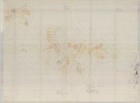
126Miles Ranch, base map #3 overlay1976-011513_052A_008_001
127Powder River Project: Federal Resources Corporation property map: Cat claims and Bob claims1973-121513_052A_012_001
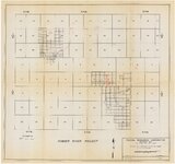
128Property map of Powder River area, Dry Fork block: T44-46N, R76-78W, Johnson & Campbell Cos., Wyoming19711513_052B_002_001
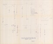
129Projected cross sections of drill holes, showing gamma peaks, cutting samples and outcrops -- south1979-061513_067_007_001
130Projected cross sections of drill holes, showing gamma peaks, cutting samples and outcrops -- north1979-061513_067_007_002
131Rimrock Gulch, definition of ore horizons, cross-sections of drill holes1979-061513_067_007_003
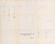
132Cross sections of selected holes showing gamma peaks and cutting samples, Indian Valley19791513_067_007_004
133W.M.R. claims, Moffat County and Rio Blanco County, Colorado [1]1979-06-121513_067_007_005
134W.M.R. claims, Moffat County and Rio Blanco County, Colorado [2]1979-06-121513_067_007_006
135W.M.R. claims, Moffat County and Rio Blanco County, Colorado [3]1979-06-121513_067_007_007
136W.M.R. claims, Moffat County and Rio Blanco County, Colorado [4]1979-06-121513_067_007_008
137CW Claims, Moffat and Rio Blanco counties1979-10-051513_067_007_009
138Moore Hill property map, Niobrara County, Wyoming, showing drill holes, profiles and outcrop pattern1970-07-151513_086_012_001
139Wyoming uranium project index map1970; 1971; 1972; 1973; 1974; 1975; 19761513_088_002_001
140Scaler vs. radiometrics graph [1]1513_49A_009_001
141Scaler vs. radiometrics graph [2]1513_49A_009_002
142Federal Resources Corporation Black Hills district: drilling progress map, 1973, July report1973-071513_49A_016_001
143Structure contours on top of Morrison Formation1513_49A_017_001
144Black Hills and the northeast portion of the Powder River Basin, Montana and Wyoming1975-111513_49A_017_002
145Scaler vs. radiometrics graph [3]1513_49A_017_003
146Federal Resources Corporation, PioneerNuclear, Inc., joint ventures: land status map1972-121513_49A_017_004
147Federal Resources Corporation, PioneerNuclear, Inc., joint ventures: land status map: preferred photo coverage19721513_49A_017_005
126 - 150 of 147